Country:
 Great Britain
Region:
City:
Latitude and Longitude:
Time Zone:
Postal Code:
IP information under different IP Channel
ip-api
Country
Region
City
ASN
Time Zone
ISP
Blacklist
Proxy
Latitude
Longitude
Postal
Route
IPinfo
Country
Region
City
ASN
Time Zone
ISP
Blacklist
Proxy
Latitude
Longitude
Postal
Route
MaxMind
Country
Region
City
ASN
Time Zone
ISP
Blacklist
Proxy
Latitude
Longitude
Postal
Route
Luminati
Country
GBRegion
eng
City
guildford
ASN
Time Zone
Europe/London
ISP
Datanet.co.uk Ltd
Latitude
Longitude
Postal
db-ip
Country
Region
City
ASN
Time Zone
ISP
Blacklist
Proxy
Latitude
Longitude
Postal
Route
ipdata
Country
Region
City
ASN
Time Zone
ISP
Blacklist
Proxy
Latitude
Longitude
Postal
Route
Popular places and events near this IP address

South East England
Region of England
Distance: Approx. 1293 meters
Latitude and longitude: 51.3,-0.8
South East England is one of the nine official regions of England in the United Kingdom at the first level of ITL for statistical purposes. It consists of the nine counties of Berkshire, Buckinghamshire, East Sussex, Hampshire, the Isle of Wight, Kent, Oxfordshire, Surrey and West Sussex. Cities and towns in the region include Aldershot, Ashford, Aylesbury, Basingstoke, Bracknell, Brighton and Hove, Canterbury, Chichester, Crawley, Eastbourne, Farnborough, Gosport, Guildford, Hastings, High Wycombe, Margate, Maidstone, Medway, Milton Keynes, Newport, Oxford, Portsmouth, Ramsgate, Reading, Slough, Southampton, Winchester, Woking and Worthing.
Farnborough North End F.C.
Association football club in England
Distance: Approx. 1072 meters
Latitude and longitude: 51.27991944,-0.80203889
Farnborough North End Football Club is a football club based in Farnborough, Hampshire.
Fleet Spurs F.C.
Association football club in England
Distance: Approx. 375 meters
Latitude and longitude: 51.29083611,-0.79985833
Fleet Spurs Football Club are a football club based in Fleet, England. They play in the Thames Valley Premier League Division One. The club is affiliated to the Hampshire Football Association and is an FA Charter Standard Development club.

Cove, Hampshire
Human settlement in England
Distance: Approx. 877 meters
Latitude and longitude: 51.2965,-0.7939
Cove is an ancient village turned suburb, forming the western part of Farnborough, in the Rushmoor district, in the county of Hampshire, England. The appropriate ward is called Cove and Southwood. It is located 33 mi (53 km) south west of London.
National Gas Turbine Establishment
Distance: Approx. 1019 meters
Latitude and longitude: 51.282957,-0.807098
The National Gas Turbine Establishment (NGTE Pyestock) in Farnborough, part of the Royal Aircraft Establishment (RAE), was the prime site in the UK for the design and development of gas turbine and jet engines. For over 50 years, Pyestock was at the forefront of gas turbine development. The NGTE came into existence during the mid-1940s, its principal predecessors were Power Jets, a formerly private company headed by Frank Whittle, the inventor of the jet engine, and the RAE turbine development team; the design teams of both entities were incorporated, initially being led by Whittle and Hayne Constant.
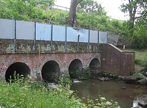
Cove Brook
River in Hampshire, England
Distance: Approx. 1034 meters
Latitude and longitude: 51.29,-0.781
Cove Brook runs 4 miles (6.4 km) from near Farnborough Airport in Farnborough, Hampshire, England and flows through the former Southwood Golf Course where it is joined by Marrow Brook and other smaller streams. It runs north through Cove before joining the Blackwater at Hawley Meadows near the M3 motorway.
Grasmere Road Ground
Distance: Approx. 1409 meters
Latitude and longitude: 51.2934,-0.7769
Grasmere Road is a cricket ground located north of Farnborough Airport on Grasmere Road, from which the ground gets its name, in Cove, Hampshire, England. The ground is bordered by housing on its west and north sides, while to the south it is bordered by an open field and on its east side by woodland. The grounds facilities include a pavilion, practice nets and a scoreboard.
Southwood, Hampshire
Distance: Approx. 886 meters
Latitude and longitude: 51.291213,-0.783623
Southwood is a suburb of Farnborough, in the borough of Rushmoor and adjacent to Cove. It is part of the Cove and Southwood ward.

Guillemont Barracks
Distance: Approx. 1763 meters
Latitude and longitude: 51.3045,-0.794
Guillemont Barracks, located just off of junction 4a of the M3, on the Minley Road (A327), was a military installation at Minley in Hampshire.

Southwood Camp
Distance: Approx. 503 meters
Latitude and longitude: 51.2904,-0.789
Southwood Camp was a military installation at Southwood in Hampshire.
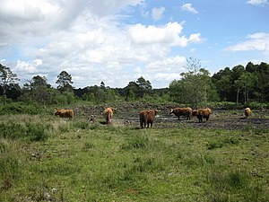
Eelmoor Marsh
Site of Special Scientific Interest in Great Britain
Distance: Approx. 1639 meters
Latitude and longitude: 51.274,-0.797
Eelmoor Marsh is a 66.3-hectare (164-acre) biological Site of Special Scientific Interest between Fleet and Farnborough in Hampshire. It is part of Thames Basin Heaths Special Protection Area for the conservation of wild birds. This site has a bog with deep peat, grass heath, woodland and a network of ditches.
Bramshot Halt railway station
Disused railway station in Bramshott, East Hampshire
Distance: Approx. 1310 meters
Latitude and longitude: 51.2917,-0.8139
Bramshot Halt railway station served the adjacent Bramshot Golf Course from 1913 to 1946 on the London and Southampton Railway and was located between Fleet and Farnborough in Hampshire.
Weather in this IP's area
few clouds
11 Celsius
10 Celsius
9 Celsius
13 Celsius
1031 hPa
85 %
1031 hPa
1022 hPa
10000 meters
1.54 m/s
30 degree
20 %
06:41:55
19:13:25