80.67.57.96 - IP Lookup: Free IP Address Lookup, Postal Code Lookup, IP Location Lookup, IP ASN, Public IP
Country:
Region:
City:
Location:
Time Zone:
Postal Code:
ISP:
ASN:
language:
User-Agent:
Proxy IP:
Blacklist:
IP information under different IP Channel
ip-api
Country
Region
City
ASN
Time Zone
ISP
Blacklist
Proxy
Latitude
Longitude
Postal
Route
db-ip
Country
Region
City
ASN
Time Zone
ISP
Blacklist
Proxy
Latitude
Longitude
Postal
Route
IPinfo
Country
Region
City
ASN
Time Zone
ISP
Blacklist
Proxy
Latitude
Longitude
Postal
Route
IP2Location
80.67.57.96Country
Region
krasnoyarskiy kray
City
uzhur
Time Zone
Asia/Krasnoyarsk
ISP
Language
User-Agent
Latitude
Longitude
Postal
ipdata
Country
Region
City
ASN
Time Zone
ISP
Blacklist
Proxy
Latitude
Longitude
Postal
Route
Popular places and events near this IP address

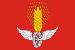
Uzhur
Town in Krasnoyarsk Krai, Russia
Distance: Approx. 1708 meters
Latitude and longitude: 55.3175,89.8225
Uzhur (Russian: Ужу́р) is a town and the administrative center of Uzhursky District in Krasnoyarsk Krai, Russia, located approximately 300 kilometers (190 mi) from Krasnoyarsk between Kuznetsk Alatau and Solgon mountain ranges where the Chernavka River flows into the Uzhurka. Population: 16,093 (2010 Census); 17,252 (2002 Census); 28,376 (1989 Soviet census).

Uzhursky District
District in Krasnoyarsk Krai, Russia
Distance: Approx. 1708 meters
Latitude and longitude: 55.3175,89.8225
Uzhursky District (Russian: Ужу́рский райо́н) is an administrative and municipal district (raion), one of the forty-three in Krasnoyarsk Krai, Russia. It is located in the southwest of the krai and borders with Nazarovsky District in the north, Balakhtinsky District in the east, Novosyolovsky District in the southeast, the Republic of Khakassia in the south, and with Sharypovsky District in the west and northwest. The area of the district is 4,226 square kilometers (1,632 sq mi).

Solnechny, Krasnoyarsk Krai
Settlement in Krasnoyarsk Krai, Russia
Distance: Approx. 7440 meters
Latitude and longitude: 55.3,89.71666667
Solnechny (Russian: Со́лнечный) is a closed urban locality (a settlement) in Krasnoyarsk Krai, Russia. As of the 2010 Census, its population was 10,384.
Weather in this IP's area
overcast clouds
-15 Celsius
-20 Celsius
-15 Celsius
-15 Celsius
1039 hPa
84 %
1039 hPa
989 hPa
10000 meters
2.37 m/s
3.6 m/s
183 degree
100 %