Country:
 France
Region:
City:
Latitude and Longitude:
Time Zone:
Postal Code:
IP information under different IP Channel
ip-api
Country
Region
City
ASN
Time Zone
ISP
Blacklist
Proxy
Latitude
Longitude
Postal
Route
IPinfo
Country
Region
City
ASN
Time Zone
ISP
Blacklist
Proxy
Latitude
Longitude
Postal
Route
MaxMind
Country
Region
City
ASN
Time Zone
ISP
Blacklist
Proxy
Latitude
Longitude
Postal
Route
Luminati
Country
FRASN
Time Zone
Europe/Paris
ISP
Association Grenode
Latitude
Longitude
Postal
db-ip
Country
Region
City
ASN
Time Zone
ISP
Blacklist
Proxy
Latitude
Longitude
Postal
Route
ipdata
Country
Region
City
ASN
Time Zone
ISP
Blacklist
Proxy
Latitude
Longitude
Postal
Route
Popular places and events near this IP address

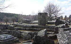
Plateau de Millevaches
Distance: Approx. 7677 meters
Latitude and longitude: 45.66666667,1.91666667
The Plateau de Millevaches (French pronunciation: [plato də milvaʃ]; Occitan: Replanat de Miuvachas) is an upland area in Limousin a former administrative region of France. It covers approximately 3,500 km2 and crosses the boundaries of three French departments: Corrèze, Creuse, and Haute-Vienne. The majority of the area is at an altitude of between 600 m and 1000 m.
Pérols-sur-Vézère
Commune in Nouvelle-Aquitaine, France
Distance: Approx. 4337 meters
Latitude and longitude: 45.5869,1.9806
Pérols-sur-Vézère (French pronunciation: [peʁɔl syʁ vezɛʁ], literally Pérols on Vézère; Occitan: Peròls de Vesera) is a commune in the Corrèze department in central France.
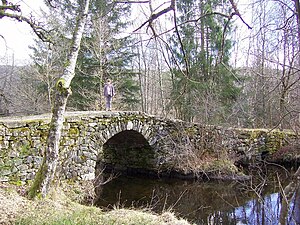
Bugeat
Commune in Nouvelle-Aquitaine, France
Distance: Approx. 110 meters
Latitude and longitude: 45.5989,1.9281
Bugeat (French pronunciation: [byʒa]; Occitan: Bujac) is a commune in the Corrèze department in central France in the Nouvelle-Aquitaine region. Its inhabitants are called les Bugeacois and les Bugeacoises.
Bonnefond
Commune in Nouvelle-Aquitaine, France
Distance: Approx. 8666 meters
Latitude and longitude: 45.5311,1.9839
Bonnefond (French pronunciation: [bɔnfɔ̃]; Occitan: Bonafont) is a commune of the Corrèze department in central France.
Gourdon-Murat
Commune in Nouvelle-Aquitaine, France
Distance: Approx. 6808 meters
Latitude and longitude: 45.5411,1.8956
Gourdon-Murat (French pronunciation: [ɡuʁdɔ̃ myʁa]; Occitan: Gordon e Murat) is a commune in the Corrèze department in central France.
Lacelle
Commune in Nouvelle-Aquitaine, France
Distance: Approx. 9224 meters
Latitude and longitude: 45.6419,1.8267
Lacelle (French pronunciation: [lasɛl]; Occitan: La Cela) is a commune in the Corrèze department of central France.

Lestards
Commune in Nouvelle-Aquitaine, France
Distance: Approx. 9975 meters
Latitude and longitude: 45.5164,1.8747
Lestards (French pronunciation: [lɛstaʁ]; Occitan: Lestaurs) is a commune in the Corrèze department in central France.
Saint-Hilaire-les-Courbes
Commune in Nouvelle-Aquitaine, France
Distance: Approx. 7383 meters
Latitude and longitude: 45.6114,1.8344
Saint-Hilaire-les-Courbes (French pronunciation: [sɛ̃.t‿ilɛʁ le kuʁb]; Occitan: Sent Alari de las Corbas) is a commune in the Corrèze department in central France.
Saint-Merd-les-Oussines
Commune in Nouvelle-Aquitaine, France
Distance: Approx. 9669 meters
Latitude and longitude: 45.6333,2.0408
Saint-Merd-les-Oussines (French pronunciation: [sɛ̃ mɛʁ le.z‿usin]; Occitan: Sent Merd las Aussinas) is a commune in the Corrèze department in central France.

Tarnac
Commune in Nouvelle-Aquitaine, France
Distance: Approx. 9377 meters
Latitude and longitude: 45.6811,1.9478
Tarnac (French pronunciation: [taʁnak]) is a commune in the Corrèze department in central France.
Toy-Viam
Commune in Nouvelle-Aquitaine, France
Distance: Approx. 5707 meters
Latitude and longitude: 45.6492,1.9331
Toy-Viam (French pronunciation: [twa vjɑ̃]; Occitan: Autoire Viam) is a commune in the Corrèze department in central France.
Viam
Commune in Nouvelle-Aquitaine, France
Distance: Approx. 3592 meters
Latitude and longitude: 45.61,1.8844
Viam (French pronunciation: [vjɑ̃]) is a commune in the Corrèze department in central France. The village is positioned on a lake, used for swimming, fishing, water-skiing, canoeing, kayaking, sailing and land activities such as hiking and cycling.
Weather in this IP's area
overcast clouds
10 Celsius
10 Celsius
10 Celsius
10 Celsius
1014 hPa
99 %
1014 hPa
933 hPa
2028 meters
1.26 m/s
4.62 m/s
315 degree
100 %
08:12:50
19:01:36