Country:
 Spain
SpainRegion:
City:
Latitude and Longitude:
Time Zone:
Postal Code:
IP information under different IP Channel
ip-api
Country
Region
City
ASN
Time Zone
ISP
Blacklist
Proxy
Latitude
Longitude
Postal
Route
IPinfo
Country
Region
City
ASN
Time Zone
ISP
Blacklist
Proxy
Latitude
Longitude
Postal
Route
MaxMind
Country
Region
City
ASN
Time Zone
ISP
Blacklist
Proxy
Latitude
Longitude
Postal
Route
Luminati
Country
ESRegion
vc
City
quartdepoblet
ASN
Time Zone
Europe/Madrid
ISP
Servicios Digitales Codinet S.L.
Latitude
Longitude
Postal
db-ip
Country
Region
City
ASN
Time Zone
ISP
Blacklist
Proxy
Latitude
Longitude
Postal
Route
ipdata
Country
Region
City
ASN
Time Zone
ISP
Blacklist
Proxy
Latitude
Longitude
Postal
Route
Popular places and events near this IP address

Mislata
Municipality in Valencian Community, Spain
Distance: Approx. 2214 meters
Latitude and longitude: 39.475,-0.41555556
Mislata (Valencian: [mizˈlata]; Spanish: [misˈlata]) is a city in the Valencian Community, Spain. It has borders with the city of Valencia and Quart de Poblet in the west and Xirivella in the south.

Luis Puig Palace
Distance: Approx. 2025 meters
Latitude and longitude: 39.50063889,-0.42733333
Luis Puig Palace (Valencian: Palau Velòdrom Lluís Puig, Spanish: Palacio Velódromo Luis Puig) is an arena in Valencia, Spain. It is primarily used for indoor sports and hosted the 2008 IAAF World Indoor Championships. The arena also hosts a 250 metres (270 yd) painted concrete cycling track which played host to the 1992 UCI Track Cycling World Championships.

Xirivella
Municipality in Valencian Community, Spain
Distance: Approx. 2330 meters
Latitude and longitude: 39.46555556,-0.42666667
Xirivella (Valencian pronunciation: [tʃiɾiˈveʎa]) is a municipality in the Valencian Community, Spain. It borders the city of Valencia, Alaquàs, Picanya and Mislata. The municipality is divided by the V-30 motorway and the river Turia, with the La Luz district on the eastern part of the river.
Manises UFO incident
Distance: Approx. 1023 meters
Latitude and longitude: 39.4833,-0.45
The Manises UFO incident took place on 11 November 1979, forcing a commercial flight of the Spanish company Transportes Aéreos Españoles, with 109 passengers, to make an emergency landing at the Manises' airport in Valencia, Spain, when they were flying over Ibiza. After the emergency landing, a Spanish Air Force Dassault Mirage F1 took off from Los Llanos Base in order to intercept the mysterious object. It is the most famous UFO sighting in Spain.

Manises
Municipality in Valencian Community, Spain
Distance: Approx. 1022 meters
Latitude and longitude: 39.48333333,-0.45
Manises (Valencian pronunciation: [maˈnizes], Spanish: [maˈnises]) is a municipality in the comarca of Horta Oest in the Valencian Community, Spain. Located in the province of Valencia, it had 30,693 inhabitants in 2018 (NSI) and is famous for its pottery and being the location of Valencia Airport.

Paterna
Municipality in Valencian Community, Spain
Distance: Approx. 2045 meters
Latitude and longitude: 39.50277778,-0.44055556
Paterna is a city and a municipality in the province of Valencia in the Valencian Community, Spain. It is located northeast of the comarca of L'Horta de Valencia, 5 kilometres (3 miles) northwest of the inland suburbs of Valencia, and on the left bank of the river Turia. Its population in 2014 was 67,156 inhabitants, being the eleventh city by population in the Valencian Community.
Quart de Poblet
Municipality in Valencian Community, Spain
Distance: Approx. 414 meters
Latitude and longitude: 39.48333333,-0.44277778
Quart de Poblet (Valencian: [ˈkwaɾd de poˈblet]; Spanish and unofficially: Cuart de Poblet [ˈkwaɾ(ð) ðe poˈβlet]), or simply Quart (Valencian: [ˈkwaɾt]; Spanish: Cuart [ˈkwaɾ(t)]), is a municipality in the comarca of Horta Oest in the Valencian Community, Spain. It has 25,499 inhabitants (NSI 2009).

Tower of Paterna
Distance: Approx. 2049 meters
Latitude and longitude: 39.50285278,-0.43999722
The Tower of Paterna (Valencian: Torre de Paterna [ˈtore ðe paˈtɛɾna]) is a historical monument of the town of Paterna, in the province of Valencia, Spain. It is the most emblematic monument of this valencian town. The origin of its construction is unknown, but it is thought that it was constructed during the Arab age, as a defense system to protect the city's inhabitants.

Benimàmet, Valencia
Old city, now part of Valencia, Spain
Distance: Approx. 2530 meters
Latitude and longitude: 39.5,-0.41666667
Benimàmet (Valencian pronunciation: [beniˈmamet], Spanish: Benimámet) is an old municipality now integrated as an urban part of Valencia, Spain. The name Benimàmet 'sons of Muhammad' is derived from Arabic during Muslim-ruled Al-Andalus.

Valencia Bioparc
Zoo in Valencia, Spain
Distance: Approx. 2777 meters
Latitude and longitude: 39.478,-0.407
Bioparc Valencia is a 10-hectare (25-acre) zoo park in Valencia, Spain. The zoo is owned by the City Council of Valencia and designed and managed by Rainforest (a private Spanish company devoted to building and managing zoos). It has a large collection of African fauna.
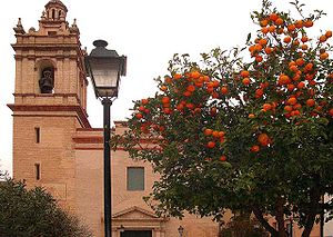
Valencia History Museum
Distance: Approx. 2896 meters
Latitude and longitude: 39.472611,-0.408222
Valencia History Museum (Catalan: Museu d’Història de València, Spanish: Museo de historia de Valencia — MhV) was inaugurated on May 7, 2003. The mission of the Valencia History Museum is to educate visitors about the historical development of the city of Valencia. The MhV depicts the past of Valencia in an informative and entertaining way, using traditional exhibition resources and new technologies.
Feria Valencia
Building in Benimàmet, Spain
Distance: Approx. 2442 meters
Latitude and longitude: 39.50411944,-0.42548889
International Sample Fair of Valencia or, as a trademark, Feria Valencia is the oldest institution organizing fair events in Spain, its year of foundation being in 1917. Recently remodeled and expanded, the work of architect José María Tomás Llavador, It constitutes one of the most important within the European circuit.
Weather in this IP's area
few clouds
17 Celsius
16 Celsius
16 Celsius
19 Celsius
1020 hPa
61 %
1020 hPa
1015 hPa
10000 meters
3.6 m/s
260 degree
20 %
08:15:57
19:17:02