80.64.32.62 - IP Lookup: Free IP Address Lookup, Postal Code Lookup, IP Location Lookup, IP ASN, Public IP
Country:
Region:
City:
Location:
Time Zone:
Postal Code:
ISP:
ASN:
language:
User-Agent:
Proxy IP:
Blacklist:
IP information under different IP Channel
ip-api
Country
Region
City
ASN
Time Zone
ISP
Blacklist
Proxy
Latitude
Longitude
Postal
Route
db-ip
Country
Region
City
ASN
Time Zone
ISP
Blacklist
Proxy
Latitude
Longitude
Postal
Route
IPinfo
Country
Region
City
ASN
Time Zone
ISP
Blacklist
Proxy
Latitude
Longitude
Postal
Route
IP2Location
80.64.32.62Country
Region
aragon
City
used
Time Zone
Europe/Madrid
ISP
Language
User-Agent
Latitude
Longitude
Postal
ipdata
Country
Region
City
ASN
Time Zone
ISP
Blacklist
Proxy
Latitude
Longitude
Postal
Route
Popular places and events near this IP address

Used, Huesca
Village in Aragon, Spain
Distance: Approx. 69 meters
Latitude and longitude: 42.32361111,-0.19194444
Used (Aragonese: Usé) is a deserted village under the local government of the municipality of Sabiñánigo, Alto Gállego, Huesca, Aragon, Spain. Located near the Sierra y Cañones de Guara natural park, the surrounding area is a very good place for speleology and sports like rock climbing and canyoning.

Sierra de Guara
Distance: Approx. 5035 meters
Latitude and longitude: 42.28861111,-0.22944444
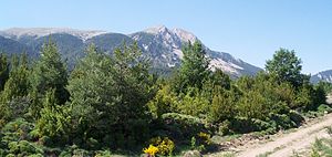
The Sierra de Guara is a mountain massif in the province of Huesca, the most northerly province in the autonomous community of Aragon, Spain. Its highest point is Tozal de Guara (2,077 m). It lies around 25 km northeast of the city of Huesca itself.
Sanctuary of San Úrbez
Distance: Approx. 4015 meters
Latitude and longitude: 42.3275,-0.24027778
The Sanctuary of San Úrbez or the Hermitage of San Úrbez (Spanish: Santuario de San Úrbez or Ermita de San Úrbez) was a monastery in Nocito, in the municipality of Nueno in the Province of Huesca, Aragon, Spain. It was established in the 12th century on the site of the hermitage of the 9th-century Saint Urbicius (Spanish: San Úrbez). The church housed his relics, which were almost entirely destroyed in the Spanish Civil War.
Lasaosa
Place in Huesca, Spain
Distance: Approx. 8296 meters
Latitude and longitude: 42.3791,-0.2599
Lasaosa is a village under the local government of the municipality of Sabiñánigo, Alto Gállego, Huesca, Aragon, Spain. It is located in Valley of the Guarguera. It is currently in the process of reconstruction, in October 2007 the feast of the Virgen del Rosario was celebrated for the first time in the last thirty-five years.
Bentué de Nocito
Place in Huesca, Spain
Distance: Approx. 2012 meters
Latitude and longitude: 42.3253,-0.2161
Bentué de Nocito is a village under the local government of the municipality of Sabiñánigo, Alto Gállego, Huesca, Aragon, Spain.
Aineto
Place in Huesca, Spain
Distance: Approx. 7559 meters
Latitude and longitude: 42.3921,-0.1928
Aineto is a village under the local government of the municipality of Sabiñánigo, Alto Gállego, Huesca, Aragon, Spain. Aineto was initially cited in 1076, and its name has had variations such as Agineto and Ayneto. It has always been a property of the Crown, meaning it belonged to the King.
San Estebán de Guarga
Place in Huesca, Spain
Distance: Approx. 9360 meters
Latitude and longitude: 42.3789,-0.2781
San Esteban de Guarga (Aragonese: Sant Isteban de Guarga) is a village under the local government of the municipality of Sabiñánigo, Alto Gállego, Huesca, Aragon, Spain.

Dolmen Losa de la Mora
Megalithic burial mound in Aragón, Spain
Distance: Approx. 8693 meters
Latitude and longitude: 42.30568,-0.08911
The dolmen Losa de la Mora or of Rodellar is a well-preserved dolmen located in Rodellar, in the municipality of Bierge, in the Sierra de Guara (Huesca, Spain). It is at an altitude of 1020 masl. It dates from Neolithic, from circa 3000 BC. It consists of three orthostats covered by a large slab, which gives the dolmen its name.
Weather in this IP's area
few clouds
-1 Celsius
-1 Celsius
-1 Celsius
-1 Celsius
1026 hPa
23 %
1026 hPa
915 hPa
10000 meters
1.01 m/s
0.74 m/s
228 degree
16 %

