Country:
Region:
City:
Latitude and Longitude:
Time Zone:
Postal Code:
IP information under different IP Channel
ip-api
Country
Region
City
ASN
Time Zone
ISP
Blacklist
Proxy
Latitude
Longitude
Postal
Route
Luminati
Country
ASN
Time Zone
Europe/Berlin
ISP
all-connect Data Communications GmbH
Latitude
Longitude
Postal
IPinfo
Country
Region
City
ASN
Time Zone
ISP
Blacklist
Proxy
Latitude
Longitude
Postal
Route
db-ip
Country
Region
City
ASN
Time Zone
ISP
Blacklist
Proxy
Latitude
Longitude
Postal
Route
ipdata
Country
Region
City
ASN
Time Zone
ISP
Blacklist
Proxy
Latitude
Longitude
Postal
Route
Popular places and events near this IP address

Upper Bavaria
Regierungsbezirk in Bavaria, Germany
Distance: Approx. 488 meters
Latitude and longitude: 48.13333333,11.56666667
Upper Bavaria (German: Oberbayern, pronounced [ˈoːbɐˌbaɪ̯ɐn] ; Bavarian: Oberbayern) is one of the seven administrative regions of Bavaria, Germany.

Bavarian Soviet Republic
1919 unrecognized socialist state in Bavaria, Germany
Distance: Approx. 488 meters
Latitude and longitude: 48.13333333,11.56666667
The Bavarian Soviet Republic (or Bavarian Council Republic), also known as the Munich Soviet Republic (German: Räterepublik Baiern, Münchner Räterepublik), was a short-lived unrecognised socialist state in Bavaria during the German revolution of 1918–1919. A group of communists and anarchists declared the Bavarian Soviet Republic on 6 April 1919, forcing the government of the existing People's State of Bavaria to flee to Bamberg. The members of the new government, led by playwright Ernst Toller, had no political or administrative experience, and after just six days in power they were ousted in a putsch organized by the Communist Party of Germany (KPD).

Kingdom of Bavaria
1806–1918 kingdom in Central Europe
Distance: Approx. 487 meters
Latitude and longitude: 48.1333,11.5667
The Kingdom of Bavaria (German: Königreich Bayern [ˈkøːnɪkʁaɪç ˈbaɪɐn]; Bavarian: Kinereich Bayern [ˈkɪnəraɪ̯x ˈb̥ajɛɐ̯n]; spelled Baiern until 1825) was a German state that succeeded the former Electorate of Bavaria in 1806 and continued to exist until 1918. With the unification of Germany into the German Empire in 1871, the kingdom became a federated state of the new empire and was second in size, power, and wealth only to the leading state, the Kingdom of Prussia. The polity's foundation dates back to the ascension of Elector Maximilian IV Joseph of the House of Wittelsbach as King of Bavaria in 1806.

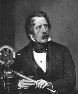
Carl August von Steinheil
German physicist
Distance: Approx. 365 meters
Latitude and longitude: 48.127222,11.565
Carl August von Steinheil (12 October 1801 – 14 September 1870) was a German physicist, inventor, engineer and astronomer.

Goetheplatz station
Station of the Munich U-Bahn
Distance: Approx. 356 meters
Latitude and longitude: 48.12916667,11.55777778
Goetheplatz is a U-Bahn station in Munich, Germany, in operation since 19 October 1971. It is used by the U3 and U6 lines, for which it originally was the southern terminus.

Sendlinger Tor station
Station of the Munich U-Bahn
Distance: Approx. 475 meters
Latitude and longitude: 48.13333333,11.56638889
Sendlinger Tor is an U-Bahn station in the city center of Munich at a junction of the lines U1/2/7 and U3/6 line of the Munich U-Bahn system. It was opened on 19 October 1971 (upper level, U3 and U6) and 18 October 1980 (lower level, U1, U2 and U7). Above ground, the station is served by routes , , and of the Munich tramway.

Alter Südfriedhof
Cemetery in Munich, Germany
Distance: Approx. 367 meters
Latitude and longitude: 48.1272,11.565
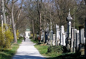
The Alter Südfriedhof (Old South Cemetery) also known as "Alter Südlicher Friedhof" is a cemetery in Munich, Germany. It was founded by Duke Albrecht V as a plague cemetery in 1563 about half a kilometer south of the Sendlinger Gate between Thalkirchner and Pestalozzistraße.

Ludwigsvorstadt-Isarvorstadt
Borough of Munich, Germany
Distance: Approx. 353 meters
Latitude and longitude: 48.12725212,11.56475794
Ludwigsvorstadt-Isarvorstadt (Central Bavarian: Ludwigsvorstod-Isarvorstod) is one of the boroughs of Munich, Germany. It consists of the districts Ludwigsvorstadt, located south of Munich Hauptbahnhof and east of the Theresienwiese, and Isarvorstadt, which is north-west of the River Isar and southeast of Munich's Old Town. The Lindwurmstraße serves as a divider for the two districts.
Volleyballhalle
Distance: Approx. 487 meters
Latitude and longitude: 48.1333,11.5667
Volleyballhalle is an indoor arena located in Munich, Germany. It hosted the volleyball competitions for the 1972 Summer Olympics in Munich. The hall has an area of 5132 square meters and included a restaurant, restrooms, and changing area.

St. Stephan's Church, Munich
Church in Munich
Distance: Approx. 330 meters
Latitude and longitude: 48.13083333,11.56666667
St. Stephan's Church is a former cemetery church of the old South Cemetery in Munich, Germany. It is the chapel of the parish church of St Peter.

LMU Klinikum
Hospital in Bavaria, Germany
Distance: Approx. 279 meters
Latitude and longitude: 48.132478,11.561845
The LMU Klinikum (until 2020 Klinikum der Universität München) is the merged hospital complex of the Ludwig Maximilian University of Munich (LMU), including the Campus Innenstadt in the city center and the Campus Großhadern in Hadern. The hospital houses more than 2000 beds with 48 clinics, institutes and departments, making it one of the largest hospitals in Europe. In 2015, the Ludwig Maximilian University was ranked the leading German university in the subject area "Clinical, pre-clinical and health" according to the Times Higher Education World University Ranking.

Dr. von Hauner Children's Hospital
Hospital
Distance: Approx. 255 meters
Latitude and longitude: 48.13016889,11.558975
The Dr. von Hauner Children's Hospital or Dr. von Haunersches Kinderspital is the pediatric clinic and polyclinic of the LMU Klinikum in Munich, Germany.
Weather in this IP's area
overcast clouds
9 Celsius
6 Celsius
8 Celsius
10 Celsius
1013 hPa
76 %
1013 hPa
951 hPa
10000 meters
4.47 m/s
6.71 m/s
270 degree
100 %
07:25:31
16:32:45