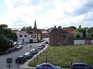
Country:
Region:
City:
Latitude and Longitude:
Time Zone:
Postal Code:
IP information under different IP Channel
ip-api
Country
Region
City
ASN
Time Zone
ISP
Blacklist
Proxy
Latitude
Longitude
Postal
Route
Luminati
Country
Region
vlg
City
beveren
ASN
Time Zone
Europe/Brussels
ISP
Sewan Belgium SA
Latitude
Longitude
Postal
IPinfo
Country
Region
City
ASN
Time Zone
ISP
Blacklist
Proxy
Latitude
Longitude
Postal
Route
db-ip
Country
Region
City
ASN
Time Zone
ISP
Blacklist
Proxy
Latitude
Longitude
Postal
Route
ipdata
Country
Region
City
ASN
Time Zone
ISP
Blacklist
Proxy
Latitude
Longitude
Postal
Route
Popular places and events near this IP address

Beveren
Municipality in Flemish Community, Belgium
Distance: Approx. 1471 meters
Latitude and longitude: 51.2,4.25
Beveren (Dutch pronunciation: [ˈbeːvərə(n)] ) is a municipality in the Belgian province of East Flanders which comprises the towns of Beveren, Doel, Haasdonk, Kallo, Kieldrecht, Melsele, Verrebroek and Vrasene. The port of the Waasland (Dutch: Waaslandhaven) is in Beveren, on the left bank of the Schelde, facing the port of Antwerp on the other side of the river.
Zwijndrecht, Belgium
Municipality in Flemish Community, Belgium
Distance: Approx. 5761 meters
Latitude and longitude: 51.21666667,4.33333333
Zwijndrecht (Dutch pronunciation: [ˈzʋɛindrɛxt] ) is both a village and a municipality located in the Flemish province of Antwerp, in Belgium. As well as Zwijndrecht proper, the municipality includes the village of Burcht. In 2021, Zwijndrecht had a total population of 19,263.

Freethiel Stadion
Multi-use stadium in Beveren, Belgium
Distance: Approx. 497 meters
Latitude and longitude: 51.214139,4.243931
Freethiel Stadion is a multi-use stadium in Beveren, Belgium. The Freethiel Stadium, also known as the Freethiel for short, is the football stadium where the Belgian football club SK Beveren (formerly known as Waasland-Beveren) plays its home games. The stadium was originally played by KSK Beveren, when that club temporarily stopped their men's team in 2010, Waasland-Beveren took its place.

Waasland
Distance: Approx. 5329 meters
Latitude and longitude: 51.25,4.202
The Waasland (Dutch pronunciation: [ˈʋaːslɑnt], archaically "Waesland") or Land van Waas (Dutch pronunciation: [ˈlɑnt vɑn ˈʋaːs]) is a historic region in northern Belgium. It is part of the Belgian provinces of East Flanders and Antwerp. The other borders are with the Scheldt and Durme rivers (east and south) and, to the north, the border with the Dutch region of Zeelandic Flanders.

Melsele
Town in Flemish Region
Distance: Approx. 2301 meters
Latitude and longitude: 51.2209,4.28152
Melsele is a town in the Belgian province of East Flanders, between the city of Beveren and the nearby town of Zwijndrecht. Tram route 3 which starts just outside the town connects it to Zwijndrecht and Antwerp. The town's road links include the E17 (France - Antwerp) and the E34 (Knokke-Heist - Antwerp).
Kasteel Cortewalle
Distance: Approx. 985 meters
Latitude and longitude: 51.2138,4.265
Cortewalle Castle (Dutch: Kasteel Cortewalle) is a moated castle in Beveren in East Flanders, Belgium.

Vrasene
Village in Flemish Region
Distance: Approx. 3975 meters
Latitude and longitude: 51.2192,4.1947
Vrasene is a village in the municipality of Beveren in the Belgian province of East Flanders. It is located about 15 kilometres (9.3 mi) west of Antwerp.

Haasdonk
Village in Flemish Region
Distance: Approx. 3865 meters
Latitude and longitude: 51.1794,4.2382
Haasdonk is a village and deelgemeente (sub-municipality) of Beveren in East Flanders, Belgium. Haasdonk was an independent municipality until 1 January 1977, when it merged with Beveren as part of the fusion of municipalities in Belgium. It is located about 12 kilometres (7.5 mi) west of Antwerp.

Burcht, Antwerp
Village in Flemish Region
Distance: Approx. 5934 meters
Latitude and longitude: 51.2,4.33333333
Burcht is a village within the municipality of Zwijndrecht located in the Flemish province of Antwerp, in Belgium.

Beveren railway station
Railway station in East Flanders, Belgium
Distance: Approx. 834 meters
Latitude and longitude: 51.20833333,4.26
Beveren is a railway station in the town of Beveren, East Flanders, Belgium. The station opened on 3 November 1844 and is located on line 59. The train services are operated by National Railway Company of Belgium (NMBS).

Kallo
Village in East Flanders, Belgium
Distance: Approx. 4712 meters
Latitude and longitude: 51.2519,4.2783
Kallo is a village and deelgemeente (sub-municipality) of Beveren in East Flanders, Belgium. Kallo was an independent municipality until 1 January 1977, when it merged with Beveren as part of the fusion of municipalities in Belgium. Most of the deelgemeente consists of harbours and industrial zones.

Church of Our Lady, Melsele
Church in East Flanders, Belgium
Distance: Approx. 2367 meters
Latitude and longitude: 51.22138889,4.28222222
The church of Our Lady, Melsele (Dutch: Onze-Lieve-Vrouwekerk van Melsele) is a Roman Catholic parish church in Melsele, in the commune of Beveren, in East Flanders, Belgium. It is a registered heritage site (beschermd erfgoed).
Weather in this IP's area
moderate rain
6 Celsius
4 Celsius
6 Celsius
7 Celsius
1003 hPa
96 %
1003 hPa
1002 hPa
5000 meters
3.09 m/s
140 degree
75 %
08:07:18
16:49:56

