80.249.121.181 - IP Lookup: Free IP Address Lookup, Postal Code Lookup, IP Location Lookup, IP ASN, Public IP
Country:
Region:
City:
Location:
Time Zone:
Postal Code:
ISP:
ASN:
language:
User-Agent:
Proxy IP:
Blacklist:
IP information under different IP Channel
ip-api
Country
Region
City
ASN
Time Zone
ISP
Blacklist
Proxy
Latitude
Longitude
Postal
Route
db-ip
Country
Region
City
ASN
Time Zone
ISP
Blacklist
Proxy
Latitude
Longitude
Postal
Route
IPinfo
Country
Region
City
ASN
Time Zone
ISP
Blacklist
Proxy
Latitude
Longitude
Postal
Route
IP2Location
80.249.121.181Country
Region
niederosterreich
City
leitzersdorf
Time Zone
Europe/Vienna
ISP
Language
User-Agent
Latitude
Longitude
Postal
ipdata
Country
Region
City
ASN
Time Zone
ISP
Blacklist
Proxy
Latitude
Longitude
Postal
Route
Popular places and events near this IP address
Korneuburg District
District in Lower Austria, Austria
Distance: Approx. 3300 meters
Latitude and longitude: 48.392,16.258
The political district Bezirk Korneuburg is located in Lower Austria and borders Vienna to the north.
Stockerau
Municipality in Lower Austria, Austria
Distance: Approx. 3913 meters
Latitude and longitude: 48.38333333,16.21666667
Stockerau (German pronunciation: [ʃtɔkəˈʁaʊ] ) is a town in the district of Korneuburg in Lower Austria, Austria. Stockerau has 16,974 inhabitants, which makes it the largest town in the Weinviertel. Stockerau is also called "Lenaustadt" (Lenau Town) because the Austrian poet Nikolaus Lenau often spent time with his grandparents here.
Leitzersdorf
Municipality in Lower Austria, Austria
Distance: Approx. 1234 meters
Latitude and longitude: 48.41666667,16.25
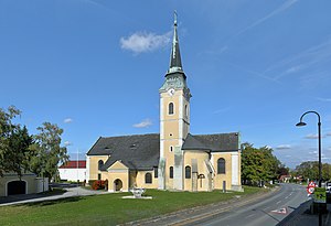
Leitzersdorf is a town in the district of Korneuburg in the Austrian state of Lower Austria.
Leobendorf
Municipality in Lower Austria, Austria
Distance: Approx. 7194 meters
Latitude and longitude: 48.38333333,16.31666667
Leobendorf is a town in the district of Korneuburg in the Austrian state of Lower Austria.
Niederhollabrunn
Municipality in Lower Austria, Austria
Distance: Approx. 6165 meters
Latitude and longitude: 48.45,16.3
Niederhollabrunn is a town in the district of Korneuburg in the Austrian state of Lower Austria.
Sierndorf
Municipality in Lower Austria, Austria
Distance: Approx. 5259 meters
Latitude and longitude: 48.43333333,16.16666667
Sierndorf is a town in the district of Korneuburg in the Austrian state of Lower Austria.

Spillern
Municipality in Lower Austria, Austria
Distance: Approx. 3914 meters
Latitude and longitude: 48.38333333,16.25
Spillern is a town in the district of Korneuburg in the Austrian state of Lower Austria.
Burg Greifenstein
Distance: Approx. 7648 meters
Latitude and longitude: 48.34944444,16.25444444
Burg Greifenstein is a castle in Lower Austria, Austria, overlooking the Danube. Burg Greifenstein is 227 metres (745 ft) above sea level. Approximately opposite to Burg Greifenstein is Burg Kreuzenstein, on the north shore of the Danube.
Burg Kreuzenstein
Castle near Leobendorf in Lower Austria, Austria
Distance: Approx. 6976 meters
Latitude and longitude: 48.37916667,16.30888889
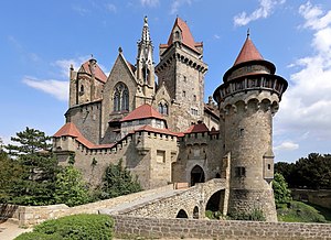
Burg Kreuzenstein is a castle near Leobendorf in Lower Austria, Austria. Burg Kreuzenstein is 265 metres (869 ft) above sea level. It was constructed on the remains of a medieval castle that had fallen into disrepair and was then demolished during the Thirty Years' War.
Battle of Leitzersdorf
Distance: Approx. 1234 meters
Latitude and longitude: 48.41666667,16.25
The Battle of Leitzersdorf was a battle between the Holy Roman Empire and the Kingdom of Hungary in 1484. Fuelled by the earlier conflicts of Matthias Corvinus and Frederick III, Holy Roman Emperor it marked the end of anti-Ottoman preparations and initiations of a holy war. It was the only open field battle of the Austro-Hungarian War, and the defeat meant – in long terms – the loss of the Archduchy of Austria for the Holy Roman Empire.

Stockerau Airfield
Airport in Austria
Distance: Approx. 3228 meters
Latitude and longitude: 48.40911111,16.19113889
Stockerau Airfield (German: Flugplatz Stockerau, ICAO: LOAU) is a private use aerodrome located 3 kilometres (2 mi) northwest of Stockerau, Lower Austria, Austria. The airport is the base of the annual CSLI Air Day for the handicapped.
Rohrwald
Forest in Lower Austria
Distance: Approx. 6159 meters
Latitude and longitude: 48.41666667,16.31666667
The Rohrwald is a forest complex in the Weinviertel area of Lower Austria. With a total area of approx. 24 sq km (9 sq mi), it represents the third largest closed forest complex in the district of Korneuburg after the Tulln Basin-Danube floodplains and the Ernstbrunn Forest.
Weather in this IP's area
clear sky
7 Celsius
5 Celsius
5 Celsius
8 Celsius
1006 hPa
70 %
1006 hPa
974 hPa
10000 meters
2.86 m/s
6.18 m/s
225 degree
10 %


