Country:
Region:
City:
Latitude and Longitude:
Time Zone:
Postal Code:
IP information under different IP Channel
ip-api
Country
Region
City
ASN
Time Zone
ISP
Blacklist
Proxy
Latitude
Longitude
Postal
Route
Luminati
Country
Region
01
City
balzers
ASN
Time Zone
Europe/Vaduz
ISP
Telecom Liechtenstein AG
Latitude
Longitude
Postal
IPinfo
Country
Region
City
ASN
Time Zone
ISP
Blacklist
Proxy
Latitude
Longitude
Postal
Route
db-ip
Country
Region
City
ASN
Time Zone
ISP
Blacklist
Proxy
Latitude
Longitude
Postal
Route
ipdata
Country
Region
City
ASN
Time Zone
ISP
Blacklist
Proxy
Latitude
Longitude
Postal
Route
Popular places and events near this IP address

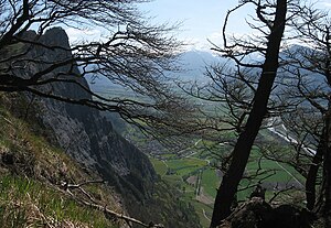
Balzers
Municipality in Oberland, Liechtenstein
Distance: Approx. 380 meters
Latitude and longitude: 47.06666667,9.5
Balzers (German pronunciation: [ˈbaltsɐs] ) is a municipality and village located in southern Liechtenstein. In 2019, the village had a population of 4,642. The main part of the village is situated along the east bank of the Rhine.

Wartau
Municipality in St. Gallen, Switzerland
Distance: Approx. 2621 meters
Latitude and longitude: 47.08333333,9.48333333
Wartau is a municipality in the Werdenberg constituency of the Swiss canton of St. Gallen. The municipality consists of a number of villages on the eastern flank of the Alvier group, along the left shore of the Alpine Rhine.

St. Luzisteig Pass
Distance: Approx. 3419 meters
Latitude and longitude: 47.03805556,9.52722222
St. Luzisteig Pass (el. 713 m.) is a mountain pass in the Alps between the canton of Graubünden in Switzerland and Liechtenstein.
Mäls
Village in Oberland, Liechtenstein
Distance: Approx. 601 meters
Latitude and longitude: 47.0625,9.49444444
Mäls is a village of Liechtenstein, located in the municipality of Balzers.

Mittlerspitz
Mountain in Switzerland
Distance: Approx. 2850 meters
Latitude and longitude: 47.065,9.53972222
Mittlerspitz is a mountain on the border of Liechtenstein and Switzerland in the Rätikon range of the Eastern Alps east of the town of Balzers, with a height of 1,897 metres (6,224 ft).

Mittagspitz
Mountain in Liechtenstein
Distance: Approx. 2502 meters
Latitude and longitude: 47.06916667,9.53416667
Mittagspitz is a mountain in Liechtenstein, close to the border with Switzerland in the Rätikon range of the Eastern Alps, east of the town of Balzers, with a height of 1,857 metres (6,093 ft).
Würznerhorn
Mountain in Switzerland
Distance: Approx. 2194 meters
Latitude and longitude: 47.06277778,9.53111111
Würznerhorn is a mountain on the border of Liechtenstein and Switzerland in the Rätikon range of the Eastern Alps close to the town of Balzers, with a height of 1,713 metres (5,620 ft).
Sportplatz Rheinau
Football stadium in Balzers, Liechtenstein
Distance: Approx. 1250 meters
Latitude and longitude: 47.07388056,9.49555278
The Sportplatz Rheinau is a football stadium in Balzers, Liechtenstein. It is the home of FC Balzers, and has a capacity of 2,000.

Fläscherberg
Mountain in Switzerland
Distance: Approx. 2923 meters
Latitude and longitude: 47.0375,9.50638889
The Fläscherberg (also known as Regitzer Spitz) is a mountain of the Rätikon, overlooking the Rhine in the Swiss canton of Graubünden. The closest locality is Fläsch on the southern side of the mountain. At the northern foot of the mountain is the border with Liechtenstein, and the town of Balzers.

Gutenberg Castle
Castle in the town of Balzers, Liechtenstein
Distance: Approx. 239 meters
Latitude and longitude: 47.0652,9.5001
Gutenberg Castle (German: Burg Gutenberg) is an intact castle in the town of Balzers, Liechtenstein, in the centre of the municipality of Balzers, the southern-most municipality in the country. Gutenberg is one of the five castles of the principality and one of two that have survived intact until the present day. Unlike Vaduz Castle, Gutenberg Castle does not serve as a residence of the princely family of Liechtenstein and is open to the general public as a museum.

Saar (Rhine)
River in Switzerland
Distance: Approx. 2950 meters
Latitude and longitude: 47.0617,9.4634
The Saar is a minor tributary of the Alpine Rhine in the Swiss canton of St. Gallen. It rises in Mittelsäss, Bad Ragaz municipality, at 2,087 m elevation.
Ellhorn
Mountain in Switzerland
Distance: Approx. 2088 meters
Latitude and longitude: 47.05361111,9.47888889
Ellhorn is a mountain in Switzerland on the Rätikon mountain range on the Central Eastern Alps, located on the border with Liechtenstein. It has an elevation 758 metres (2,487 ft) above sea level.
Weather in this IP's area
broken clouds
9 Celsius
9 Celsius
8 Celsius
10 Celsius
1028 hPa
100 %
1028 hPa
971 hPa
10000 meters
1.49 m/s
1.51 m/s
185 degree
73 %
07:06:36
17:04:25
