Country:
Region:
City:
Latitude and Longitude:
Time Zone:
Postal Code:
IP information under different IP Channel
ip-api
Country
Region
City
ASN
Time Zone
ISP
Blacklist
Proxy
Latitude
Longitude
Postal
Route
Luminati
Country
Region
by
City
bamberg
ASN
Time Zone
Europe/Berlin
ISP
Stadtnetz Bamberg Gesellschaft fuer Telekommunikation mbH
Latitude
Longitude
Postal
IPinfo
Country
Region
City
ASN
Time Zone
ISP
Blacklist
Proxy
Latitude
Longitude
Postal
Route
db-ip
Country
Region
City
ASN
Time Zone
ISP
Blacklist
Proxy
Latitude
Longitude
Postal
Route
ipdata
Country
Region
City
ASN
Time Zone
ISP
Blacklist
Proxy
Latitude
Longitude
Postal
Route
Popular places and events near this IP address

Bamberg
Town in Bavaria, Germany
Distance: Approx. 2825 meters
Latitude and longitude: 49.89138889,10.88694444
Bamberg (, US also , German: [ˈbambɛʁk] ; East Franconian: Bambärch) is a town in Upper Franconia district in Bavaria, Germany, on the river Regnitz close to its confluence with the river Main. Bamberg had 79,000 inhabitants in 2022. The town dates back to the 9th century, when its name was derived from the nearby Babenberch castle.
Schlenkerla
Pub in Bamberg, Germany
Distance: Approx. 2988 meters
Latitude and longitude: 49.89166667,10.88472222
Schlenkerla is a historic brewpub in Bamberg, Franconia, Germany, renowned for its smoked Aecht Schlenkerla Rauchbier.
University of Bamberg
University
Distance: Approx. 2911 meters
Latitude and longitude: 49.89388889,10.88666667
The University of Bamberg (German: Otto-Friedrich-Universität Bamberg) in Bamberg, Germany, specializes in the humanities, cultural studies, social sciences, economics, and applied computer science.

Brose Arena
Distance: Approx. 893 meters
Latitude and longitude: 49.87916667,10.92055556
Brose Arena (official spelling: brose ARENA) is the fourth largest multi-functional indoor arena in Bavaria, after the Olympic Hall and the SAP Garden in Munich and the Arena Nürnberger Versicherung in Nuremberg.

Breitengüßbach
Municipality in Bavaria, Germany
Distance: Approx. 2501 meters
Latitude and longitude: 49.89166667,10.89166667
Breitengüßbach (or Breitengüssbach) is a community in the Upper Franconian district of Bamberg in Bavaria. It was first mentioned as Gusibach and as belonging to the royal court at Hallstadt in an Imperial document issued between 812 and 830.
Villa Dessauer
Distance: Approx. 2403 meters
Latitude and longitude: 49.89083333,10.89277778
The Villa Dessauer is a mansion in Bamberg, Germany, which is used as an art gallery by the local City Council. The edifice was built in 1884 by the Jewish merchant Carl Dessauer. During the Nazi regime, the villa was confiscated, but after World War II the son of the former owner received his property back and sold it to the City of Bamberg.

Warner Barracks
Distance: Approx. 2282 meters
Latitude and longitude: 49.907,10.925
Warner Barracks was a United States Army military base in the city of Bamberg, Bavaria, southern Germany. The base had been occupied by U.S. forces since the end of World War II. Elements of the U.S. Army's 3rd Infantry Division and 45th Infantry Division entered the town on 13 and 14 April 1945. But before the war, this military site had a colorful history that goes hand-in-hand with Bamberg's history, which began in the 10th century.

Bamberg station
Railway station in Bamberg, Germany
Distance: Approx. 2463 meters
Latitude and longitude: 49.90083333,10.89944444
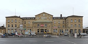
Bamberg station is the only passenger station in the city of Bamberg in Upper Franconia in the German state of Bavaria. It is a major hub station for local trains operated by Deutsche Bahn and Agilis and is also a regularly served by Intercity-Express and Intercity trains. The station is on the Nuremberg–Bamberg, Bamberg–Hof and Bamberg–Rottendorf railway lines.

E.T.A.-Hoffmann-Theater
Distance: Approx. 2495 meters
Latitude and longitude: 49.89055556,10.89138889
The E.T.A.-Hoffmann-Theater is a theatre in Bamberg, Bavaria, Germany, named after the writer E. T. A. Hoffmann.
Fuchs-Park-Stadion
Distance: Approx. 1582 meters
Latitude and longitude: 49.90055556,10.92888889
Fuchs-Park-Stadion is an athletics stadium in Bamberg, Germany.
Drudenhaus (prison)
Distance: Approx. 2582 meters
Latitude and longitude: 49.89341111,10.89123889
The Drudenhaus (also known as Malefizhaus, Trudenhaus, Hexenhaus, and Hexengefängnis) was a famous special prison for people accused during the Bamberg witch trials. The prison was constructed in 1627 on the order of Johann Georg Fuchs von Dornheim, Prince Bishop of Bamberg, and closed in 1632.

Bamberg-Breitenau Airfield
Airport in Bamberg
Distance: Approx. 2095 meters
Latitude and longitude: 49.90388889,10.91444444
The Bamberg-Breitenau Airfield (ICAO code: EDQA) is the special airfield of the Upper Franconian town of Bamberg, Germany. It was operated by the United States Army from 1945 to 2012 as Bamberg Army Airfield (ICAO code: ETEJ), but was already used mainly for civil air traffic at that time. Today, the airfield is approved for sport and business jets up to 10 t maximum take-off mass (MTOW), a refueling system is available.
Weather in this IP's area
overcast clouds
9 Celsius
8 Celsius
5 Celsius
9 Celsius
1025 hPa
63 %
1025 hPa
995 hPa
10000 meters
1.8 m/s
4.11 m/s
151 degree
100 %
07:12:43
16:47:04


