Country:
Region:
City:
Latitude and Longitude:
Time Zone:
Postal Code:
IP information under different IP Channel
ip-api
Country
Region
City
ASN
Time Zone
ISP
Blacklist
Proxy
Latitude
Longitude
Postal
Route
Luminati
Country
Region
13
City
porto
ASN
Time Zone
Europe/Lisbon
ISP
Nos Comunicacoes, S.A.
Latitude
Longitude
Postal
IPinfo
Country
Region
City
ASN
Time Zone
ISP
Blacklist
Proxy
Latitude
Longitude
Postal
Route
db-ip
Country
Region
City
ASN
Time Zone
ISP
Blacklist
Proxy
Latitude
Longitude
Postal
Route
ipdata
Country
Region
City
ASN
Time Zone
ISP
Blacklist
Proxy
Latitude
Longitude
Postal
Route
Popular places and events near this IP address

Oliveira de Azeméis
Municipality in Norte, Portugal
Distance: Approx. 1076 meters
Latitude and longitude: 40.83333333,-8.48333333
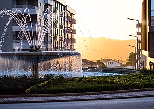
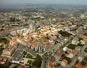
Oliveira de Azeméis (Portuguese pronunciation: [ɔliˈvɐjɾɐ ðɨ ɐzɨˈmɐjʃ] ) is a city and municipality in the Porto Metropolitan Area of Portugal. Administratively, the municipality belongs to the District of Aveiro. The population of the municipality in 2011 was 68,611, in an area of 161.10 km2.

São João da Madeira
Municipality in Norte, Portugal
Distance: Approx. 6359 meters
Latitude and longitude: 40.89722222,-8.48888889
São João da Madeira (Portuguese pronunciation: [sɐ̃w ʒuˈɐ̃w dɐ mɐˈðɐjɾɐ] ), is a city and a municipality in northwestern region of the Portuguese Norte region. It's part of the larger Porto Metropolitan Area, located 30 km from central Porto. The population in 2011 was 21,713.

Vale de Cambra
Municipality in Norte, Portugal
Distance: Approx. 6441 meters
Latitude and longitude: 40.85,-8.4
Vale de Cambra (Portuguese pronunciation: [ˈval(ɨ) ðɨ ˈkɐ̃bɾɐ] ; Proto-Celtic: *Cambra) is a city and a municipality in Portugal. The population in 2011 was 22,864, in an area of 147.33 km². It had 21,440 electors in 2006.

Entre Douro e Vouga
Distance: Approx. 6883 meters
Latitude and longitude: 40.9,-8.5
Entre Douro e Vouga (Portuguese pronunciation: [ˌẽtɾɨ ˌðoɾu i ˈvoɣɐ]) was a former NUTS3 Portuguese subregion. It was abolished at the January 2015 NUTS 3 revision. It is now part of Metropolitan Area of Porto - NUTS3, integrated in the NUTS2 Norte Region.
Arrifana (Santa Maria da Feira)
Civil parish in Norte, Portugal
Distance: Approx. 8216 meters
Latitude and longitude: 40.913,-8.497
Arrifana (Portuguese pronunciation: [ɐʁiˈfɐnɐ]) is a Portuguese parish, located in the municipality of Santa Maria da Feira. The population in 2011 was 6,551, in an area of 5.29 km2. Its local inhabitants are known as Arrifanense.
Mosteirô
Civil parish in Norte, Portugal
Distance: Approx. 7967 meters
Latitude and longitude: 40.899,-8.531
Mosteirô is a former civil parish in the municipality of Santa Maria da Feira, Portugal. In 2013, the parish merged into the new parish São Miguel do Souto e Mosteirô. It has a population of 2,043 inhabitants and a total area of 2.95 km2.
Estádio Conde Dias Garcia
Distance: Approx. 6672 meters
Latitude and longitude: 40.89823889,-8.49907222
Estádio Conde Dias Garcia is a multi-use stadium in São João da Madeira, Portugal. It is currently used mostly for football matches and is the home ground of A.D. Sanjoanense. The stadium holds a seating capacity of 15,000.
Oliveira de Azeméis, Santiago de Riba-Ul, Ul, Macinhata da Seixa e Madail
Civil parish in Norte, Portugal
Distance: Approx. 121 meters
Latitude and longitude: 40.84,-8.475
Oliveira de Azeméis, Santiago de Riba-Ul, Ul, Macinhata da Seixa e Madail is a civil parish in the municipality of Oliveira de Azeméis in Porto Metropolitan Area, Portugal. It was formed in 2013 by the merger of the former parishes Oliveira de Azeméis, Santiago de Riba-Ul, Ul, Macinhata da Seixa and Madail. The population in 2011 was 20,760, in an area of 25.94 km2.

Ponte da Pica
Distance: Approx. 3331 meters
Latitude and longitude: 40.86961,-8.48713
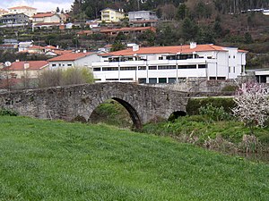
Ponte da Pica is a bridge in Portugal. It is located in Oliveira de Azeméis, Aveiro District.
Carregosa
Civil parish in Norte, Portugal
Distance: Approx. 7130 meters
Latitude and longitude: 40.885,-8.414
Carregosa is a civil parish in the municipality of Oliveira de Azeméis, Portugal. The population in 2011 was 3,419, in an area of 11.82 km2.

Estádio Carlos Osório
Distance: Approx. 453 meters
Latitude and longitude: 40.8419,-8.4703
Estádio Carlos Osório is a stadium in Oliveira de Azeméis, Aveiro, Portugal. It is currently used for football matches and is the home ground of Liga de Honra side U.D. Oliveirense. The ground holds a seating capacity of 1,750.
São Miguel do Souto e Mosteirô
Civil parish in Norte, Portugal
Distance: Approx. 8229 meters
Latitude and longitude: 40.888,-8.551
São Miguel do Souto e Mosteirô is a civil parish in the municipality of Santa Maria da Feira, Portugal. It was formed in 2013 by the merger of the former parishes Souto and Mosteirô. The population in 2011 was 6,734, in an area of 13.80 km2.
Weather in this IP's area
few clouds
18 Celsius
18 Celsius
18 Celsius
20 Celsius
1018 hPa
77 %
1018 hPa
993 hPa
10000 meters
2.06 m/s
250 degree
20 %
07:25:02
17:13:34
