Country:
 Denmark
Region:
City:
Latitude and Longitude:
Time Zone:
Postal Code:
IP information under different IP Channel
ip-api
Country
Region
City
ASN
Time Zone
ISP
Blacklist
Proxy
Latitude
Longitude
Postal
Route
IPinfo
Country
Region
City
ASN
Time Zone
ISP
Blacklist
Proxy
Latitude
Longitude
Postal
Route
MaxMind
Country
Region
City
ASN
Time Zone
ISP
Blacklist
Proxy
Latitude
Longitude
Postal
Route
Luminati
Country
DKRegion
84
City
frederiksberg
ASN
Time Zone
Europe/Copenhagen
ISP
GlobalConnect A/S
Latitude
Longitude
Postal
db-ip
Country
Region
City
ASN
Time Zone
ISP
Blacklist
Proxy
Latitude
Longitude
Postal
Route
ipdata
Country
Region
City
ASN
Time Zone
ISP
Blacklist
Proxy
Latitude
Longitude
Postal
Route
Popular places and events near this IP address

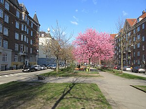
Vesterbro, Copenhagen
District of Copenhagen, Denmark
Distance: Approx. 747 meters
Latitude and longitude: 55.66722222,12.555
Vesterbro is one of the 15 administrative, statistical, and city tax districts (bydele) comprising the municipality of Copenhagen, Denmark. It covers an area of 3.76 km2 (1.45 sq mi), and has a population of 51,466 and a population density of 13,688 per km2. Neighboring city districts are: to the northeast, the Indre By, also known as "Copenhagen Center", "Downtown Copenhagen" or "City".

Dybbølsbro railway station
Commuter railway station in Copenhagen, Denmark
Distance: Approx. 520 meters
Latitude and longitude: 55.66527778,12.55944444
Dybbølsbro station is a central S-train railway station serving the district of Vesterbro in Copenhagen, Denmark.

Gemini Residence
Residential in Islands Brygge
Distance: Approx. 679 meters
Latitude and longitude: 55.66083333,12.56861111
Gemini Residence is a residential building on the Islands Brygge waterfront in Copenhagen, Denmark. Built to the design of MVRDV, the building has been created by converting two former seed silos. It is located at the end of Bryggebroen, connecting Amager-side Islands Brygge to Zealand-side Vesterbro across the harbour, and close to the southern end of Havneparken.

DieselHouse
Diesel technology museum in Copenhagen
Distance: Approx. 495 meters
Latitude and longitude: 55.6565,12.5552
DieselHouse is an interactive exhibition on diesel technology located on the grounds of the still operating H. C. Ørsted Power Station in the South Docklands of Copenhagen, Denmark. The exhibition is centred on a gigantic decommissioned Burmeister & Wain diesel engine which was the world's largest for more than 30 years.

H. C. Ørsted Power Station
Distance: Approx. 431 meters
Latitude and longitude: 55.65685278,12.55696389
H. C. Ørsted Power Station (Danish: H. C. Ørstedværket) is a natural gas fired combined heat and power station located at Enghave Brygge, Sydhavnen in Copenhagen, Denmark. It is owned and operated by Ørsted. It is named after the Danish physicist Hans Christian Ørsted, the discoverer of electromagnetism.
Sønder Boulevard
Park in Copenhagen, Denmark
Distance: Approx. 762 meters
Latitude and longitude: 55.6651,12.5485
Sønder Boulevard (lit. "South Boulevard") is a boulevard in the Vesterbro district of Copenhagen, Denmark, whose broad central reserve has been turned into a linear park with various facilities for sports and other activities. It runs from Halmtorvet next to Copenhagen Central Station in the north east to the Carlsberg district in the southwest.

Kalvebod Brygge
Distance: Approx. 672 meters
Latitude and longitude: 55.66504722,12.565225
Kalvebod Brygge (lit. 'Kalvebod Quay') is a waterfront area in the Vesterbro district of Copenhagen, Denmark. The name also refers to a section of the Ring 2 ring road which follows the waterfront from Langebro in the north to the H. C. Ørsted Power Station in the south. The area is dominated by office buildings, Tivoli Conference Center, several hotels and the shopping centre Fisketorvet.
Enghave Brygge
Distance: Approx. 600 meters
Latitude and longitude: 55.6555,12.5603
Enghave Brygge (English: Enghave Quay) is a waterfront area in the Southern Docklands of Copenhagen, Denmark. It is located between Vesterbro to the north and Teglholmen to the south, and opposite Islands Brygge across the water. The area is undergoing significant development, with the northern half now housing around 2.000 inhabitants, and construction of apartment blocks in the southern half is underway.

Havneholmen, Copenhagen
Distance: Approx. 333 meters
Latitude and longitude: 55.6608,12.5631
Havneholmen (lit. 'The Harbour Isle') is a mixed-use development located on reclaimed land off Kalvebod Brygge in the harbor of Copenhagen, Denmark. It is located just east of the shopping centre Fisketorvet from which it is separated by a narrow canal, although it is annexed to mainland Kalvebod Brygge at its southern end. Havneholmen is connected to Islands Brygge on the other side of the harbor by Brygge Bridge, a foot and cycling bridge.

Fisketorvet
Shopping mall in Copenhagen, Denmark
Distance: Approx. 274 meters
Latitude and longitude: 55.662,12.5615
Fisketorvet - Copenhagen Mall is a shopping centre located on Kalvebod Brygge waterfront in Copenhagen, Denmark. It is Denmark's third largest shopping center by size. Fisketorvet - Copenhagen Mall regularly hosts events for the guests such as: Fastelavn (a Danish Carnival) Copenhagen Cooking & Food Festival Holiday tickets The centre is located at Fisketorvet Dybbølsbro station next to the harbour.

Absalon's Church
Distance: Approx. 704 meters
Latitude and longitude: 55.6654,12.5503
Absalon's Church (Danish: Absalons Kirke) is a defunct church in the Absalons Sogn of Copenhagen, Denmark. It was begun in 1926 to designs by Arthur Wittmaack and Vilhelm Hvalsøe. It opened on 2 September 1934.
Havneholmen station
Copenhagen metro station
Distance: Approx. 508 meters
Latitude and longitude: 55.65861111,12.565
Havneholmen station is an underground Copenhagen Metro station, located next to the eponymous street and development, in Copenhagen, Denmark. The station is on the M4 Line, between Copenhagen Central and Enghave Brygge.
Weather in this IP's area
overcast clouds
14 Celsius
13 Celsius
13 Celsius
14 Celsius
1018 hPa
92 %
1018 hPa
1017 hPa
10000 meters
4.12 m/s
140 degree
100 %
07:46:52
18:02:32