Country:
 Italy
ItalyRegion:
City:
Latitude and Longitude:
Time Zone:
Postal Code:
IP information under different IP Channel
ip-api
Country
Region
City
ASN
Time Zone
ISP
Blacklist
Proxy
Latitude
Longitude
Postal
Route
IPinfo
Country
Region
City
ASN
Time Zone
ISP
Blacklist
Proxy
Latitude
Longitude
Postal
Route
MaxMind
Country
Region
City
ASN
Time Zone
ISP
Blacklist
Proxy
Latitude
Longitude
Postal
Route
Luminati
Country
ITASN
Time Zone
Europe/Rome
ISP
SEEWEB s.r.l.
Latitude
Longitude
Postal
db-ip
Country
Region
City
ASN
Time Zone
ISP
Blacklist
Proxy
Latitude
Longitude
Postal
Route
ipdata
Country
Region
City
ASN
Time Zone
ISP
Blacklist
Proxy
Latitude
Longitude
Postal
Route
Popular places and events near this IP address

Villa of the Papyri
Ancient Roman villa in Ercolano, Italy
Distance: Approx. 3181 meters
Latitude and longitude: 40.80666667,14.34555556
The Villa of the Papyri (Italian: Villa dei Papiri, also known as Villa dei Pisoni and in early excavation records as the Villa Suburbana) was an ancient Roman villa in Herculaneum, in what is now Ercolano, southern Italy. It is named after its unique library of papyri scrolls, discovered in 1750. The Villa was considered to be one of the most luxurious houses in all of Herculaneum and in the Roman world.
San Sebastiano al Vesuvio
Comune in Campania, Italy
Distance: Approx. 1628 meters
Latitude and longitude: 40.83333333,14.36666667
San Sebastiano al Vesuvio (Neapolitan: San Bastiano) is a comune (municipality) in the Metropolitan City of Naples, located on the western slopes of Mount Vesuvius. Its elevation means that it is often a few degrees cooler than the neighbouring metropolis of Naples. In 1944 it was destroyed and two children were killed by the eruption of Mount Vesuvius during the Allies' occupation of southern Italy, but has since been rebuilt.

National Railway Museum of Pietrarsa
Railway museum in Campania, Italy
Distance: Approx. 2726 meters
Latitude and longitude: 40.8217,14.3205
The National Railway Museum of Pietrarsa (Italian: Museo Nazionale Ferroviario di Pietrarsa) is close to the Naples–Portici railway. The museum is housed in what was originally the 'Bourbon works' Officine di Pietrarsa, founded in 1840 on the orders of Ferdinand II of Bourbon to build steam engines for ships and boilers for locomotives. The factory was organized into pavilions which housed the different production steps.
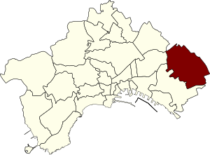
Barra (Naples)
Distance: Approx. 2605 meters
Latitude and longitude: 40.83333333,14.31666667
Barra is an eastern quarter of Naples, southern Italy, with a population of some 40,000 inhabitants (38,103 in the 2001 census.) Barra occupies the easternmost section of the Naples comune's territory, ranging from the sea to the Vesuvio's slopes, bounding with Poggioreale. The area has suffered much the same fate of urban decay as the rest of the eastern periphery of Naples, a fate that includes drugs and entrenched organized crime. Historically, it was one of the Vesuvian areas built up under the Bourbons in the 18th century and still displays some structures from that period that have been restored and incorporated into the tourist/cultural itinerary of "Vesuvian Villas".

San Giovanni a Teduccio
Quarter of Naples, Italy
Distance: Approx. 2605 meters
Latitude and longitude: 40.83333333,14.31666667
San Giovanni a Teduccio is a coastal suburb in the east of Naples, in southern Italy.
Miano
Distance: Approx. 2605 meters
Latitude and longitude: 40.83333333,14.31666667
Miano is a suburb of Naples, Italy, with a population of around 26,000.

Botanical Garden of Portici of the University of Naples Federico II
Distance: Approx. 2624 meters
Latitude and longitude: 40.81178,14.34394
The Orto Botanico di Portici (20,000 m2), also known as the Orto Botanico della Facoltà di Agraria dell'Università di Napoli-Portici, is a botanical garden operated by the University of Naples Agriculture Department, and located at Via Università, 100 – 80055 Portici, Province of Naples, Campania, Italy. It is open weekday mornings, but reservations must be made in advance and an admission fee is charged. The garden's site was formerly a Royal palace of Portici built 1738-1748 by Charles III of Spain, King of Naples and Sicily.

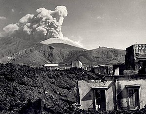
Herculaneum
Roman town destroyed by eruption of Mount Vesuvius
Distance: Approx. 3251 meters
Latitude and longitude: 40.806,14.3482
Herculaneum is an ancient Roman town, located in the modern-day comune of Ercolano, Campania, Italy. Herculaneum was buried under a massive pyroclastic flow in the eruption of Mount Vesuvius in 79 AD. Like the nearby city of Pompeii, Herculaneum is famous as one of the few ancient cities to be preserved nearly intact, as the solidified material from the volcano that blanketed the town protected it against looting and the elements. Although less known than Pompeii today, it was the first and, for a long time, the only discovered Vesuvian city (in 1709).
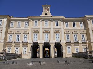
Royal Palace of Portici
Distance: Approx. 2702 meters
Latitude and longitude: 40.8112,14.3427
The Royal Palace of Portici (Reggia di Portici or Palazzo Reale di Portici; Neapolitan: Reggia ‘e Puortece) is a former royal palace in Portici, Southeast of Naples along the coast, in the region of Campania, Italy. Today it is the home of the Orto Botanico di Portici, a botanical garden operated by the University of Naples Federico II. These gardens were once part of the large royal estate that included an English garden, a zoo and formal parterres. It is located just a few metres from the Roman ruins of Herculaneum and is home to the Accademia Ercolanese, the deposit for all found objects of archaeological site.
Ponticelli
Distance: Approx. 2605 meters
Latitude and longitude: 40.83333333,14.31666667
Ponticelli is an eastern suburb of Naples, southern Italy with a population of some 70,000 inhabitants.

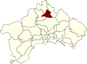
6th municipality of Naples
Borough in Italy
Distance: Approx. 2454 meters
Latitude and longitude: 40.84004444,14.319075
The Sixth Municipality (In Italian: Sesta Municipalità or Municipalità 6) is one of the ten boroughs in which the Italian city of Naples is divided. It is the largest municipality in the city by surface area.
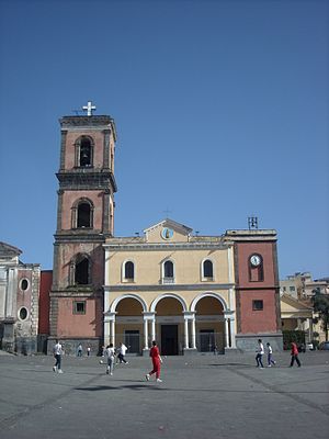
Basilica of Santa Maria a Pugliano
Distance: Approx. 2576 meters
Latitude and longitude: 40.8124,14.3527
The Basilica of Santa Maria a Pugliano is the main church in Ercolano and the oldest church in the area around Mount Vesuvius. The church contains two pagan marble sarcophagi from the 2nd and 4th centuries AD, later adapted into Christian altars, probably in the 11th century. There are records of an oratory dedicated to the Virgin Mary in the 11th century on a hill called Pugliano, whose name probably derives from the 'praedium pollianum', a farm on the outskirts of Ercolano belonging to someone called Pollio or Pollione.
Weather in this IP's area
scattered clouds
19 Celsius
19 Celsius
18 Celsius
20 Celsius
1016 hPa
94 %
1016 hPa
1007 hPa
10000 meters
2.06 m/s
70 degree
40 %
07:17:14
18:17:51