80.240.84.145 - IP Lookup: Free IP Address Lookup, Postal Code Lookup, IP Location Lookup, IP ASN, Public IP
Country:
 USA
USARegion:
City:
Location:
Time Zone:
Postal Code:
ISP:
ASN:
language:
User-Agent:
Proxy IP:
Blacklist:
IP information under different IP Channel
ip-api
Country
Region
City
ASN
Time Zone
ISP
Blacklist
Proxy
Latitude
Longitude
Postal
Route
db-ip
Country
Region
City
ASN
Time Zone
ISP
Blacklist
Proxy
Latitude
Longitude
Postal
Route
IPinfo
Country
Region
City
ASN
Time Zone
ISP
Blacklist
Proxy
Latitude
Longitude
Postal
Route
IP2Location
80.240.84.145Country
usRegion
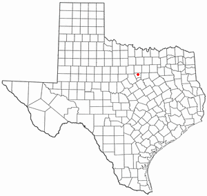
texas
City
granbury
Time Zone
America/Chicago
ISP
Language
User-Agent
Latitude
Longitude
Postal
ipdata
Country
Region
City
ASN
Time Zone
ISP
Blacklist
Proxy
Latitude
Longitude
Postal
Route
Popular places and events near this IP address

Hood County, Texas
County in Texas, United States
Distance: Approx. 3623 meters
Latitude and longitude: 32.43,-97.83
Hood County is a county in the U.S. state of Texas. As of the 2020 census, the population was 61,598. Its county seat is Granbury.
Granbury, Texas
City in Texas, United States
Distance: Approx. 2769 meters
Latitude and longitude: 32.44194444,-97.76472222
Granbury is a city in and the county seat of Hood County, Texas, United States. As of the 2020 census, the city's population was 10,958, and it is the principal city of the Granbury micropolitan statistical area. Granbury is named after Confederate General Hiram B. Granbury.
Oak Trail Shores, Texas
Census-designated place in Texas, United States
Distance: Approx. 6045 meters
Latitude and longitude: 32.48722222,-97.83
Oak Trail Shores is an unincorporated community and census-designated place (CDP) in Hood County, Texas, United States. Its population was 2,755 at the 2010 census. It is part of the Granbury micropolitan area as well as the Dallas–Fort Worth metroplex.

DeCordova, Texas
City in Texas, United States
Distance: Approx. 9559 meters
Latitude and longitude: 32.42777778,-97.69388889
DeCordova is an unincorporated city in Hood County, Texas, United States. As of the US 2020 Census, it had a population of 3,007. It is a gated residential community located on Lake Granbury, 6 miles (10 km) east-southeast of Granbury, and is part of the Granbury, Texas Micropolitan Statistical Area.

Stockton Bend, Texas
City in Texas, United States
Distance: Approx. 4827 meters
Latitude and longitude: 32.47527778,-97.76111111
Stockton Bend, formerly Brazos Bend, is a city in Hood County, Texas, United States. It was incorporated in May 2004 originally as "Brazos Bend", and is located along the main stem of the Brazos River. As of the 2020 census it had a population of 380.

Granbury Independent School District
School district in Texas
Distance: Approx. 410 meters
Latitude and longitude: 32.4457,-97.7951
Granbury Independent School District is a public school district based in Granbury, Texas (USA). In addition to Granbury, the district serves the eastern Hood County cities of DeCordova and Stockton Bend (formerly Brazos Bend), and the majority of Cresson. The district boundary also includes the unincorporated communities of Canyon Creek, Oak Trail Shores, and Pecan Plantation.
KPIR
Radio station in Glanbury, Texas
Distance: Approx. 2265 meters
Latitude and longitude: 32.46194444,-97.78888889
KPIR (1420 kHz) is a commercial AM radio station in Granbury, Texas, serving Hood County. It is owned by Jerry Reynolds, with the license held by KPIR Granbury, LLC. It airs a classic country radio format, featuring Texas country artists. It also carries Granbury High School football games.
Tidwell Field
Baseball park located in Texas, United States
Distance: Approx. 1647 meters
Latitude and longitude: 32.442591,-97.811724
Tidwell Field is a baseball park located in Granbury, TX and was the home of the Texas Collegiate League Granbury Generals in 2004. It is also the home of the Granbury Pirates baseball team.

Hood County Courthouse Historic District
Historic district in Texas, United States
Distance: Approx. 996 meters
Latitude and longitude: 32.4425,-97.78361111
The Hood County Courthouse Historic District in Granbury, Hood County, Texas encompasses 12 acres of land. The principal building in and the focal point of the district is the historic Hood County Courthouse built in 1890–1891. Other major buildings include the 1885 Hood County Jailhouse, the 1885 First National Bank Building, the 1891 building which formerly housed the Hood County News, the 1893 Aston-Landers Saloon Building, the 1893 Nutt Brothers Building, and the 1886 Granbury Opea House.

Granbury High School
Public school in the United States
Distance: Approx. 1536 meters
Latitude and longitude: 32.438537,-97.81
Granbury High School is a public high school located in the city of Granbury, Texas, United States and classified as a 5A school by the University Interscholastic League (UIL). It is part of the Granbury Independent School District which serves students grades 9–12 from Granbury, Hood County along with portions of Johnson County and Parker County. The school was founded around 1870 at a different location.

Granbury Regional Airport
Airport
Distance: Approx. 2153 meters
Latitude and longitude: 32.44444444,-97.81694444
Granbury Regional Airport (ICAO: KGDJ, FAA LID: GDJ, formerly F55) is a city-owned, public-use airport located two nautical miles (4 km) west of the central business district of Granbury, a city in Hood County, Texas, United States. Formerly known as Granbury Municipal Airport, it is included in the National Plan of Integrated Airport Systems for 2011–2015, which categorized it as a general aviation facility. Although most U.S. airports use the same three-letter location identifier for the FAA and IATA, this airport is assigned GDJ by the FAA but has no designation from the IATA (which assigned GDJ to Gandajika Airport in Gandajika, DR Congo).
Canyon Creek, Hood County, Texas
Census-designated place in Texas, United States
Distance: Approx. 7095 meters
Latitude and longitude: 32.39277778,-97.74638889
Canyon Creek is an unincorporated community and census-designated place (CDP) in Hood County, Texas, United States. The population was 916 at the 2010 census. It is part of the Granbury micropolitan area as well as the Dallas–Fort Worth metroplex.
Weather in this IP's area
clear sky
8 Celsius
8 Celsius
8 Celsius
10 Celsius
1017 hPa
63 %
1017 hPa
986 hPa
10000 meters
0.89 m/s
1.34 m/s
90 degree