Country:
Region:
City:
Latitude and Longitude:
Time Zone:
Postal Code:
IP information under different IP Channel
ip-api
Country
Region
City
ASN
Time Zone
ISP
Blacklist
Proxy
Latitude
Longitude
Postal
Route
IPinfo
Country
Region
City
ASN
Time Zone
ISP
Blacklist
Proxy
Latitude
Longitude
Postal
Route
MaxMind
Country
Region
City
ASN
Time Zone
ISP
Blacklist
Proxy
Latitude
Longitude
Postal
Route
Luminati
Country
Region
ara
City
andrezieuxboutheon
ASN
Time Zone
Europe/Paris
ISP
Arelion Sweden AB
Latitude
Longitude
Postal
db-ip
Country
Region
City
ASN
Time Zone
ISP
Blacklist
Proxy
Latitude
Longitude
Postal
Route
ipdata
Country
Region
City
ASN
Time Zone
ISP
Blacklist
Proxy
Latitude
Longitude
Postal
Route
Popular places and events near this IP address
Furan (river)
River in France
Distance: Approx. 588 meters
Latitude and longitude: 45.52472222,4.24972222
Furan (also written as: Furens) is a 39.3 km long river in central France (Loire department), right tributary of the river Loire. It flows through the city Saint-Étienne and flows into the Loire in the small town Andrézieux-Bouthéon.

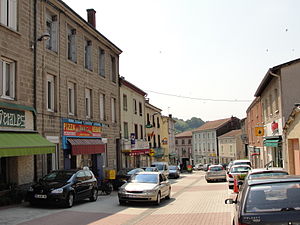
Andrézieux-Bouthéon
Commune in Auvergne-Rhône-Alpes, France
Distance: Approx. 521 meters
Latitude and longitude: 45.5269,4.2608
Andrézieux-Bouthéon (French pronunciation: [ɑ̃dʁezjø buteɔ̃]; Arpitan: Andrèsiô-Botion) is a commune of the Loire department in central France. It lies on the right bank of the river Loire, at its confluence with the river Furan, 13 km north of the city of Saint-Étienne.

Saint-Just-Saint-Rambert
Commune in Auvergne-Rhône-Alpes, France
Distance: Approx. 2839 meters
Latitude and longitude: 45.5003,4.2406
Saint-Just-Saint-Rambert (French pronunciation: [sɛ̃ ʒy(st) sɛ̃ ʁɑ̃bɛʁ]) is a commune in the Loire department in central France. Saint-Just-Saint-Rambert was created in 1973 by the merger of two former communes: Saint-Just-sur-Loire and Saint-Rambert-sur-Loire.

Bonson, Loire
Commune in Auvergne-Rhône-Alpes, France
Distance: Approx. 3138 meters
Latitude and longitude: 45.5242,4.2167
Bonson (French pronunciation: [bɔ̃sɔ̃]) is a commune in the Loire department in central France.

Saint-Bonnet-les-Oules
Place in Auvergne-Rhône-Alpes, France
Distance: Approx. 6331 meters
Latitude and longitude: 45.5433,4.3328
Saint-Bonnet-les-Oules (French pronunciation: [sɛ̃ bɔnɛ le.z‿ul]) is a commune in the Loire department in central France.
La Fouillouse
Commune in Auvergne-Rhône-Alpes, France
Distance: Approx. 4945 meters
Latitude and longitude: 45.5044,4.3144
La Fouillouse (French pronunciation: [la fujuz]) is a commune in the Loire department in central France.
Veauche
Commune in Auvergne-Rhône-Alpes, France
Distance: Approx. 4732 meters
Latitude and longitude: 45.5628,4.2786
Veauche (French pronunciation: [voʃ]; Arpitan: Viôche) is a commune in the Loire department in central France. It is 20 km (12 mi) from Saint-Etienne and is bordered on the west by the Loire River.

Sury-le-Comtal
Commune in Auvergne-Rhône-Alpes, France
Distance: Approx. 5939 meters
Latitude and longitude: 45.5383,4.1839
Sury-le-Comtal (French pronunciation: [syʁi lə kɔ̃tal]) is a commune in the Loire department in central France.
Veauchette
Commune in Auvergne-Rhône-Alpes, France
Distance: Approx. 4477 meters
Latitude and longitude: 45.5628,4.2661
Veauchette (French pronunciation: [voʃɛt]) is a commune in the Loire department in the Auvergne-Rhône-Alpes region in central France.

Saint-Cyprien, Loire
Commune in Auvergne-Rhône-Alpes, France
Distance: Approx. 2335 meters
Latitude and longitude: 45.5389,4.2372
Saint-Cyprien (French pronunciation: [sɛ̃ sipʁijɛ̃] ; Arpitan: Sant-Cebrin) is a commune in the Loire department in central France.

Canton of Saint-Just-Saint-Rambert
Canton in Auvergne-Rhône-Alpes, France
Distance: Approx. 3816 meters
Latitude and longitude: 45.5344,4.2107
The canton of Saint-Just-Saint-Rambert is a French administrative division located in the department of Loire and the Auvergne-Rhône-Alpes region.

Canton of Andrézieux-Bouthéon
Canton in Auvergne-Rhône-Alpes, France
Distance: Approx. 805 meters
Latitude and longitude: 45.53,4.26
The canton of Andrézieux-Bouthéon is an administrative division of the Loire department, in eastern France. It was created at the French canton reorganisation which came into effect in March 2015. Its seat is in Andrézieux-Bouthéon.
Weather in this IP's area
broken clouds
15 Celsius
15 Celsius
14 Celsius
15 Celsius
1017 hPa
82 %
1017 hPa
972 hPa
10000 meters
75 %
08:03:24
18:52:23


