Country:
 Belgium
Region:
City:
Latitude and Longitude:
Time Zone:
Postal Code:
IP information under different IP Channel
ip-api
Country
Region
City
ASN
Time Zone
ISP
Blacklist
Proxy
Latitude
Longitude
Postal
Route
IPinfo
Country
Region
City
ASN
Time Zone
ISP
Blacklist
Proxy
Latitude
Longitude
Postal
Route
MaxMind
Country
Region
City
ASN
Time Zone
ISP
Blacklist
Proxy
Latitude
Longitude
Postal
Route
Luminati
Country
BERegion
bru
City
ixelleselsene
ASN
Time Zone
Europe/Brussels
ISP
Arelion Sweden AB
Latitude
Longitude
Postal
db-ip
Country
Region
City
ASN
Time Zone
ISP
Blacklist
Proxy
Latitude
Longitude
Postal
Route
ipdata
Country
Region
City
ASN
Time Zone
ISP
Blacklist
Proxy
Latitude
Longitude
Postal
Route
Popular places and events near this IP address

Museum of Natural Sciences
Museum of natural history in Brussels, Belgium
Distance: Approx. 637 meters
Latitude and longitude: 50.83694444,4.37611111
The Museum of Natural Sciences of Belgium (French: Muséum des Sciences naturelles de Belgique; Dutch: Museum voor Natuurwetenschappen van België) is a Brussels museum dedicated to natural history. It is a part of the Royal Belgian Institute of Natural Sciences (French: Institut royal des Sciences naturelles de Belgique (IRSNB); Dutch: Koninklijk Belgisch Instituut voor Natuurwetenschappen (KBIN)). The Dinosaur Hall of the museum is the world's largest museum hall completely dedicated to dinosaurs.

Ixelles
Municipality of the Brussels-Capital Region, Belgium
Distance: Approx. 151 meters
Latitude and longitude: 50.83333333,4.36666667
Ixelles (French, pronounced [iksɛl]) or Elsene (Dutch, pronounced [ˈɛlsənə] ) is one of the 19 municipalities of the Brussels-Capital Region, Belgium. Located to the south-east of Brussels' city centre, it is geographically bisected by the City of Brussels. It is also bordered by the municipalities of Auderghem, Etterbeek, Forest, Uccle, Saint-Gilles and Watermael-Boitsfort.
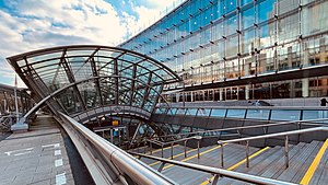
Brussels-Luxembourg railway station
Railway station in Brussels, Belgium
Distance: Approx. 649 meters
Latitude and longitude: 50.83888889,4.37388889
Brussels-Luxembourg railway station (French: Gare de Bruxelles-Luxembourg; Dutch: Station Brussel-Luxemburg) is a railway station in the European Quarter of Brussels, Belgium, located under the Esplanade of the European Parliament (part of the European Parliament complex).

Leopold Quarter
Neighbourhood in Brussels, Belgium
Distance: Approx. 519 meters
Latitude and longitude: 50.83888889,4.37
The Leopold Quarter (French: Quartier Léopold; Dutch: ) is a quarter of Brussels, Belgium. Today, the term is sometimes confused with the European Quarter, as the area has come to be dominated by the institutions of the European Union (EU) and organisations dealing with them, although the two terms are not in fact the same, with the Leopold Quarter being a smaller more specific district of the municipalities of the City of Brussels, Etterbeek, Ixelles and Saint-Josse-ten-Noode. The Leopold Quarter traditionally encompassed the area immediately south of the Small Ring (Brussels' inner ring road), between the Namur Gate and Louvain Gate.

Porte de Namur metro station
Metro station in Brussels, Belgium
Distance: Approx. 597 meters
Latitude and longitude: 50.83833333,4.36222222
Porte de Namur (French, pronounced [pɔʁt də namyʁ]) or Naamsepoort (Dutch) is a Brussels Metro station on the southern segment of lines 2 and 6. It is located under the Small Ring (Brussels' inner ring road) at the Square du Bastion/Bolwerksquare, next to the Chaussée d'Ixelles/Elsense Steenweg, in the municipality of Ixelles, south of the City of Brussels, Belgium. The station takes its name from the Namur Gate area, itself named after the Namur Gate in Brussels' old city walls.

Place du Luxembourg
Square in Brussels, Belgium
Distance: Approx. 626 meters
Latitude and longitude: 50.83919,4.37266
The Place du Luxembourg (French) or Luxemburgplein (Dutch), meaning "Luxembourg Square", is a square in the European Quarter of Brussels, Belgium. It is better known by local European bureaucrats and journalists by one of its nicknames, Place Lux or Plux. The square is mostly located in the municipality of Ixelles, with a small part in the City of Brussels, between the Rue d'Arlon/Aarlenstraat and the Rue du Luxembourg/Luxemburgstraat.

Chaussée de Wavre
Thoroughfare in Brussels, Belgium
Distance: Approx. 285 meters
Latitude and longitude: 50.83694444,4.3675
The Chaussée de Wavre (French: [ʃo.se d(ə) wavʁ]) or Waversesteenweg (Dutch) is a major street in Brussels, Belgium, running through the municipalities of Ixelles, Etterbeek and Auderghem. It starts at a crossroad with the Chaussée d'Ixelles/Elsensesteenweg near the Namur Gate in Ixelles, goes down to the Place Jourdan/Jourdanplein in Etterbeek, then goes up to the La Chasse crossroad, continues to the Arsenal crossroad with the Greater Ring. After this crossroad, the street enters Auderghem, crosses the Boulevard du Souverain/Vorstlaan, then merges with the European route E411 where it runs along the Red Cloister and then the Sonian Forest.

Institut Redouté-Peiffer
Distance: Approx. 201 meters
Latitude and longitude: 50.83416667,4.37083333
The Institut Redouté-Peiffer is a secondary technical and professional school in Anderlecht, in the Brussels Capital Region, Belgium. It is under the control of the French Community Commission (French: Communautaire Française, pronounced "COCOF"), and was previously the provincial college of the Province of Brabant. It was created from the merger of the Pierre-Joseph Redouté Institute and the Serge Peiffer Institute.

Namur Gate
Former city gate and current neighbourdhood in Brussels, Belgium
Distance: Approx. 611 meters
Latitude and longitude: 50.83833333,4.36194444
The Namur Gate (French: Porte de Namur, pronounced [pɔʁt də namyʁ]; Dutch: Naamsepoort) was one of the medieval city gates of the second walls of Brussels, Belgium. Built in the 14th century, it was demolished in 1784 during the construction of the Small Ring (Brussels' inner ring road). In the 21st century, the Porte de Namur (French) or Naamsepoort (Dutch) more commonly denotes the Ixelles neighbourhood where the gate formerly stood.

Museum of Ixelles
Art museum in Brussels, Belgium
Distance: Approx. 425 meters
Latitude and longitude: 50.83166667,4.37222222
The Museum of Ixelles (French: Musée d'Ixelles; Dutch: Museum van Elsene), also called the (Municipal) Museum of Fine Arts of Ixelles (French: Musée (communal) des Beaux-Arts d'Ixelles; Dutch: (Gemeentelijk) Museum voor Schone Kunsten van Elsene), is a municipal art museum in Brussels, Belgium, focusing on Belgian art from the 19th and 20th centuries. The museum is located at 71, rue Jean Van Volsem/Jean Van Volsemstraat in Ixelles. It is served by the bus stops Musée d'Ixelles/Museum van Elsene (on line 71) and Malibran (on lines 38 and 60).

Marie Haps Faculty of Translation and Interpreting
Educational institution in Brussels
Distance: Approx. 546 meters
Latitude and longitude: 50.83862222,4.37196111
The Marie Haps Faculty of Translation and Interpreting (TIMH, in French: Faculté de traduction et interprétation Marie Haps) is a faculty of Saint-Louis University, Brussels (UCLouvain) located on its own campus in Brussels' European Quarter, in the municipalities of Ixelles and the City of Brussels. It is Belgium's oldest translation school, founded in 1955, and the fifth faculty of Saint-Louis University, Brussels, which it fully merged with in 2015.

Monument to John Cockerill, Brussels
Monument in Brussels, Belgium
Distance: Approx. 628 meters
Latitude and longitude: 50.83916667,4.37277778
The Monument to John Cockerill (French: Monument à John Cockerill, Dutch: Monument voor John Cockerill) is a group of statues erected in Brussels, Belgium, in memory of the Belgian-British industrialist John Cockerill, a pioneer of the steel industry and the railways in Belgium in the 19th century, as well as the industrial workers of Belgium. The monumental group was designed in 1872 by the sculptor Armand Cattier in eclectic style. It stands in the centre of Place du Luxembourg/Luxemburgplein in Ixelles, with its back to the former Brussels-Luxembourg railway station's entrance and to the postmodern buildings of the Espace Léopold, seat of the European Parliament in Brussels.
Weather in this IP's area
broken clouds
15 Celsius
15 Celsius
15 Celsius
16 Celsius
1014 hPa
91 %
1014 hPa
1004 hPa
6000 meters
1.03 m/s
200 degree
75 %
08:10:48
18:44:06