Country:
 Germany
Region:
City:
Latitude and Longitude:
Time Zone:
Postal Code:
IP information under different IP Channel
ip-api
Country
Region
City
ASN
Time Zone
ISP
Blacklist
Proxy
Latitude
Longitude
Postal
Route
IPinfo
Country
Region
City
ASN
Time Zone
ISP
Blacklist
Proxy
Latitude
Longitude
Postal
Route
MaxMind
Country
Region
City
ASN
Time Zone
ISP
Blacklist
Proxy
Latitude
Longitude
Postal
Route
Luminati
Country
DEASN
Time Zone
Europe/Berlin
ISP
Host Europe GmbH
Latitude
Longitude
Postal
db-ip
Country
Region
City
ASN
Time Zone
ISP
Blacklist
Proxy
Latitude
Longitude
Postal
Route
ipdata
Country
Region
City
ASN
Time Zone
ISP
Blacklist
Proxy
Latitude
Longitude
Postal
Route
Popular places and events near this IP address

Upper Rhine
Section of the Rhine in Germany and Switzerland
Distance: Approx. 3670 meters
Latitude and longitude: 48.95,8.26666667
The Upper Rhine (German: Oberrhein [ˈoːbɐˌʁaɪn] ; French: Rhin Supérieur; kilometres 167 to 529 of the Rhine) is the section of the Rhine between the Middle Bridge in Basel, Switzerland, and the Rhine knee in Bingen, Germany. It is surrounded by the Upper Rhine Plain (Oberrheinische Tiefebene). Most of its upper section marks the France–Germany border.

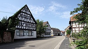
Rheinstetten
Town in Baden-Württemberg, Germany
Distance: Approx. 1634 meters
Latitude and longitude: 48.96055556,8.28972222
Rheinstetten (German pronunciation: [ʁaɪnˈʃtɛtn̩] ; South Franconian: Rhoischdedde) is a town in the west of Baden-Württemberg on the border to Rhineland-Palatinate. It is situated to the south-west of Karlsruhe and belongs to the rural district of Karlsruhe. The city has fewer inhabitants than Bruchsal, Ettlingen, Bretten and Stutensee and is therefore the fifth largest city in the district of Karlsruhe.

Durmersheim
Municipality in Baden-Württemberg, Germany
Distance: Approx. 4199 meters
Latitude and longitude: 48.93833333,8.27694444
Durmersheim is a small town in the district of Rastatt, Baden-Württemberg, Southwest Germany and has a population of 12,112 (2020). Durmersheim is situated between Karlsruhe and Rastatt, in the valley of the river Rhine near the border to France. There is also a forest in the valley, named Hardtwald, c.
Neuburg am Rhein
Municipality in Rhineland-Palatinate, Germany
Distance: Approx. 4461 meters
Latitude and longitude: 48.98805556,8.24972222
Neuburg am Rhein is a municipality in the district of Germersheim, in Rhineland-Palatinate, Germany. It is the southernmost municipality in the state.
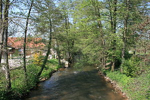
Lauter (Rhine)
River in Germany and France
Distance: Approx. 3131 meters
Latitude and longitude: 48.985,8.26777778
The Lauter (in its upper course also: Wieslauter) is a river in Germany and France. The Lauter is a left tributary of the Rhine. Its length is 55 kilometres (34 mi), of which 39 km is in France and on the France–Germany border.
Dm-Arena
Distance: Approx. 1985 meters
Latitude and longitude: 48.979957,8.328791
Dm-Arena is a multi-purpose hall in Rheinstetten near Karlsruhe, Germany. The indoor arena is one of four exhibition halls of the Karlsruhe Trade Fair Centre (Messe Karlsruhe). It opened in 2003 and holds 14,000 people.
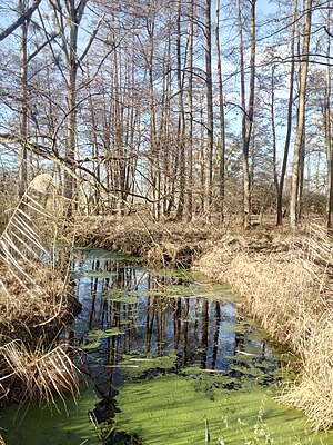
Kunzenbach
River in Germany
Distance: Approx. 3465 meters
Latitude and longitude: 48.9498,8.2707
Kunzenbach is a small river of Baden-Württemberg, Germany. It is a branch of the Federbach near Durmersheim.
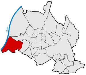
Daxlanden
Borough of Karlsruhe in Baden-Württemberg, Germany
Distance: Approx. 4145 meters
Latitude and longitude: 49.002,8.337
Daxlanden is a borough of Karlsruhe. The former fishing village lies west of the city centre of Karlsruhe, near the Rhine on the river Alb and comprises about 11,500 inhabitants.
Grünwinkel
Borough of Karlsruhe in Baden-Württemberg, Germany
Distance: Approx. 4586 meters
Latitude and longitude: 49,8.35
Grünwinkel is a borough in the southwest of Karlsruhe, Baden-Württemberg, in the southwest of Germany.

Ettlingen Line
Defensive line built in 1707 during the War of the Spanish Succession
Distance: Approx. 3174 meters
Latitude and longitude: 48.9825,8.345
The Ettlingen Line (German: Ettlinger Linie) or Lower Line (Untere Linie) was a defensive line built in 1707 during the War of the Spanish Succession from brushwood (Verhauen) and palisades, which replaced the 1701 Bühl-Stollhofen Line after that had been destroyed in May 1707 and levelled by French troops.
Neuburgweier
Stadtteil of Rheinstetten in Baden-Württemberg, Germany
Distance: Approx. 2817 meters
Latitude and longitude: 48.96944444,8.26666667
Neuburgweier is a part of the city Rheinstetten, which was first established as a municipality in the course of an administrative reform in 1975. In terms of inhabitants and area, it is the smallest of the three city parts - Neuburgweier, Forchheim and Mörsch. Following places border on Neuburgweier: Forchheim, Mörsch, Au am Rhein and on the other side of the Rhine, Neuburg am Rhein.
Oberreut
District of Karlsruhe
Distance: Approx. 3546 meters
Latitude and longitude: 48.98333333,8.35
Oberreut is a district in the south of Karlsruhe. The town is located around 2.5 kilometers southwest of the city center of Karlsruhe and south of the Bundesstraße 10.
Weather in this IP's area
overcast clouds
14 Celsius
14 Celsius
13 Celsius
15 Celsius
1023 hPa
89 %
1023 hPa
1009 hPa
10000 meters
0.99 m/s
1.9 m/s
35 degree
100 %
07:06:33
19:36:00