Country:
 Ireland
Region:
City:
Latitude and Longitude:
Time Zone:
Postal Code:
IP information under different IP Channel
ip-api
Country
Region
City
ASN
Time Zone
ISP
Blacklist
Proxy
Latitude
Longitude
Postal
Route
IPinfo
Country
Region
City
ASN
Time Zone
ISP
Blacklist
Proxy
Latitude
Longitude
Postal
Route
MaxMind
Country
Region
City
ASN
Time Zone
ISP
Blacklist
Proxy
Latitude
Longitude
Postal
Route
Luminati
Country
IERegion
l
City
dunlaoghaire
ASN
Time Zone
Europe/Dublin
ISP
Three Ireland (Hutchison) limited
Latitude
Longitude
Postal
db-ip
Country
Region
City
ASN
Time Zone
ISP
Blacklist
Proxy
Latitude
Longitude
Postal
Route
ipdata
Country
Region
City
ASN
Time Zone
ISP
Blacklist
Proxy
Latitude
Longitude
Postal
Route
Popular places and events near this IP address

Royal Irish Yacht Club
Sporting organisation in Dún Laoghaire, Ireland
Distance: Approx. 249 meters
Latitude and longitude: 53.29444444,-6.1325
The Royal Irish Yacht Club is a yacht club located in Dún Laoghaire Harbour, County Dún Laoghaire–Rathdown, Republic of Ireland. The club was founded in 1831, with the Marquess of Anglesey, who commanded the cavalry at the Battle of Waterloo being its first Commodore. John Skipton Mulvany designed the clubhouse, which still retains a number of original architectural features since being opened in 1851.

Dún Laoghaire railway station
Rail station in Ireland
Distance: Approx. 314 meters
Latitude and longitude: 53.2949,-6.1345
Dún Laoghaire (Mallin) railway station (Irish: Stáisiún Uí Mhealláin, Dún Laoghaire) is a station in Dún Laoghaire, Dún Laoghaire–Rathdown, Ireland.

National Maritime Museum of Ireland
Maritime museum in Dún Laoghaire, Ireland
Distance: Approx. 470 meters
Latitude and longitude: 53.292156,-6.131767
The National Maritime Museum of Ireland (Irish: Músaem Mhuirí Náisiúnta na hÉireann) opened in 1978 in the former Mariners' Church in Moran Park, located between the seafront and the centre of Dún Laoghaire town, southeast of Dublin city. President Michael D. Higgins officially re-opened the museum in 2012.
St. Michael's Hospital (Dún Laoghaire)
Hospital in Dún Laoghaire, Ireland
Distance: Approx. 615 meters
Latitude and longitude: 53.293813,-6.13866
St. Michael's Hospital (Irish: Ospidéal Naomh Micheál) is a public hospital in Dún Laoghaire in Ireland. It is managed by Ireland East Hospital Group.

People's Park, Dún Laoghaire
Small semi-formal park, Dún Laoghaire, Ireland
Distance: Approx. 725 meters
Latitude and longitude: 53.289863,-6.128735
The People's Park is a small public park in the suburban town of Dún Laoghaire, south of Dublin, Ireland. Located near the East Pier of Dún Laoghaire Harbour and Glasthule, it opened in 1890, and major elements were redeveloped between 1985 and 1997, and again in 2012.

Dún Laoghaire Harbour
Port in Ireland
Distance: Approx. 138 meters
Latitude and longitude: 53.295062,-6.130345
Dún Laoghaire Harbour and Carlisle Pier were constructed in the nineteenth century for the purposes of sheltering ships and accommodating the mailboat which sailed between Dún Laoghaire and Holyhead. The nearby settlement of Dún Laoghaire has also previously been known as Kingstown and also as Dun Leary. Carlisle Pier has been known previously as Kingston Pier and the Mailboat Pier.

Dún Laoghaire
County town of Dún Laoghaire–Rathdown and port suburb of Dublin, Ireland
Distance: Approx. 760 meters
Latitude and longitude: 53.3,-6.14
Dún Laoghaire ( dun LEER-ee, Irish: [ˌd̪ˠuːn̪ˠ ˈl̪ˠeːɾʲə, - ˈl̪ˠiːɾʲə]) is a suburban coastal town in County Dublin in Ireland. It is the administrative centre of the county of Dún Laoghaire–Rathdown. The town was built up alongside a small existing settlement following 1816 legislation that allowed the building of a major port to serve Dublin.
Mariners' Church, Dún Laoghaire
Former church in Dún Laoghaire, Ireland, now a museum
Distance: Approx. 467 meters
Latitude and longitude: 53.29222222,-6.13205556
The Mariners' Church is a former Church of Ireland church located in Haigh Terrace, near the centre of Dún Laoghaire town, southeast of Dublin city. It now houses the National Maritime Museum of Ireland.

Dún Laoghaire Harbour Police
Law enforcement agency
Distance: Approx. 403 meters
Latitude and longitude: 53.29444,-6.135588
The Dún Laoghaire Harbour Police is a small, specialised police force in Dún Laoghaire, County Dublin, Ireland operating under the jurisdiction of the Dún Laoghaire Rathdown Country Council. The force has the power of arrest under Section 54 of the Harbours Act 1996 [1], to arrest persons in connection with offences under the Act, although they are then required to hand them over to the Garda Síochána. Prior to the passage of the Act, the Harbour Police were under the employ of the Department for the Marine and were sworn as constables under the Harbour, Docks & Piers Clauses Act 1847.
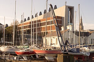
DLR Lexicon
Library in Dún Laoghaire, south-Dublin, Ireland.
Distance: Approx. 384 meters
Latitude and longitude: 53.293,-6.1321
DLR Lexicon, branded as dlr LexIcon, is a building in Dún Laoghaire, Ireland, housing the main public library and cultural centre of Dún Laoghaire–Rathdown County Council (DLR CC). It has attracted controversy, with opponents critical of its massive façade and its €36.6m cost at a time of austerity in Ireland, and supporters praising its interior, usability, and environmentally responsible construction.

County Hall, Dún Laoghaire
Municipal building in Dún Laoghaire-Rathdown, Ireland
Distance: Approx. 368 meters
Latitude and longitude: 53.2943,-6.1348
County Hall (Irish: Halla an Chontae, Dún Laoghaire), formerly known as Dún Laoghaire Town Hall, and before that, Kingstown Town Hall, is a municipal facility in Marine Road, Dún Laoghaire in the county of Dún Laoghaire–Rathdown, Ireland.
Pavilion Theatre (Dún Laoghaire)
Facility in Dún Laoghaire, Ireland
Distance: Approx. 337 meters
Latitude and longitude: 53.294013,-6.133716
Pavilion Theatre (Irish: Amharclann an Phailliúin) is a theatre, cinema and arts centre in Dún Laoghaire, Ireland.
Weather in this IP's area
scattered clouds
15 Celsius
14 Celsius
13 Celsius
16 Celsius
1031 hPa
76 %
1031 hPa
1031 hPa
10000 meters
2.57 m/s
150 degree
40 %
07:00:32
19:38:13