Country:
 Latvia
Region:
City:
Latitude and Longitude:
Time Zone:
Postal Code:
IP information under different IP Channel
ip-api
Country
Region
City
ASN
Time Zone
ISP
Blacklist
Proxy
Latitude
Longitude
Postal
Route
IPinfo
Country
Region
City
ASN
Time Zone
ISP
Blacklist
Proxy
Latitude
Longitude
Postal
Route
MaxMind
Country
Region
City
ASN
Time Zone
ISP
Blacklist
Proxy
Latitude
Longitude
Postal
Route
Luminati
Country
LVRegion
087
City
salaspils
ASN
Time Zone
Europe/Riga
ISP
SIA Tet
Latitude
Longitude
Postal
db-ip
Country
Region
City
ASN
Time Zone
ISP
Blacklist
Proxy
Latitude
Longitude
Postal
Route
ipdata
Country
Region
City
ASN
Time Zone
ISP
Blacklist
Proxy
Latitude
Longitude
Postal
Route
Popular places and events near this IP address

Salaspils
Town in Latvia
Distance: Approx. 900 meters
Latitude and longitude: 56.86666667,24.35
Salaspils (; German: Kircholm; Swedish: Kirkholm) (literally: "island castle") is a town in Latvia, the administrative centre of Salaspils Municipality. The town is situated on the northern bank of the Daugava river, 18 kilometers to the south-east of the city of Riga.

Battle of Kircholm
1605 battle of the Polish–Swedish War of 1600–11
Distance: Approx. 1280 meters
Latitude and longitude: 56.84861111,24.34805556
The Battle of Kircholm (Lithuanian: Salaspilio mūšis; Polish: Bitwa pod Kircholmem; Swedish: Slaget vid Kirkholm; 27 September [O.S. 17 September] 1605) was one of the major battles in the Polish–Swedish War of 1600–1611. The battle was decided in 20 minutes by a devastating charge of Polish-Lithuanian cavalry, including the Winged Hussars. The battle ended in a decisive victory of the Polish-Lithuanian forces, and is remembered as one of the greatest triumphs of Commonwealth cavalry.

Rumbula, Riga
Neighborhood of Riga, Latvia
Distance: Approx. 5178 meters
Latitude and longitude: 56.9,24.3
Rumbula is a neighbourhood of Riga located in the Latgale Suburb, on the right bank of the Daugava river. With a population of about 368 inhabitants in 2010, Rumbula's territory covers 6.978 km2 (2.694 sq mi). Rumbula is also the home of Rumbula Air Base, a defunct airport formerly used by Soviet and Latvian armies.

Riga Hydroelectric Power Plant
Hydroelectric power plant in Latvia
Distance: Approx. 4374 meters
Latitude and longitude: 56.85222222,24.27194444
Riga Hydroelectric Power Plant (Latvian: Rīgas hidroelektrostacija, shortened Rīgas HES) is located just beyond Riga's southern border. It is geographically located in the town of Salaspils. Total installed power generating capacity is 402 MW. There are six generators, two transformers and two 330 kV power lines (to Salaspils and Bišuciems).

Riga Hydroelectric Power Plant Crossing Pylon
Transmission tower in Latvia
Distance: Approx. 2934 meters
Latitude and longitude: 56.83805556,24.37
The Riga Hydroelectric Power Plant Crossing Pylon is an overhead powerline crossing of the Daugava River, near Salaspils in the Latvia. The present crossing was built in 1974, and includes one 112-metre tall lattice tower. It is the tallest electricity pylon in the Latvia.

Salaspils Municipality
Municipality of Latvia
Distance: Approx. 1020 meters
Latitude and longitude: 56.85166667,24.35055556
Salaspils Municipality (Latvian: Salaspils novads) is a municipality in Vidzeme, Latvia. The municipality was formed in 2004 by reorganization of Salaspils town and its rural territory, the administrative centre being Salaspils. In 2010 the rural territory was renamed Salaspils parish.

Salaspils camp
Nazi forced labour and concentration camp
Distance: Approx. 2990 meters
Latitude and longitude: 56.87438889,24.30136111
Salaspils camp was established at the end of 1941 at a point 18 km (11 mi) southeast of Riga (Latvia), in Salaspils. The Nazi bureaucracy drew distinctions between different types of camps. Officially, it was the Salaspils Police Prison and Re-Education Through Labor Camp (Polizeigefängnis und Arbeitserziehungslager).
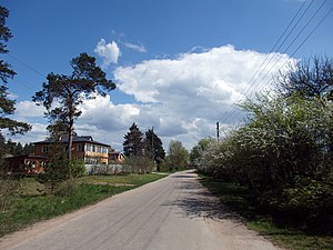
Dārziņi
Neighbourhood of Riga, Latvia
Distance: Approx. 4129 meters
Latitude and longitude: 56.86472222,24.27527778
Dārziņi is a neighbourhood of Riga, the capital of Latvia, which is located in the Latgale Suburb. The neighbourhood mostly consists of summer homes and small plant gardens for personal use, and it is the southernmost neighbourhood of Riga. Dārziņi were added to the city of Riga in 1968.

Dārziņi Station
Railway station in Latvia
Distance: Approx. 3916 meters
Latitude and longitude: 56.87009444,24.28102222
Dārziņi Station is a railway station on the Riga – Daugavpils Railway.
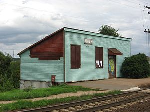
Dole Station
Railway station in Latvia
Distance: Approx. 1234 meters
Latitude and longitude: 56.86444444,24.32416667
Dole Station is a railway station on the Riga–Daugavpils Railway.
Salaspils Station
Railway station in Latvia
Distance: Approx. 655 meters
Latitude and longitude: 56.86065833,24.353125
Salaspils Station is a railway station on the Riga – Daugavpils Railway.

National Botanic Garden of Latvia
Botanic garden in Latvia
Distance: Approx. 1065 meters
Latitude and longitude: 56.86377778,24.35833333
The National Botanic Garden of Latvia (Latvian: Nacionālais botāniskais dārzs) is a botanical garden in Salaspils, Latvia. It is one of the largest botanical gardens in the Baltic states.
Weather in this IP's area
broken clouds
4 Celsius
4 Celsius
4 Celsius
4 Celsius
1013 hPa
96 %
1013 hPa
1012 hPa
10000 meters
1.02 m/s
1.04 m/s
127 degree
80 %
07:40:57
18:38:57