80.190.117.174 - IP Lookup: Free IP Address Lookup, Postal Code Lookup, IP Location Lookup, IP ASN, Public IP
Country:
Region:
City:
Location:
Time Zone:
Postal Code:
ISP:
ASN:
language:
User-Agent:
Proxy IP:
Blacklist:
IP information under different IP Channel
ip-api
Country
Region
City
ASN
Time Zone
ISP
Blacklist
Proxy
Latitude
Longitude
Postal
Route
db-ip
Country
Region
City
ASN
Time Zone
ISP
Blacklist
Proxy
Latitude
Longitude
Postal
Route
IPinfo
Country
Region
City
ASN
Time Zone
ISP
Blacklist
Proxy
Latitude
Longitude
Postal
Route
IP2Location
80.190.117.174Country
Region
bayern
City
sauerlach
Time Zone
Europe/Berlin
ISP
Language
User-Agent
Latitude
Longitude
Postal
ipdata
Country
Region
City
ASN
Time Zone
ISP
Blacklist
Proxy
Latitude
Longitude
Postal
Route
Popular places and events near this IP address
Munich (district)
District in Bavaria, Germany
Distance: Approx. 3374 meters
Latitude and longitude: 48,11.67
Munich (German: Landkreis München) is a Landkreis (district) in Bavaria, Germany. It borders (from the north and clockwise) the districts of Dachau, Freising, Erding, Ebersberg, Rosenheim, Miesbach, Bad Tölz-Wolfratshausen, Starnberg, Fürstenfeldbruck, and almost encircles (except for the west and northwest sides) the district-free city of Munich itself, which is the district seat.

Oberhaching
Municipality in Bavaria, Germany
Distance: Approx. 7254 meters
Latitude and longitude: 48.01666667,11.58333333
Oberhaching is a municipality in Bavaria, Germany, with 13,638 inhabitants (2020) on an area of 26.6 km2 (10.3 sq mi). It is located 15 km (9.3 mi) south of Munich city centre and has a 1,250 year history.
Lauterbach (company)
Distance: Approx. 7326 meters
Latitude and longitude: 48.022921,11.715559
Lauterbach GmbH (German pronunciation: [ˈlaʊtɐbax] ) is a German firm specializing in Debuggers, Trace Modules and logic analyzers used for debugging, profiling and analyzing embedded systems. The company was founded in 1979 by Lothar Lauterbach. In 2009 the firm was renamed from Lauterbach Datentechnik GmbH to Lauterbach GmbH. The company is global market leader for pure software as well as hardware-assisted debug- and trace development tools for embedded systems, which it sells under the brand name TRACE32.
Höhenkirchen-Siegertsbrunn station
Railway station in Germany
Distance: Approx. 7157 meters
Latitude and longitude: 48.01880556,11.71919444
Höhenkirchen-Siegertsbrunn is a station on the Munich S-Bahn network on the Munich-Giesing–Kreuzstraße railway. It is located in the community of Höhenkirchen-Siegertsbrunn, south-east of Munich. It has two side-platforms with a large distance between the tracks.

Ayinger Brewery
German brewery
Distance: Approx. 8950 meters
Latitude and longitude: 47.97194444,11.77388889
Ayinger Brewery ( EYE-ing-gər; German: Brauerei Aying) is in Aying, Bavaria, Germany, about 25 km south of Munich. Ayinger beers are exported to Italy, the United States, and the rest of Europe.

Höhenkirchen-Siegertsbrunn
Municipality in Bavaria, Germany
Distance: Approx. 7756 meters
Latitude and longitude: 48.01666667,11.73333333
Höhenkirchen-Siegertsbrunn is a municipality in Upper Bavaria, situated south of Munich. It is one of the municipalities with the longest names in Germany, the longest being Hellschen-Heringsand-Unterschaar.

Otterfing
Municipality in Bavaria, Germany
Distance: Approx. 6510 meters
Latitude and longitude: 47.91666667,11.68333333
Otterfing is a municipality in the district of Miesbach in Bavaria in Germany.

Brunnthal
Municipality in Bavaria, Germany
Distance: Approx. 5468 meters
Latitude and longitude: 48.01666667,11.68333333
Brunnthal is a municipality in the district of Munich in Bavaria in Germany.

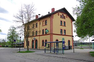
Sauerlach
Municipality in Bavaria, Germany
Distance: Approx. 628 meters
Latitude and longitude: 47.96666667,11.65
Sauerlach is a municipality in the district of Munich in Bavaria in Germany.

Deisenhofen station
Munich S-Bahn station
Distance: Approx. 7461 meters
Latitude and longitude: 48.0195,11.5836
Deisenhofen is a Munich S-Bahn railway station in Deisenhofen, a district of Oberhaching.
Furth (b Deisenhofen) station
Railway station in Oberhaching, Germany
Distance: Approx. 8427 meters
Latitude and longitude: 48.0358,11.5936
Furth (b Deisenhofen) station (German: Haltepunkt Furth (b Deisenhofen)) is a railway station in the municipality of Furth, located in the Munich district in Bavaria, Germany.

Furth (Oberhaching)
Village of Oberhaching in Bavaria, Germany
Distance: Approx. 7597 meters
Latitude and longitude: 48.02944444,11.59944444
Furth is a part of Oberhaching, located in the Munich district of Bavaria, Germany. It lies at a transition point over the Hachinger Bach and is first mentioned in written sources in 1172. The district of Furth borders in the north on the Perlacher Forst, in the south on the district of Deisenhofen (Oberhaching), in the west on the district of Grünwald and in the east on the district of Taufkirchen.
Weather in this IP's area
moderate rain
9 Celsius
8 Celsius
8 Celsius
10 Celsius
1002 hPa
69 %
1002 hPa
927 hPa
10000 meters
2.24 m/s
2.68 m/s
298 degree
81 %

