8.29.197.95 - IP Lookup: Free IP Address Lookup, Postal Code Lookup, IP Location Lookup, IP ASN, Public IP
Country:
Region:
City:
Location:
Time Zone:
Postal Code:
IP information under different IP Channel
ip-api
Country
Region
City
ASN
Time Zone
ISP
Blacklist
Proxy
Latitude
Longitude
Postal
Route
Luminati
Country
ASN
Time Zone
America/Chicago
ISP
IX Reach Ltd
Latitude
Longitude
Postal
IPinfo
Country
Region
City
ASN
Time Zone
ISP
Blacklist
Proxy
Latitude
Longitude
Postal
Route
IP2Location
8.29.197.95Country
Region
delaware
City
wilmington
Time Zone
America/New_York
ISP
Language
User-Agent
Latitude
Longitude
Postal
db-ip
Country
Region
City
ASN
Time Zone
ISP
Blacklist
Proxy
Latitude
Longitude
Postal
Route
ipdata
Country
Region
City
ASN
Time Zone
ISP
Blacklist
Proxy
Latitude
Longitude
Postal
Route
Popular places and events near this IP address
Wilmington station (Delaware)
Passenger rail station in Wilmington, Delaware
Distance: Approx. 402 meters
Latitude and longitude: 39.736759,-75.551093
Wilmington station, also known as the Joseph R. Biden, Jr., Railroad Station, is a passenger rail station in Wilmington, Delaware. It serves nine Amtrak train routes and is part of the Northeast Corridor. It also serves SEPTA Regional Rail commuter trains on the Wilmington/Newark Line as well as DART First State local buses and Greyhound Lines intercity buses.

Swedes' Landing
Distance: Approx. 626 meters
Latitude and longitude: 39.7364,-75.5392
Swedes' Landing is the warehouse road found along the Minquas Kill in Wilmington, Delaware that is close to the Delaware River. This was the site where the initial Swedish landing took place and marks the spot where the New Sweden colony began. The first Swedish expedition to North America, under the command of Peter Minuit, embarked from the port of Gothenburg in late 1637.
Holy Trinity Church (Old Swedes)
Church in Wilmington, Delaware
Distance: Approx. 581 meters
Latitude and longitude: 39.73852778,-75.54055556
Holy Trinity Church, also known as Old Swedes, is a historic church at East 7th and Church Street in Wilmington, Delaware. It was consecrated on Trinity Sunday, June 4, 1699, by a predominantly Swedish congregation formerly of the colony of New Sweden. The church is among the few surviving public buildings that reflect the Swedish colonial effort.

Old Asbury Methodist Church
Historic church in Wilmington, Delaware
Distance: Approx. 333 meters
Latitude and longitude: 39.738425,-75.548781
Old Asbury Methodist Church is a historic Methodist church located at Walnut and 3rd Streets in Wilmington, New Castle County, Delaware. It was the first Methodist church in Wilmington. The church is a two-story, three-bay, L-shaped stuccoed stone structure in a vernacular Italianate style.
St. Mary of the Immaculate Conception Church (Wilmington, Delaware)
Historic church in Delaware, United States
Distance: Approx. 407 meters
Latitude and longitude: 39.739125,-75.544043
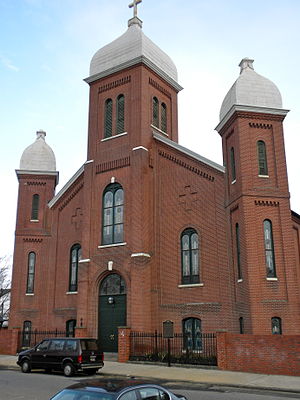
St. Mary of the Immaculate Conception is a historic Roman Catholic church located at 600 E Sixth St. (6th and Pine Streets) in Wilmington, New Castle County, Delaware.
St. Mary's School (Wilmington, Delaware)
United States historic place
Distance: Approx. 370 meters
Latitude and longitude: 39.738824,-75.544217
St. Mary's School is a historic Roman Catholic school building in Wilmington, New Castle County, Delaware. It was built in 1866 to serve children of parishioners of the adjacent St.
Hendrickson House
Distance: Approx. 518 meters
Latitude and longitude: 39.7385,-75.5414
Hendrickson House is one of the oldest houses in the U.S. state of Delaware and one of the oldest surviving Swedish-American homes in the United States. The house was originally built in the early 18th century in Chester, Pennsylvania as the home of Swedish farmer Andrew Hendrickson and his wife, Brigitta Morton, who were both born in the New Sweden colony. In 1958 the house was moved to Wilmington, Delaware.
Old Customshouse (Wilmington, Delaware)
United States historic place
Distance: Approx. 635 meters
Latitude and longitude: 39.741318,-75.54918
The Old Customshouse is a historic government building at 516 North King Street in Wilmington, Delaware. It was built in 1855 and added to the National Register of Historic Places in 1974.

Philips-Thompson Buildings
United States historic place
Distance: Approx. 472 meters
Latitude and longitude: 39.73944444,-75.54972222
Philips-Thompson Buildings was a set of two historic commercial buildings located at Wilmington, New Castle County, Delaware. They were built about 1884, and were two three-story, red brick buildings. They had a row of square decorative terra cotta tiles divides the second and third stories.
Church Street Historic District (Wilmington, Delaware)
Historic district in Delaware, United States
Distance: Approx. 619 meters
Latitude and longitude: 39.73916667,-75.54055556
Church Street Historic District is a national historic district located at Wilmington, New Castle County, Delaware. It encompasses 26 contributing buildings, 22 of which are single family fully attached rowhouse dwellings. They are primarily two-story, brick structures.
Lower Market Street Historic District
Historic district in Delaware, United States
Distance: Approx. 584 meters
Latitude and longitude: 39.73916667,-75.55194444
Lower Market Street Historic District is a national historic district located at Wilmington, New Castle County, Delaware. It encompasses 132 contributing buildings the central business district of Wilmington. It includes attached commercial and commercial/residential structures dating from the mid-18th to the early-20th century.
Water Street station
Distance: Approx. 625 meters
Latitude and longitude: 39.7376,-75.5535
Water Street Station is a former station of the Baltimore and Ohio Railroad in Wilmington, Delaware, designed by Frank Furness. The station was located on the eastern end of the B&O's Landenberg branch, roughly parallel to the Northeast Corridor of the Pennsylvania Railroad. The station served only trains terminating in Wilmington; through trains used a separate station at Delaware Avenue to the northwest.
Weather in this IP's area
overcast clouds
13 Celsius
13 Celsius
12 Celsius
14 Celsius
1004 hPa
89 %
1004 hPa
1003 hPa
10000 meters
0.45 m/s
2.24 m/s
279 degree
87 %


