Country:
 USA
USARegion:
City:
Latitude and Longitude:
Time Zone:
Postal Code:
IP information under different IP Channel
ip-api
Country
Region
City
ASN
Time Zone
ISP
Blacklist
Proxy
Latitude
Longitude
Postal
Route
IPinfo
Country
Region
City
ASN
Time Zone
ISP
Blacklist
Proxy
Latitude
Longitude
Postal
Route
MaxMind
Country
Region
City
ASN
Time Zone
ISP
Blacklist
Proxy
Latitude
Longitude
Postal
Route
Luminati
Country
USRegion
ca
City
santaclara
ASN
Time Zone
America/Los_Angeles
ISP
NVIDIA-NET
Latitude
Longitude
Postal
db-ip
Country
Region
City
ASN
Time Zone
ISP
Blacklist
Proxy
Latitude
Longitude
Postal
Route
ipdata
Country
Region
City
ASN
Time Zone
ISP
Blacklist
Proxy
Latitude
Longitude
Postal
Route
Popular places and events near this IP address

Santa Clara, California
City in California, United States
Distance: Approx. 1519 meters
Latitude and longitude: 37.35444444,-121.96916667
Santa Clara ( SAN-tə KLARR-ə; Spanish for "Saint Clare") is a city in the county of the same name in the state of California. The city's population was 127,647 at the 2020 census, making it the eighth-most populous city in the Bay Area. Located in the southern Bay Area, the city was founded by the Spanish in 1777 with the establishment of Mission Santa Clara de Asís under the leadership of Junípero Serra.
Buchser High School
Defunct high school in Santa Clara, California, United States
Distance: Approx. 749 meters
Latitude and longitude: 37.3457,-121.9821
Emil R. Buchser High School was a public high school in Santa Clara, California. It graduated its first class in 1960 and changed its name in 1981 to, Santa Clara High School, which was around many years at a much older location before Buchser High's campus. Santa Clara High's previous campus became the home of the new Buchser Middle School.

Santa Clara High School (Santa Clara, California)
Public secondary school in Santa Clara, California, United States
Distance: Approx. 741 meters
Latitude and longitude: 37.34591,-121.98179
Santa Clara High School is a comprehensive, co-educational, public high school located in Santa Clara, California, United States. It is one of five high schools in the Santa Clara Unified School District (SCUSD).

Battle of Santa Clara (1847)
Battle that happened 2 1/2 miles from Santa Clara de Asis Mission
Distance: Approx. 2336 meters
Latitude and longitude: 37.35333333,-121.95333333
The Battle of Santa Clara, nicknamed the "Battle of the Mustard Stalks", was a skirmish during the Mexican–American War, fought on January 2, 1847, 2+1⁄2 miles west of Mission Santa Clara de Asís in California. In late December, the former Californio military commander of Yerba Buena and a rancher from the San Mateo peninsula, Francisco Sanchez, imprisoned the American Mayor of Yerba Buena, Washington Bartlett, and five of his men, who were all engaged in a foraging raid on the peninsula. After receiving the news of the abduction on December 29, Commodore Montgomery in San Francisco ordered Marine Captain Ward Marston to rescue Bartlett and his men.
Le Papillon (restaurant)
Restaurant in California, United States
Distance: Approx. 2459 meters
Latitude and longitude: 37.31972222,-121.9725
Le Papillon (the French word for butterfly, pronounced [lə papiˈjɔ̃]) is a French restaurant located in San Jose, California. Le Papillon is located on a busy street corner between a hotel and a strip mall. Although the surrounding area is prosaic, the restaurant is "elegant (and expensive)".

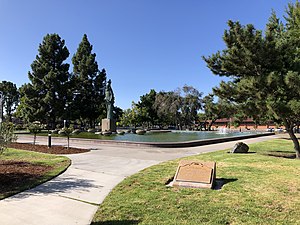
Triton Museum of Art
Art museum in Santa Clara, California
Distance: Approx. 2394 meters
Latitude and longitude: 37.3561082,-121.9552176
The Triton Museum of Art is a contemporary art museum located at 1505 Warburton Avenue in Santa Clara, California.

Santa Clara County Fire Department
Fire dept. in California, United States
Distance: Approx. 2090 meters
Latitude and longitude: 37.36,-121.97
The Santa Clara County Fire Department (SCCFD) provides fire protection and emergency medical services to the county of Santa Clara, California. Established in 1947, the SCCFD is responsible for the unincorporated areas of Santa Clara County as well as the communities of Campbell, Cupertino, Los Altos, Los Altos Hills, Los Gatos, Monte Sereno, and Saratoga. The service area encompasses approximately 128 square miles (330 km2) with a population of 226,700.

Morgan Horse (sculpture)
Distance: Approx. 2394 meters
Latitude and longitude: 37.3561082,-121.9552176
Morgan Horse, is a public artwork by artist Alexandrovich “Sascha” Stanislav Schnittmann, located in front of the Triton Museum of Art, in Santa Clara, California.

Shiv Durga Temple of Bay Area
Temple in USA
Distance: Approx. 1982 meters
Latitude and longitude: 37.35326,-121.99234
Shiv Durga Temple of Bay Area is a Hindu temple in Santa Clara, California that serves the Hindu population of the San Francisco Bay Area. The temple opened in December 2012. The main deity of the temple is Goddess Durga.
Santa Clara Campaign Treaty Site
Template for California Historical Landmarks in Santa Clara County.
Distance: Approx. 2249 meters
Latitude and longitude: 37.35222222,-121.95361111
The Santa Clara Campaign Treaty Site stands as a historic landmark that commemorates the Battle of Santa Clara, an armed clash that transpired during the Mexican-American War, fought on January 2, 1847. It was followed by a truce meeting the subsequent day. During this meeting, Marine Captain Ward Marston, commanding the United States expeditionary force, and Francisco Sánchez, the leader of the Mexican-Californian ranchers, came to an agreement on January 7, 1847.
Wilson High School (California)
Alternative high school in Santa Clara, Santa Clara County, California, United States
Distance: Approx. 1724 meters
Latitude and longitude: 37.3463,-121.9567
Wilson High School is an alternative public high school in Santa Clara, California, United States. It is one of five high schools in the Santa Clara Unified School District (SCUSD) and is accredited by the Western Association of Schools and Colleges (WASC).

Pomeroy Green
Historic tract housing in San Jose, California
Distance: Approx. 1162 meters
Latitude and longitude: 37.34555556,-121.9875
Pomeroy Green is a housing complex in Santa Clara, California, USA construction in 1961. The two-story complex has sixteen multifamily buildings, with a range of configurations per building. Pomeroy Green was registered on the National Register of Historic Places on March 24, 2021.
Weather in this IP's area
clear sky
14 Celsius
14 Celsius
12 Celsius
17 Celsius
1011 hPa
90 %
1011 hPa
1008 hPa
10000 meters
06:44:47
19:26:18