8.25.215.170 - IP Lookup: Free IP Address Lookup, Postal Code Lookup, IP Location Lookup, IP ASN, Public IP
Country:
Region:
City:
Location:
Time Zone:
Postal Code:
ISP:
ASN:
language:
User-Agent:
Proxy IP:
Blacklist:
IP information under different IP Channel
ip-api
Country
Region
City
ASN
Time Zone
ISP
Blacklist
Proxy
Latitude
Longitude
Postal
Route
db-ip
Country
Region
City
ASN
Time Zone
ISP
Blacklist
Proxy
Latitude
Longitude
Postal
Route
IPinfo
Country
Region
City
ASN
Time Zone
ISP
Blacklist
Proxy
Latitude
Longitude
Postal
Route
IP2Location
8.25.215.170Country
Region
california
City
san jose
Time Zone
America/Los_Angeles
ISP
Language
User-Agent
Latitude
Longitude
Postal
ipdata
Country
Region
City
ASN
Time Zone
ISP
Blacklist
Proxy
Latitude
Longitude
Postal
Route
Popular places and events near this IP address
Independence High School (San Jose, California)
Magnet high school in San Jose, California, United States
Distance: Approx. 2743 meters
Latitude and longitude: 37.37244167,-121.85908611
Independence High School, also referred to as IHS, is a public high school located in the Berryessa district of San Jose, California, United States. The school is operated by the East Side Union High School District (ESUHSD). Its namesake is the United States Declaration of Independence, which celebrated its bicentennial in the same year Independence High was established in 1976.

Berryessa, San Jose
Neighborhood of San Jose in Santa Clara, California, United States
Distance: Approx. 2194 meters
Latitude and longitude: 37.3863287,-121.8605104
Berryessa is a district of San Jose, California, located in North San Jose. The district is named after the Berryessa family, a prominent Californio family of the Bay Area which historically owned most of the area.
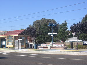
Cropley station
VTA light rail station in San Jose, California
Distance: Approx. 1999 meters
Latitude and longitude: 37.40337,-121.88207
Cropley station is a light rail station operated by Santa Clara Valley Transportation Authority (VTA). This station is served by VTA's Orange Line. The station was opened on June 24, 2004, as part of the second phase of VTA's Tasman East light rail extension.
Hostetter station
VTA light rail station in San Jose, California
Distance: Approx. 1730 meters
Latitude and longitude: 37.395349,-121.870072
Hostetter station is a light rail station in San Jose, California, United States. It is operated by the Santa Clara Valley Transportation Authority (VTA) and is served by the Orange Line. The station, built as part of the Tasman East/Capitol extension from I-880/Milpitas station (now Alder station) to Alum Rock Transit Center, was originally intended as the terminus of phase two of the Tasman East project.
Berryessa station (VTA)
VTA light rail station in San Jose, California
Distance: Approx. 2112 meters
Latitude and longitude: 37.387302,-121.861522
Berryessa station is a light rail station operated by Santa Clara Valley Transportation Authority (VTA). This station is served by VTA's Orange Line. The station was opened on June 24, 2004, as part of VTA's Capitol light rail extension.

Penitencia Creek station
VTA light rail station in San Jose, California
Distance: Approx. 2598 meters
Latitude and longitude: 37.382546,-121.856179
Penitencia Creek station is a light rail station operated by Santa Clara Valley Transportation Authority (VTA). This station is served by VTA's Orange Line. The station was opened on June 24, 2004, as part of VTA's Capitol light rail extension.
Penitencia Creek
Creek in California
Distance: Approx. 2063 meters
Latitude and longitude: 37.3675,-121.88027778
Upper Penitencia Creek is actually one of two creeks by the name Penitencia Creek in the northeastern Santa Clara Valley of Santa Clara County, California. They are both tributaries of Coyote Creek. The upper creek was diverted southwestward, connecting it directly to Coyote Creek ca.

San Jose Flea Market
Shopping mall
Distance: Approx. 1909 meters
Latitude and longitude: 37.36922,-121.8789
The San Jose Flea Market, located in Berryessa district of San Jose, California, was founded by George Bumb Sr. in March 1960. He had the idea to open a flea market while working in the solid waste and landfill business.

Silicon Valley University
Distance: Approx. 1803 meters
Latitude and longitude: 37.400276,-121.893924
Silicon Valley University (SVU) was a private, non-profit higher educational institution located in San Jose, California. The university was accredited by the Accrediting Council for Independent Colleges and Schools (ACICS) at the bachelor's degree and master's degree levels until December 7, 2017. On April 5, 2018, the state regulators of California ordered SVU to close and refund students' money within 45 days.
KIPP San Jose Collegiate
Public charter high school in the United States
Distance: Approx. 2913 meters
Latitude and longitude: 37.368646,-121.860211
KIPP San Jose Collegiate is a high school in San Jose, California, part of the KIPP chain. It is in the East Side Union High School District and was founded in 2008. KIPP San Jose Collegiate opened in August 2008.

Milpitas station
Transit center served by BART trains, VTA light rail and buses
Distance: Approx. 2795 meters
Latitude and longitude: 37.41027778,-121.89111111
Milpitas station, also known as Milpitas Transit Center, is an intermodal transit station located near the intersection of East Capitol Avenue and Montague Expressway in Milpitas, California, United States. The station is served by the Orange and Green lines of Bay Area Rapid Transit (BART), the Orange Line of the VTA light rail system, VTA buses, and AC Transit buses. The elevated Montague light rail station opened in June 2004.
Berryessa/North San José station
BART station in San Jose, California, United States
Distance: Approx. 2138 meters
Latitude and longitude: 37.3683606,-121.8746546
Berryessa/North San José station (also known as Berryessa station and Berryessa Transit Center) is an intermodal transit center located in the Berryessa district of San Jose, California, United States. The station is served by Bay Area Rapid Transit (BART) and Santa Clara Valley Transportation Authority (VTA) buses. The transit center opened for bus service on December 28, 2019, and subsequently for BART service on June 13, 2020.
Weather in this IP's area
clear sky
11 Celsius
10 Celsius
9 Celsius
13 Celsius
1026 hPa
43 %
1026 hPa
997 hPa
10000 meters
2.57 m/s
270 degree


