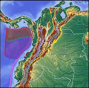
Country:
Region:
City:
Latitude and Longitude:
Time Zone:
Postal Code:
IP information under different IP Channel
ip-api
Country
Region
City
ASN
Time Zone
ISP
Blacklist
Proxy
Latitude
Longitude
Postal
Route
Luminati
Country
ASN
Time Zone
America/Bogota
ISP
DOBLECLICK SOFTWARE E INGENERIA
Latitude
Longitude
Postal
IPinfo
Country
Region
City
ASN
Time Zone
ISP
Blacklist
Proxy
Latitude
Longitude
Postal
Route
db-ip
Country
Region
City
ASN
Time Zone
ISP
Blacklist
Proxy
Latitude
Longitude
Postal
Route
ipdata
Country
Region
City
ASN
Time Zone
ISP
Blacklist
Proxy
Latitude
Longitude
Postal
Route
Popular places and events near this IP address

Bogotá
Capital and largest city of Colombia
Distance: Approx. 3384 meters
Latitude and longitude: 4.71111111,-74.07222222
Bogotá (, also UK: , US: , Spanish pronunciation: [boɣoˈta] ), officially Bogotá, Distrito Capital, abbreviated Bogotá, D.C., and formerly known as Santa Fe de Bogotá (Spanish: [ˌsanta ˈfe ðe βoɣoˈta]; lit. 'Holy Faith of Bogotá') during the Spanish Colonial period and between 1991 and 2000, is the capital and largest city of Colombia, and one of the largest cities in the world. The city is administered as the Capital District, as well as the capital of, though not politically part of, the surrounding department of Cundinamarca. Bogotá is a territorial entity of the first order, with the same administrative status as the departments of Colombia.

Engativá
Locality of Bogotá in Bogotá D.C., Colombia
Distance: Approx. 3635 meters
Latitude and longitude: 4.72611111,-74.1
Engativá is the 10th locality of Bogotá. It is located in the west of the city. This district is mostly inhabited by lower middle and working class residents.

Bogotá Colombia Temple
Distance: Approx. 4096 meters
Latitude and longitude: 4.707801,-74.056247
The Bogotá Colombia Temple is the 57th operating temple of the Church of Jesus Christ of Latter-day Saints (LDS Church).
Autopista Norte
Distance: Approx. 3564 meters
Latitude and longitude: 4.76194444,-74.04638889
Autopista Norte, also called Autopista paseo de los libertadores (Way of the Liberators Highway), is a major road in Bogotá, Colombia, running through the northern part of the city to its southern end at Avenida Caracas.

Avenida Suba
Distance: Approx. 3969 meters
Latitude and longitude: 4.70583333,-74.07083333
Avenida Suba is a major road in northern Bogotá, Colombia, connecting the locality of Suba with the rest of the capital.

Suba, Bogotá
Locality of Bogotá in Bogotá D.C., Colombia
Distance: Approx. 1432 meters
Latitude and longitude: 4.741,-74.084
Suba is the 11th locality of Bogotá, capital of Colombia. It is located in the northwest of the city, bordering to the north the municipality of Chía in Cundinamarca, to the west the municipality of Cota, to the east the locality Usaquén and to the south the localities Engativá and Barrios Unidos. This district is inhabited by residents of all social classes.

Colegio Helvetia
Private Swiss school in Bogotá, Colombia
Distance: Approx. 3018 meters
Latitude and longitude: 4.71486,-74.07622
Colegio Helvetia is a private multilingual (Spanish, German, French) Swiss school located in Suba, Bogotá, Colombia.

Roman Catholic Diocese of Engativá
Diocese of the Catholic Church in Colombia
Distance: Approx. 3635 meters
Latitude and longitude: 4.72611111,-74.1
The Roman Catholic Diocese of Engativá (Latin: Engativensis) is a diocese located in the city of Engativá in the ecclesiastical province of Bogotá in Colombia.

Centro Comercial Santafé
Shopping mall in Bogotá, Colombia
Distance: Approx. 3564 meters
Latitude and longitude: 4.76194444,-74.04638889
The Centro Comercial Santafé (English: Santafé Shopping Center) is a mall located in Bogotá, Colombia. It is the fourth largest shopping mall in Colombia (the largest is Centro Mayor in Bogotá), and the fifth in Latin America, surpassed by Leste Aricanduva Mall in São Paulo, Brazil. Opened on May 13, 2006.
Colegio Helvetica de Bogotá
Swiss international school in Bogotá, Colombia
Distance: Approx. 3025 meters
Latitude and longitude: 4.7148,-74.07622
Colegio Helvetica de Bogotá (CHB; German: Schweizerschule Bogotá) is a Swiss international school in Bogotá, Colombia. It serves up to grade 12 (final year of Sekundarstufe II). It was founded in 1949.

Chibcha Terrane
Distance: Approx. 2084 meters
Latitude and longitude: 4.72288889,-74.07325
The Chibcha Terrane (Spanish: Terreno Chibcha, TCH), named after Chibcha, is the largest of the geological provinces (terranes) of Colombia. The terrane, the oldest explored domains of which date to the Meso- to Neoproterozoic, is situated on the North Andes Plate. The megaregional Romeral Fault System forms the contact of the terrane with the Tahamí Terrane.

La Conejera Hill
Distance: Approx. 3697 meters
Latitude and longitude: 4.77444444,-74.06694444
La Conejera Hill is a 2,680-metre (8,790 ft) high hill located in the north of Bogotá, Colombia. It has an area of 161.4 ha (399 acres), a prominence of 115 m (377 ft), and a height of 2,680 m (8,790 ft). It is an extended hill in a south-north direction, occupying the area between Calles 170 and 200, and Carreras 80 and 90.
Weather in this IP's area
broken clouds
17 Celsius
17 Celsius
17 Celsius
19 Celsius
1013 hPa
59 %
1013 hPa
755 hPa
10000 meters
4.12 m/s
50 degree
75 %
05:44:52
17:38:34
