79.98.58.151 - IP Lookup: Free IP Address Lookup, Postal Code Lookup, IP Location Lookup, IP ASN, Public IP
Country:
Region:
City:
Location:
Time Zone:
Postal Code:
ISP:
ASN:
language:
User-Agent:
Proxy IP:
Blacklist:
IP information under different IP Channel
ip-api
Country
Region
City
ASN
Time Zone
ISP
Blacklist
Proxy
Latitude
Longitude
Postal
Route
db-ip
Country
Region
City
ASN
Time Zone
ISP
Blacklist
Proxy
Latitude
Longitude
Postal
Route
IPinfo
Country
Region
City
ASN
Time Zone
ISP
Blacklist
Proxy
Latitude
Longitude
Postal
Route
IP2Location
79.98.58.151Country
Region
ile-de-france
City
carrieres-sur-seine
Time Zone
Europe/Paris
ISP
Language
User-Agent
Latitude
Longitude
Postal
ipdata
Country
Region
City
ASN
Time Zone
ISP
Blacklist
Proxy
Latitude
Longitude
Postal
Route
Popular places and events near this IP address

Houilles–Carrières-sur-Seine station
Railway station in Paris, France
Distance: Approx. 1608 meters
Latitude and longitude: 48.921,2.184
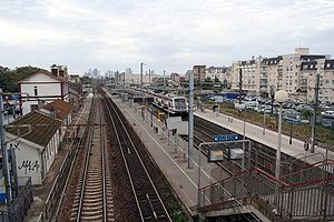
Houilles–Carrières-sur-Seine station (French: Gare de Houilles-Carrières-sur-Seine) is a railway station in Houilles, a suburb of Paris, on the Paris–Le Havre railway.
Nanterre
Prefecture of Hauts-de-Seine, Île-de-France, France
Distance: Approx. 1578 meters
Latitude and longitude: 48.8988,2.1969
Nanterre (, French: [nɑ̃tɛʁ] ) is the prefecture of the Hauts-de-Seine department in the western suburbs of Paris, France. It is located some 11 km (6.8 mi) northwest of the centre of Paris. In 2018, the commune had a population of 96,807.

Arrondissement of Nanterre
Arrondissement in Île-de-France, France
Distance: Approx. 2245 meters
Latitude and longitude: 48.89444444,2.20333333
The arrondissement of Nanterre is an arrondissement of France in the Hauts-de-Seine department in the Île-de-France region. It has 17 communes. Its population is 911,155 (2021), and its area is 91.8 km2 (35.4 sq mi).
Houilles
Commune in Île-de-France, France
Distance: Approx. 2259 meters
Latitude and longitude: 48.9261,2.1892
Houilles (French pronunciation: [uj] ) is a commune in the Yvelines department in the Île-de-France region in north-central France. It is a northwestern suburb of Paris, located 14.2 km (8.8 mi) from the center of Paris.

Nanterre Cathedral
Distance: Approx. 2175 meters
Latitude and longitude: 48.89083333,2.19611111
Nanterre Cathedral (French: Cathédrale Sainte-Geneviève-et-Saint-Maurice de Nanterre) is a Roman Catholic church located in the town of Nanterre, France. The cathedral is the seat of the Bishop of Nanterre. Formerly Nanterre Parish Church, it became the Nanterre Cathedral after the establishment of the diocese in 1966.

Maison Fournaise
Restaurant and museum of Paris, France
Distance: Approx. 2250 meters
Latitude and longitude: 48.8896,2.1633
The Maison Fournaise (French: [mɛzɔ̃ fuʁnɛz]; "House of Fournaise") is a restaurant and museum located on the Île des Impressionnistes, a long island in Seine river in Chatou, west of Paris.

Montesson
Commune in Île-de-France, France
Distance: Approx. 2173 meters
Latitude and longitude: 48.9085,2.1496
Montesson (French pronunciation: [mɔ̃tesɔ̃]) is a commune in the Yvelines department in the Île-de-France region in north-central France. It is located in the western suburbs of Paris. Transport in Montesson is served by buses with T-tickets as well as by several Paris-suburban lines: Line 01, Line 04, Line 07, Line 19, Line 22.

Nanterre-Ville station
Railway station in Nanterre, France
Distance: Approx. 1776 meters
Latitude and longitude: 48.8952,2.19569
Nanterre-Ville station (French pronunciation: [nɑ̃tɛʁ vil]) is a railway station in Nanterre on the A1 branch on Line A of the Réseau Express Régional system. Trains come every 10 minutes and the area is about 12 minutes ride from La Defense business district and about 18 minutes from the Arc de Triomphe.

Carrières-sur-Seine
Commune in Île-de-France, France
Distance: Approx. 224 meters
Latitude and longitude: 48.9089,2.1789
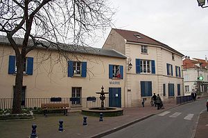
Carrières-sur-Seine (French: [kaʁjɛʁ syʁ sɛn] ) is a commune in the Yvelines department in the Île-de-France region in north-central France. The inhabitants of the town of Carrières-sur-Seine are called Carrillons (masculine plural) or Carrillonnes (feminine plural) in French, not to confuse with "carillon(ne)s" which would translate into "Chimes" and "Ringing," respectively.

Roman Catholic Diocese of Nanterre
Catholic diocese in France
Distance: Approx. 2174 meters
Latitude and longitude: 48.8907,2.1958
The Diocese of Nanterre (Latin: Dioecesis Nemptodurensis; French: Diocèse de Nanterre) is a Latin diocese of the Catholic Church in France. Erected in 1966, the diocese was split off from the Diocese of Versailles and the Archdiocese of Paris. Currently the diocese remains a suffragan of the Archdiocese of Paris.

Corrida de Houilles
Distance: Approx. 2041 meters
Latitude and longitude: 48.9244,2.1875
The Corrida de Houilles, officially Corrida pédestre internationale de Houilles (Houilles International Footrace), is an annual 10K run that takes place at the end of December in Houilles, France. The competition was created in 1972 by Alexandre Joly, a French politician who would later become Mayor of Houilles. He was inspired by the Saint Silvester Road Race in São Paulo and decided to set up his own local race in his hometown with the same format – hosting the race on New Year's Eve.
Canton of Nanterre-1
Administrative division of Hauts-de-Seine, France
Distance: Approx. 1705 meters
Latitude and longitude: 48.9,2.2
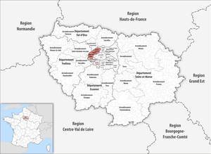
The canton of Nanterre-1 is an administrative division of the Hauts-de-Seine department, in northern France. It was created at the French canton reorganisation which came into effect in March 2015. Its seat is in Nanterre.
Weather in this IP's area
broken clouds
9 Celsius
6 Celsius
8 Celsius
10 Celsius
994 hPa
74 %
994 hPa
983 hPa
10000 meters
8.23 m/s
220 degree
75 %

