Country:
 Germany
Region:
City:
Latitude and Longitude:
Time Zone:
Postal Code:
IP information under different IP Channel
ip-api
Country
Region
City
ASN
Time Zone
ISP
Blacklist
Proxy
Latitude
Longitude
Postal
Route
IPinfo
Country
Region
City
ASN
Time Zone
ISP
Blacklist
Proxy
Latitude
Longitude
Postal
Route
MaxMind
Country
Region
City
ASN
Time Zone
ISP
Blacklist
Proxy
Latitude
Longitude
Postal
Route
Luminati
Country
DEASN
Time Zone
Europe/Berlin
ISP
InfraServ GmbH & Co. Gendorf KG
Latitude
Longitude
Postal
db-ip
Country
Region
City
ASN
Time Zone
ISP
Blacklist
Proxy
Latitude
Longitude
Postal
Route
ipdata
Country
Region
City
ASN
Time Zone
ISP
Blacklist
Proxy
Latitude
Longitude
Postal
Route
Popular places and events near this IP address

Altötting
Town in Bavaria, Germany
Distance: Approx. 6281 meters
Latitude and longitude: 48.22666667,12.67833333
Altötting (German: [altˈʔœtɪŋ] , Bavarian: [ɔidˈɛːde̝ŋ]; Oidäding) is a town in Bavaria, capital of the district Altötting of Germany. For 500 years it has been the scene of religious pilgrimages by Catholics in honor of Mary, including a visit by Pope John Paul II in 1980 and one by Pope Benedict XVI in 2006.
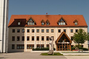
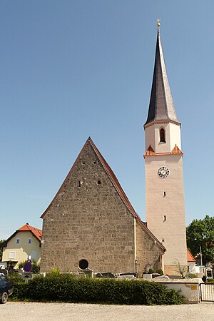
Burgkirchen an der Alz
Municipality in Bavaria, Germany
Distance: Approx. 1259 meters
Latitude and longitude: 48.16666667,12.71666667
Burgkirchen an der Alz is a municipality in the district of Altötting, in Bavaria, Germany. It is situated on the river Alz, 8 km west of Burghausen.
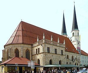
Neuötting
Town in Bavaria, Germany
Distance: Approx. 5136 meters
Latitude and longitude: 48.21666667,12.68333333
Neuötting is a town in the district of Altötting, in Bavaria, Germany. It is situated on the river Inn, 2 km north of Altötting, about 70 km north of Salzburg, 80 southwest of Passau and almost 100 km east of Munich. It is a stop on the railway line between Munich and Simbach.
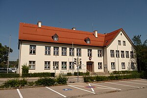
Emmerting
Municipality in Bavaria, Germany
Distance: Approx. 4237 meters
Latitude and longitude: 48.2,12.76666667
Emmerting is a municipality in the district of Altötting in Bavaria in Germany and member of the administrative association of the same name.

Halsbach
Municipality in Bavaria, Germany
Distance: Approx. 7880 meters
Latitude and longitude: 48.11666667,12.66666667
Halsbach is a municipality in the district of Altötting in Bavaria in Germany.

Kastl, Upper Bavaria
Municipality in Bavaria, Germany
Distance: Approx. 2908 meters
Latitude and longitude: 48.2,12.7
Kastl is a municipality in the district of Altötting in Bavaria in Germany. It is the result of a merger of Oberkastl, Unterkastl, and Forstkastl in the 1960s.
Mehring
Municipality in Bavaria, Germany
Distance: Approx. 4713 meters
Latitude and longitude: 48.18333333,12.78333333
Mehring is a municipality in the district of Altötting in Bavaria in Germany.
Unterneukirchen
Municipality in Bavaria, Germany
Distance: Approx. 7680 meters
Latitude and longitude: 48.16513611,12.61868611
Unterneukirchen is a municipality in the district of Altötting in Bavaria in Germany.
Halsbach (river)
River in Germany
Distance: Approx. 1104 meters
Latitude and longitude: 48.16833333,12.72527778
Halsbach is a river of Bavaria, Germany. It flows into the Alz in Burgkirchen an der Alz.

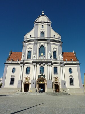
Shrine of Our Lady of Altötting
Distance: Approx. 6310 meters
Latitude and longitude: 48.22626,12.67654
The Shrine of Our Lady of Altötting, also known as the Chapel of Grace (German: Gnadenkapelle), is the national shrine of Bavaria dedicated to the Blessed Virgin Mary. It is known for the many healings which are said to have taken place there, and is commonly called the Lourdes of Germany. The octagonal chapel which houses the image of Our Lady dates to about A.D. 660, and is the oldest Marian shrine in Germany.
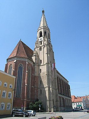
Basilica of St. Ann, Altötting
Church in Bavaria, Germany
Distance: Approx. 6575 meters
Latitude and longitude: 48.2279,12.6737
The Basilica of St. Ann (German: Basilika St. Anna ) also called Altötting Basilica It is the main place of Catholic worship of Altötting, Bavaria, in the diocese of Passau.
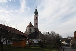
Collegiate Church of Saints Philip and James, Altötting
Distance: Approx. 6259 meters
Latitude and longitude: 48.22555556,12.67611111
The Collegiate Church of Saints Philip and James, Altötting (German: Stiftspfarrkirche St. Philipp und Jakob), with the associated college or community of secular canons (German: Kollegiatstift Altötting), was founded in about 1228 in Altötting, Bavaria, southern Germany.
Weather in this IP's area
broken clouds
10 Celsius
10 Celsius
9 Celsius
13 Celsius
1020 hPa
99 %
1020 hPa
969 hPa
10000 meters
4.47 m/s
12.97 m/s
89 degree
79 %
06:51:57
19:13:48