Country:
Region:
City:
Latitude and Longitude:
Time Zone:
Postal Code:
IP information under different IP Channel
ip-api
Country
Region
City
ASN
Time Zone
ISP
Blacklist
Proxy
Latitude
Longitude
Postal
Route
Luminati
Country
Region
idf
City
paris
ASN
Time Zone
Europe/Paris
ISP
Societe Francaise Du Radiotelephone - SFR SA
Latitude
Longitude
Postal
IPinfo
Country
Region
City
ASN
Time Zone
ISP
Blacklist
Proxy
Latitude
Longitude
Postal
Route
db-ip
Country
Region
City
ASN
Time Zone
ISP
Blacklist
Proxy
Latitude
Longitude
Postal
Route
ipdata
Country
Region
City
ASN
Time Zone
ISP
Blacklist
Proxy
Latitude
Longitude
Postal
Route
Popular places and events near this IP address

Mont-Saint-Aignan
Commune in Normandy, France
Distance: Approx. 933 meters
Latitude and longitude: 49.463,1.0883
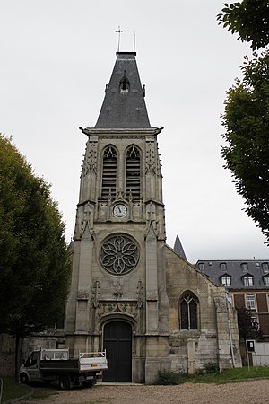
Mont-Saint-Aignan (French pronunciation: [mɔ̃ sɛ̃t‿ɛɲɑ̃]) is a commune in the Seine-Maritime department in the region of Normandy, northwestern France. The inhabitants of the town of Mont-Saint-Aignan are called Mont-Saint-Aignanais in French. Due to the presence of higher education institutions (notably the University of Rouen and the NEOMA Business School) and the city's relatively small population, Mont-Saint-Aignan is considered the French city that has the largest proportion of students relative to its population (students represented in 2014 25,61% of the total population).

Rouen Business School
Business school
Distance: Approx. 2286 meters
Latitude and longitude: 49.46333333,1.06444444
The Rouen Business School (French: Ecole Supérieure de Commerce de Rouen) was a leading French business school. It was founded in 1871. On 24 April 2013, Rouen Business School and Reims Management School announced the merger of the two schools into a single entity - NEOMA Business School.

Bois-Guillaume
Commune in Normandy, France
Distance: Approx. 1492 meters
Latitude and longitude: 49.4614,1.1092
Bois-Guillaume (French pronunciation: [bwa ɡijom]) is a commune in the Seine-Maritime department in the Normandy region in northern France.

Rouen-Rive-Droite station
Railway station in Rouen, France
Distance: Approx. 2406 meters
Latitude and longitude: 49.44888889,1.09388889
Rouen-Rive-Droite is a large railway station serving the city of Rouen, Normandy, France. The station is on Rue Verte in the north of the city. Services are mainly intercity but many services are local.
Muséum d'Histoire Naturelle de Rouen
Museum in France
Distance: Approx. 2634 meters
Latitude and longitude: 49.44708333,1.09930556
The Muséum d'Histoire Naturelle de Rouen (Natural History Museum) is a museum in Rouen, northern France, founded in 1828 by Félix Archimède Pouchet. Georges Pennetier was the second curator from 1873 to 1923, then Robert Régnier from 1924 to 1965. In October 2014, the museum of Rouen opened the Asian section of the gallery of the continents, the result of several years of cooperation with in particular Agus Koeciank and Jenny Lee, two Indonesian artists who have interpreted the Asian ethnographic collections of the museum of Rouen.

University of Rouen Normandy
French university
Distance: Approx. 2279 meters
Latitude and longitude: 49.460001,1.067002
The University of Rouen Normandy (Université de Rouen Normandie) is a French university, in the Academy of Rouen.
Bihorel
Commune in Normandy, France
Distance: Approx. 2366 meters
Latitude and longitude: 49.4553,1.1169
Bihorel (French pronunciation: [biɔʁɛl]) is a commune of the Seine-Maritime department in the Normandy region in northern France. It is a northeastern suburb of Rouen.

Canton of Bois-Guillaume
Canton in Normandy, France
Distance: Approx. 2084 meters
Latitude and longitude: 49.47194444,1.12277778
The Canton of Bois-Guillaume is a canton situated in the Seine-Maritime département and in the Normandy region of northern France. It covers northern suburbs of Rouen, including the town of Bois-Guillaume, and the rural area north of Rouen.

Canton of Mont-Saint-Aignan
Canton in Normandy, France
Distance: Approx. 1844 meters
Latitude and longitude: 49.465,1.07
The Canton of Mont-Saint-Aignan is a canton situated in the Seine-Maritime département and in the Normandy region of northern France.

Rouen Castle
Distance: Approx. 2684 meters
Latitude and longitude: 49.44638889,1.09444444
Rouen Castle (Château Bouvreuil) was a fortified ducal and royal residence in the city of Rouen, capital of the duchy of Normandy, now in France. With the exception of the tower wrongly associated with Joan of Arc, which was restored by Viollet-le-Duc in the 19th century, the castle was destroyed at the end of the 16th century, its stones quarried for other construction.
Museum of Antiquities (Rouen)
Museum in Rouen, France
Distance: Approx. 2646 meters
Latitude and longitude: 49.447,1.0995
The Musée des Antiquités (known until around 2016 as the Musée départemental des Antiquités) is a museum in the French city of Rouen, housing archaeological finds from the department of Seine-Maritime. It is classified as a Museum of France. It was set up in 1831 to house the finds excavated at Lillebonne at the instigation of prefect Henri Dupont-Delporte.
Rouen Ceramic Museum
Distance: Approx. 2783 meters
Latitude and longitude: 49.4455,1.0936
The Rouen Ceramic Museum (French – musée de la Céramique de Rouen) is a museum located in the hôtel d'Hocqueville in the French city of Rouen. It has the title Museum of France. It was established in 1864, and contains a collection of around 5000 pieces.
Weather in this IP's area
overcast clouds
7 Celsius
4 Celsius
7 Celsius
8 Celsius
1023 hPa
100 %
1023 hPa
1005 hPa
10000 meters
4.12 m/s
110 degree
100 %
07:55:53
17:22:58


