Country:
Region:
City:
Latitude and Longitude:
Time Zone:
Postal Code:
IP information under different IP Channel
ip-api
Country
Region
City
ASN
Time Zone
ISP
Blacklist
Proxy
Latitude
Longitude
Postal
Route
Luminati
Country
ASN
Time Zone
Europe/Paris
ISP
Societe Francaise Du Radiotelephone - SFR SA
Latitude
Longitude
Postal
IPinfo
Country
Region
City
ASN
Time Zone
ISP
Blacklist
Proxy
Latitude
Longitude
Postal
Route
db-ip
Country
Region
City
ASN
Time Zone
ISP
Blacklist
Proxy
Latitude
Longitude
Postal
Route
ipdata
Country
Region
City
ASN
Time Zone
ISP
Blacklist
Proxy
Latitude
Longitude
Postal
Route
Popular places and events near this IP address

Rosny-sous-Bois
Administrative division of Paris, France
Distance: Approx. 1303 meters
Latitude and longitude: 48.8667,2.4833
Rosny-sous-Bois (French: [ʁoni su bwɑ] ) is a commune in the eastern suburbs of Paris, France. It is located 10.1 km (6.3 mi) from the centre of Paris. It is the seat of the national centre of road information of the national gendarmerie.

Fontenay-sous-Bois
Commune in Île-de-France, France
Distance: Approx. 596 meters
Latitude and longitude: 48.8517,2.4772
Fontenay-sous-Bois (French pronunciation: [fɔ̃tnɛ su bwɑ]) is a commune in the eastern suburbs of Paris, France. It is located 9.3 km (5.8 mi) from the center of Paris.

Nogent-sur-Marne
Subprefecture and commune in Île-de-France, France
Distance: Approx. 1948 meters
Latitude and longitude: 48.8375,2.4833
Nogent-sur-Marne (French pronunciation: [nɔʒɑ̃ syʁ maʁn]) is a commune in the eastern suburbs of Paris, France. It is located 10.6 km (6.6 mi) from the centre of Paris. Nogent-sur-Marne is a sous-préfecture of the Val-de-Marne département, being the seat of the Arrondissement of Nogent-sur-Marne.

Neuilly-Plaisance
Commune in Île-de-France, France
Distance: Approx. 1838 meters
Latitude and longitude: 48.8619,2.5064
Neuilly-Plaisance (French pronunciation: [nœji plɛzɑ̃s] ) is a commune in the eastern suburbs of Paris, France. It is located 11.8 km (7.3 mi) from the center of Paris. The composer Alain Margoni was born in Neuilly-Plaisance on 13 October 1934.

Le Perreux-sur-Marne
Commune in Île-de-France, France
Distance: Approx. 2044 meters
Latitude and longitude: 48.8422,2.5036
Le Perreux-sur-Marne (French pronunciation: [lə pɛʁø syʁ maʁn] , literally Le Perreux on Marne) is a commune in the Val-de-Marne department in the eastern suburbs of Paris, France. It is located 11.7 km (7.3 mi) from the center of Paris.
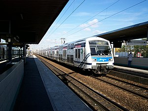
Val de Fontenay station
Distance: Approx. 413 meters
Latitude and longitude: 48.85431,2.48914
Val de Fontenay station is a Réseau Express Régional station in the Paris suburb Fontenay-sous-Bois.

Fort de Nogent
Distance: Approx. 1144 meters
Latitude and longitude: 48.84479,2.4818
The Fort de Nogent or Fort de Nogent-sur-Marne is a French fortification forming part of the fortifications of Paris. Despite its name, the fort is located in Fontenay-sous-Bois; the name is derived from Nogent-sur-Marne the town the fort was planned to protect. The fort is now occupied by the recruitment organization for the Foreign Legion of the French Army.

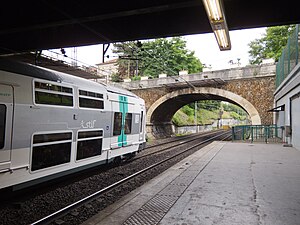
Fontenay-sous-Bois station
Distance: Approx. 1922 meters
Latitude and longitude: 48.8436,2.4639
Fontenay-sous-Bois station is a railway station on Réseau Express Régional network in Fontenay-sous-Bois, Val-de-Marne, France.
Nogent–Le Perreux station
Railway station in France
Distance: Approx. 1988 meters
Latitude and longitude: 48.83858,2.49426
Nogent–Le Perreux is a French railway station in Nogent-sur-Marne, Val-de-Marne.
Canton of Fontenay-sous-Bois
Distance: Approx. 1141 meters
Latitude and longitude: 48.85,2.47
The canton of Fontenay-sous-Bois is an administrative division of the Val-de-Marne department, Île-de-France region, northern France. It was created at the French canton reorganisation which came into effect in March 2015. Its seat is in Fontenay-sous-Bois.

Musée de l'Histoire vivante
Distance: Approx. 1490 meters
Latitude and longitude: 48.866,2.472
The Musée de l'Histoire vivante (Museum of Living History) is an historical museum located in Montreuil-sous-bois, adjacent to the eastern part of Paris, France. Created in 1937 by the Association pour l'Histoire Vivante (Association for Living History) under the impulse of Communist politician Jacques Duclos, it opened its doors on 23 March 1939 for the 150th anniversary of the French Revolution. Jean Bruhat was entrusted with the management of the project.

Rosny-sous-Bois station
Railway station in Rosny-sous-Bois, France
Distance: Approx. 1757 meters
Latitude and longitude: 48.87073,2.48559
Rosny-sous-Bois is a French railway station in Rosny-sous-Bois, Seine-Saint-Denis département, in Île-de-France region.
Weather in this IP's area
overcast clouds
10 Celsius
8 Celsius
9 Celsius
10 Celsius
1023 hPa
95 %
1023 hPa
1014 hPa
10000 meters
3.09 m/s
130 degree
100 %
07:48:33
17:19:10

