Country:
Region:
City:
Latitude and Longitude:
Time Zone:
Postal Code:
IP information under different IP Channel
ip-api
Country
Region
City
ASN
Time Zone
ISP
Blacklist
Proxy
Latitude
Longitude
Postal
Route
Luminati
Country
ASN
Time Zone
Europe/Madrid
ISP
Alliance Healthcare Espana S.A.
Latitude
Longitude
Postal
IPinfo
Country
Region
City
ASN
Time Zone
ISP
Blacklist
Proxy
Latitude
Longitude
Postal
Route
db-ip
Country
Region
City
ASN
Time Zone
ISP
Blacklist
Proxy
Latitude
Longitude
Postal
Route
ipdata
Country
Region
City
ASN
Time Zone
ISP
Blacklist
Proxy
Latitude
Longitude
Postal
Route
Popular places and events near this IP address

Battle of Saragossa
1710 battle during the War of the Spanish Succession
Distance: Approx. 5357 meters
Latitude and longitude: 41.60861111,-0.88972222
The Battle of Saragossa, also known as the Battle of Zaragoza, took place on 20 August 1710 during the War of the Spanish Succession. A Spanish Bourbon army loyal to Philip V of Spain and commanded by the Marquis de Bay was defeated by a Grand Alliance force under Guido Starhemberg. Despite this victory, which allowed Philip's rival Archduke Charles to enter the Spanish capital of Madrid, the allies were unable to consolidate their gains.

Pabellón Príncipe Felipe
Indoor sporting arena located in Spain
Distance: Approx. 4980 meters
Latitude and longitude: 41.63533889,-0.86627222
Pabellón Príncipe Felipe is an arena in Zaragoza, Spain. Opened on 17 April 1990, the arena holds 10,744 people. It is primarily used for basketball (home of Basket Zaragoza) and handball (home of Caja3 Aragón).
Pastriz
Municipality in Aragon, Spain
Distance: Approx. 4153 meters
Latitude and longitude: 41.62000001,-0.78199999
Pastriz is a municipality located in the province of Zaragoza, Aragon, Spain. According to the 2004 census (INE), the municipality has a population of 1,216 inhabitants.
Church of Santa Engracia de Zaragoza
Distance: Approx. 7020 meters
Latitude and longitude: 41.64888889,-0.88277778
The Church of Santa Engracia de Zaragoza is a basilica church in Zaragoza, Spain. It was built on the spot where Saint Engratia and her companions were said to have been martyred in 303 AD. The Basilica of Santa Engracia is located at Plaza de Santa Engracia.
Nuevo Estadio de San José
Project to build a football stadium
Distance: Approx. 4484 meters
Latitude and longitude: 41.6290446,-0.8662033
The Estadio de San José is a project to build a football stadium which will replace Estadio La Romareda in the neighborhood of San José, in Zaragoza, Spain as the home stadium of Real Zaragoza. The stadium will have a capacity of 43,000. The stadium architects is Joaquín Sicilia, and the cost is estimated between 125 million euros.

San Miguel de los Navarros
Cultural property in Zaragoza, Spain
Distance: Approx. 6741 meters
Latitude and longitude: 41.6496,-0.8765
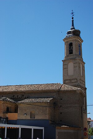
San Miguel de los Navarros is a church in Zaragoza, Spain. It has a single nave with side chapels, a polygonal apse and a bell tower, located at the northern side. The church and its bell tower are notable examples of Mudéjar architecture.

Santa María Magdalena, Zaragoza
Distance: Approx. 6867 meters
Latitude and longitude: 41.6525,-0.87388889
Santa María Magdalena is a church in Zaragoza, Spain, built in the 14th century in Mudéjar style.

Monastery of Comendadoras Canonesas del Santo Sepulcro
Historic site in Zaragoza, Spain
Distance: Approx. 6914 meters
Latitude and longitude: 41.653745,-0.872477
The Monastery of Comendadoras Canonesas del Santo Sepulcro (Spanish: Monasterio de Comendadoras Canonesas del Santo Sepulcro) is a monastery located in Zaragoza, Spain. It was declared Bien de Interés Cultural in 1893.

Paseo de la Constitución
Distance: Approx. 6848 meters
Latitude and longitude: 41.6478,-0.8813
El Paseo de la Constitución (Constitution Walk) is located in Zaragoza, Spain.

Zaragoza Museum
Museum in Zaragoza, Spain
Distance: Approx. 6732 meters
Latitude and longitude: 41.64819444,-0.87861111
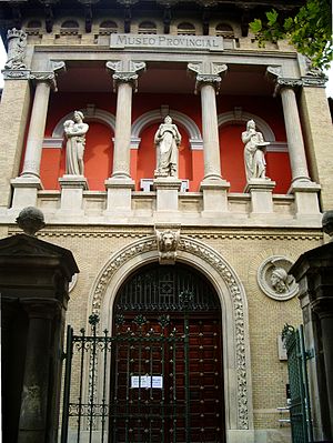
Zaragoza Museum (Spanish - Museo de Zaragoza) is a national museum in the Plaza de los Sitios in the city of Zaragoza in Spain. Its collections range from the Lower Palaeolithic to the modern era and include archaeology, fine arts, ethnology and Iberian ceramics. It is the city's oldest museum and its main building - housing the fine arts and archaeology display - is the Neo-Renaissance structure designed for the Spanish-French Exhibition of 1908 by Ricardo Magdalena and Julio Bravo.

Larrinaga Palace
20th-century building in Zaragoza, Spain
Distance: Approx. 5135 meters
Latitude and longitude: 41.63833333,-0.86444444
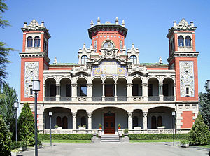
The Larrinaga Palace is an early 20th century palace located in Zaragoza, Aragon.

Ebro Hydrographic Confederation
The organization that manages, regulates and maintains the water and irrigation of the Ebro Basin
Distance: Approx. 6884 meters
Latitude and longitude: 41.64472222,-0.88611111
The Ebro Hydrographic Confederation (in Spanish: Confederación Hidrográfica del Ebro, CHE) is the organization that manages, regulates and maintains the water and irrigation of the Ebro hydrographic basin (northeastern Spain). The organization's headquarters are in Zaragoza and it was the first institution created in the world with the objective of managing an entire river basin in a unitary manner.
Weather in this IP's area
few clouds
11 Celsius
10 Celsius
10 Celsius
11 Celsius
1022 hPa
84 %
1022 hPa
998 hPa
8000 meters
1.54 m/s
110 degree
15 %
07:51:28
17:44:19

