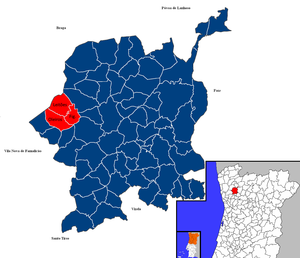
Country:
 Portugal
Region:
City:
Latitude and Longitude:
Time Zone:
Postal Code:
IP information under different IP Channel
ip-api
Country
Region
City
ASN
Time Zone
ISP
Blacklist
Proxy
Latitude
Longitude
Postal
Route
IPinfo
Country
Region
City
ASN
Time Zone
ISP
Blacklist
Proxy
Latitude
Longitude
Postal
Route
MaxMind
Country
Region
City
ASN
Time Zone
ISP
Blacklist
Proxy
Latitude
Longitude
Postal
Route
Luminati
Country
PTRegion
03
City
novais
ASN
Time Zone
Europe/Lisbon
ISP
Nos Comunicacoes, S.A.
Latitude
Longitude
Postal
db-ip
Country
Region
City
ASN
Time Zone
ISP
Blacklist
Proxy
Latitude
Longitude
Postal
Route
ipdata
Country
Region
City
ASN
Time Zone
ISP
Blacklist
Proxy
Latitude
Longitude
Postal
Route
Popular places and events near this IP address
Aves (Santo Tirso)
Civil parish in Norte, Portugal
Distance: Approx. 6383 meters
Latitude and longitude: 41.364,-8.407
Aves is an industrial town and civil parish (freguesia) in northern Portugal. The population in 2011 was 8,458, in an area of 6.16 km2. It is located in the municipality of Santo Tirso, 6 km to the northeast of the municipality seat, the city of Santo Tirso proper, bordering the parish of Lordelo in the municipality of Guimarães.
Bente, Portugal
Distance: Approx. 3426 meters
Latitude and longitude: 41.389,-8.45
Bente is a former civil parish in the municipality of Vila Nova de Famalicão in the Minho region, Portugal. In 2013, the parish merged into the new parish Carreira e Bente. Its surface area is 1.30 km² and its population, in 2001, was 959.

Estádio do CD Aves
Stadium in Vila das Aves, Portugal
Distance: Approx. 5940 meters
Latitude and longitude: 41.366932,-8.411789
Estádio do CD das Aves is a multi-use stadium in Vila das Aves, Portugal. It is currently used mostly for football matches and is the home ground of previous C.D. Aves until 2021 and currently AVS Futebol SAD from 2023. The stadium holds 8,560 people and was built in 1981.
Sequeiró
Civil parish in Norte, Portugal
Distance: Approx. 5903 meters
Latitude and longitude: 41.36694444,-8.45583333
Sequeirô is a former civil parish in the municipality of Santo Tirso, Portugal. In 2013, the parish merged into the new parish Areias, Sequeiró, Lama e Palmeira. It is located 3 km north of the city of Santo Tirso.
Pousada de Saramagos
Civil parish in Norte, Portugal
Distance: Approx. 1306 meters
Latitude and longitude: 41.4292,-8.4333
Pousada de Saramagos is a Portuguese village belonging to the municipality of Vila Nova de Famalicão, in the North of Portugal, more precisely in the region of Minho. The population in 2011 was 2,234, in an area of 2.12 km2. It is about 9 km far from its municipal seat.
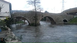
Vizela River
River in northern Portugal
Distance: Approx. 6082 meters
Latitude and longitude: 41.3629,-8.4319
Vizela River (Portuguese pronunciation: [viˈzɛlɐ]) is a river in Portugal. It flows into Ave River and it is named after the city of Vizela.

Joane
Civil parish in Norte, Portugal
Distance: Approx. 2400 meters
Latitude and longitude: 41.434,-8.416
Joane is a civil parish in the municipality of Vila Nova de Famalicão, Portugal. The population in 2011 was 8,089, in an area of 7.32 km2. It is the birthplace of Bernardino Machado, two times President of Portugal during the First Republic.
Riba de Ave
Civil parish in Norte, Portugal
Distance: Approx. 4275 meters
Latitude and longitude: 41.394,-8.394
Riba de Ave (also known as Riba d'Ave) is a Portuguese town located in the municipality of Vila Nova de Famalicão. The population in 2011 was 3,425, in an area of 2.76 km². The town has existed since before Portugal became a country, although it has never been more than a tiny village in the Ave Valley.
Carreira e Bente
Civil parish in Norte, Portugal
Distance: Approx. 4180 meters
Latitude and longitude: 41.38,-8.437
Carreira e Bente is a civil parish in the municipality of Vila Nova de Famalicão, Portugal. It was formed in 2013 by the merger of the former parishes Carreira and Bente. The population in 2011 was 2,576, in an area of 3.58 km2.
Leitões, Oleiros e Figueiredo
Civil parish in Norte, Portugal
Distance: Approx. 6647 meters
Latitude and longitude: 41.468,-8.392
Leitões, Oleiros e Figueiredo (officially: União das Freguesias de Leitões, Oleiros e Figueiredo) is a civil parish in the municipality of Guimarães, Portugal. It was formed in 2013 by the merger of the former parishes Leitões, Oleiros, and Figueiredo. The population in 2021 was 1,437, in an area of 8.98 km2.

Abação e Gémeos
Civil parish in Norte, Portugal
Distance: Approx. 6647 meters
Latitude and longitude: 41.468,-8.392
Abação e Gémeos (officially: União das Freguesias de Abação e Gémeos) is a civil parish in the municipality of Guimarães, Portugal. It was formed in 2013 by the merger of the former parishes São Tomé de Abação and Gémeos. The population in 2021 was 2,683, in an area of 6.73 km2.

Airão Santa Maria, Airão São João e Vermil
Civil parish in Norte, Portugal
Distance: Approx. 6647 meters
Latitude and longitude: 41.468,-8.392
Airão Santa Maria, Airão São João e Vermil (officially: União das Freguesias de Airão Santa Maria, Airão São João e Vermil) is a civil parish in the municipality of Guimarães, Portugal. It was formed in 2013 by the merger of the former parishes Santa Maria de Airão, São João Batista de Airão, and Vermil. The population in 2021 was 3,213, in an area of 7.48 km2.
Weather in this IP's area
overcast clouds
20 Celsius
20 Celsius
19 Celsius
20 Celsius
1020 hPa
88 %
1020 hPa
1007 hPa
10000 meters
0.52 m/s
0.77 m/s
238 degree
100 %
07:29:37
19:17:28