78.88.28.220 - IP Lookup: Free IP Address Lookup, Postal Code Lookup, IP Location Lookup, IP ASN, Public IP
Country:
Region:
City:
Location:
Time Zone:
Postal Code:
IP information under different IP Channel
ip-api
Country
Region
City
ASN
Time Zone
ISP
Blacklist
Proxy
Latitude
Longitude
Postal
Route
Luminati
Country
Region
10
City
sieradz
ASN
Time Zone
Europe/Warsaw
ISP
Vectra S.A.
Latitude
Longitude
Postal
IPinfo
Country
Region
City
ASN
Time Zone
ISP
Blacklist
Proxy
Latitude
Longitude
Postal
Route
IP2Location
78.88.28.220Country
Region
mazowieckie
City
marki
Time Zone
Europe/Warsaw
ISP
Language
User-Agent
Latitude
Longitude
Postal
db-ip
Country
Region
City
ASN
Time Zone
ISP
Blacklist
Proxy
Latitude
Longitude
Postal
Route
ipdata
Country
Region
City
ASN
Time Zone
ISP
Blacklist
Proxy
Latitude
Longitude
Postal
Route
Popular places and events near this IP address

Marki
Place in Masovian Voivodeship, Poland
Distance: Approx. 1453 meters
Latitude and longitude: 52.33333333,21.1
Marki (Polish pronunciation: [ˈmarkʲi] ) is a town in central Poland, in the Warsaw metropolitan area in the Masovian Voivodeship, just to the north-east of the Polish capital Warsaw. Marki, a Warsaw suburb, was incorporated in 1967. While by Polish standards Marki is a relatively young town, with approximately 31,000 residents, it is one of the fastest-growing cities in the Masovian province.
Ząbki
Place in Masovian Voivodeship, Poland
Distance: Approx. 3193 meters
Latitude and longitude: 52.29277778,21.11611111
Ząbki [ˈzɔmpki] is a town in central Poland with 31,884 inhabitants (2013). It is situated in the Masovian Voivodeship, just northeast of Warsaw.

Horowe Bagno Nature Reserve
Nature reserve in Marki, Poland
Distance: Approx. 2315 meters
Latitude and longitude: 52.3,21.1
Horowe Bagno is a peat nature reserve in Marki near Warsaw in Poland. The area of the reserve is 43,82 ha.
Zielonka
Place in Masovian Voivodeship, Poland
Distance: Approx. 4278 meters
Latitude and longitude: 52.30083333,21.15861111
Zielonka [ʑɛˈlɔnka] is a town in Wołomin County, Masovian Voivodeship, Poland, with 17,398 inhabitants (2013). It is located about 13 km to the north-east of the centre of Warsaw. Zielonka borders Warsaw and several other towns of the Warsaw metropolitan area: Ząbki and Marki in the west, Kobyłka in the north, and Sulejówek in the south.
Masovian Governorate
1837–1844 unit of Poland
Distance: Approx. 3090 meters
Latitude and longitude: 52.34833333,21.10277778
Masovia Governorate was an administrative-territorial unit (guberniya) of Congress Poland of the Russian Empire, which existed from 1837 to 1844, with its capital in Warsaw.
Augustówek
Village in Masovian Voivodeship, Poland
Distance: Approx. 4172 meters
Latitude and longitude: 52.35,21.06666667
Augustówek [auɡusˈtuvɛk] is a village in the administrative district of Gmina Czosnów, within Nowy Dwór County, Masovian Voivodeship, in east-central Poland. It lies approximately 23 kilometres (14 mi) east of Czosnów, 28 km (17 mi) east of Nowy Dwór Mazowiecki, and 16 km (10 mi) north of Warsaw.
Targówek (shopping centre)
Shopping mall in Warsaw, Poland
Distance: Approx. 3760 meters
Latitude and longitude: 52.30333333,21.05722222
Targówek Shopping Center is a shopping center in Warsaw, at ul. Głębocka 15, in the district of Targówek. It has over 140 Polish and international shops and restaurants as well as a Multikino 12 screen cinema.

Military Institute of Armament Technology
Polish scientific institution
Distance: Approx. 4506 meters
Latitude and longitude: 52.305,21.1658
Military Institute of Armament Technology (Polish: Wojskowy Instytut Techniczny Uzbrojenia; WITU) is a Polish scientific institution responsible for the research and development of new technologies for use by the military. It is based in Zielonka at the outskirts of Warsaw. Subordinate to the Ministry of National Defence, the institute is considered one of "central institutions", that is one of state-owned institutions essential to the functioning of the state.
Ząbki Municipal Stadium
Distance: Approx. 2315 meters
Latitude and longitude: 52.3,21.1
The Ząbki Municipal Stadium (Polish: Stadion Miejski w Ząbkach), officially since 2018 called Dozbud Arena for sponsorship reasons., and Dolcan Arena in the past; is a multi-use stadium in Ząbki, Poland. It is currently used mostly for football matches and is the home ground of Ząbkovia Ząbki. The stadium holds 2,100 people and was extensively rebuilt to its current look in 2012.

Kondratowicza metro station
Metro station in Warsaw, Poland
Distance: Approx. 5029 meters
Latitude and longitude: 52.29211111,21.04736111
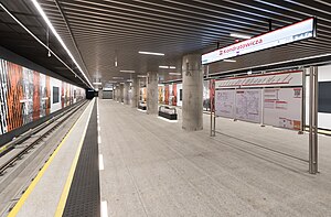
Kondratowicza is a station on the north-eastern part of Line M2 (Warsaw Metro). It is located in the vicinity of Ludwika Kondratowicza, Malborska, 20 Dywizji Piechoty Wojska Polskiego and Aleksandra Kowalskiego streets. The station is located by the Masovian Bródno District Hospital (Mazowiecki Szpital Bródnowski).

Warszawa Zacisze Wilno railway station
Railway stop in Warsaw, Poland
Distance: Approx. 5055 meters
Latitude and longitude: 52.27777778,21.08
Warszawa Zacisze Wilno railway station is a railway station in the Targówek district of Warsaw, Poland. As of 2022, it is used by Koleje Mazowieckie, which runs services to Warszawa Wileńska and Czyżew.

Brzeziny, Warsaw
Neighbourhood in Warsaw, Masovian Voivodeship, Poland
Distance: Approx. 4901 meters
Latitude and longitude: 52.32305556,21.03277778
Brzeziny is a neighbourhood, and an area of the Municipal Information System, in the city of Warsaw, Poland, located within the district of Białołęka.
Weather in this IP's area
light shower snow
-2 Celsius
-9 Celsius
-3 Celsius
-1 Celsius
1013 hPa
81 %
1013 hPa
1002 hPa
10000 meters
9.26 m/s
280 degree
75 %

