78.41.247.47 - IP Lookup: Free IP Address Lookup, Postal Code Lookup, IP Location Lookup, IP ASN, Public IP
Country:
Region:
City:
Location:
Time Zone:
Postal Code:
IP information under different IP Channel
ip-api
Country
Region
City
ASN
Time Zone
ISP
Blacklist
Proxy
Latitude
Longitude
Postal
Route
Luminati
Country
Region
u
City
vasteras
ASN
Time Zone
Europe/Stockholm
ISP
CGI Sverige AB
Latitude
Longitude
Postal
IPinfo
Country
Region
City
ASN
Time Zone
ISP
Blacklist
Proxy
Latitude
Longitude
Postal
Route
IP2Location
78.41.247.47Country
Region
sodermanlands lan
City
ostra
Time Zone
Europe/Stockholm
ISP
Language
User-Agent
Latitude
Longitude
Postal
db-ip
Country
Region
City
ASN
Time Zone
ISP
Blacklist
Proxy
Latitude
Longitude
Postal
Route
ipdata
Country
Region
City
ASN
Time Zone
ISP
Blacklist
Proxy
Latitude
Longitude
Postal
Route
Popular places and events near this IP address
Eskilstunaån
River in Sweden
Distance: Approx. 7177 meters
Latitude and longitude: 59.44722222,16.4875
Eskilstunaån (Eskilstuna River) is a small river in Sweden, length 32 km, running through the city of Eskilstuna and the town of Torshälla in Södermanland County. The river drains Lake Hjälmaren into Lake Mälaren. It is by local custom alternatively referred to as Torshällaån (Torshälla River) in its lower course from Torshälla to Lake Mälaren.

Årby
Housing development in Eskilstuna, Sweden
Distance: Approx. 6951 meters
Latitude and longitude: 59.38194444,16.52055556
Årby or Årby housing projects is one of the public housing and private owned developments in Eskilstuna, Sweden. The housing opened in the 1960s as a result of the Million Programme by the Swedish government.

Kjulaås
Place in Södermanland, Sweden
Distance: Approx. 5829 meters
Latitude and longitude: 59.38333333,16.66666667
Kjulaås is a locality situated in Eskilstuna Municipality, Södermanland County, Sweden with 837 inhabitants in 2010.
Sundbyholm
Place in Södermanland, Sweden
Distance: Approx. 964 meters
Latitude and longitude: 59.43333333,16.61666667
Sundbyholm is a locality situated in Eskilstuna Municipality, Södermanland County, Sweden with 485 inhabitants in 2010.

Fiholm Castle
Distance: Approx. 7703 meters
Latitude and longitude: 59.43388889,16.7425
Fiholm Manor is a Landed Estate located approximately 20 km West of Eskilstuna in Eskilstuna Municipality, Södermanland County, Sweden. It is privately owned. The Landed Estate of Fiholm was commissioned by the Swedish statesman Axel Oxenstierna in 1640 to the plans of the French architect Simon de Vallée.

Sundbyholm Castle
Distance: Approx. 2589 meters
Latitude and longitude: 59.44777778,16.62388889
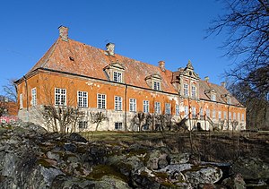
Sundbyholm Castle is a castle near the town of Eskilstuna, Sweden on the southern shore of Lake Mälaren.
Blacken (basin)
Distance: Approx. 6157 meters
Latitude and longitude: 59.46666667,16.53333333
Blacken is a basin in Lake Mälaren, the third-largest lake in Sweden. It is located in the western portion of the lake.
Södermanland Runic Inscription 109
Swedish runic inscription
Distance: Approx. 6678 meters
Latitude and longitude: 59.375,16.54555556
Sö 109 is the Rundata designation for a runic inscription on a Viking Age memorial runestone that is located in Gredby, which is near Eskilstuna, Södermanland County, Sweden, which was in the historic province of Södermanland.

Eskilstuna House
Distance: Approx. 7617 meters
Latitude and longitude: 59.372,16.525
Eskilstuna House (Swedish: Eskilstunahus) was a royal palace in Eskilstuna, in present-day Södermanland County, Sweden. It was erected on the site of a medieval monastery in the 16th century, and was later destroyed in a fire in 1680. The palace was the county seat of Eskilstunahus County during its existence, before its merger into Södermanland County in 1683.

Jäder Church
Church in Södermanland County, Sweden
Distance: Approx. 5085 meters
Latitude and longitude: 59.40972222,16.69111111
Jäder Church, Swedish: Jäders kyrka, is a church building in the village of Jäder, Eskilstuna Municipality, Södermanland County, Sweden, approximately 10 km east of Eskilstuna. Belonging to the Lutheran Church of Sweden, it is part of Kafjärden Parish in the Diocese of Strängnäs. Until 1995, it was the main church of the historical Jäder Parish.
Skiftinge
Distance: Approx. 5253 meters
Latitude and longitude: 59.39305556,16.54111111
Skiftinge is an urban area situated in Eskilstuna Municipality, Södermanland County, Sweden with 5,104 inhabitants as of 2018. A suburb, the area is located 3 kilometers north of central Eskilstuna and was officially part of the city proper until 2015.

Stiga Sports Arena
Multi-purpose arena in Eskilstuna, Sweden
Distance: Approx. 7684 meters
Latitude and longitude: 59.37930556,16.50761111
Stiga Sports Arena Eskilstuna, or simply Stiga Sports Arena, is an indoor venue and sports arena in the Munktellstaden district in central Eskilstuna, Sweden, which is commonly used to host sporting events, such as handball, floorball, and futsal at a national level.
Weather in this IP's area
snow
1 Celsius
-1 Celsius
1 Celsius
1 Celsius
993 hPa
93 %
993 hPa
989 hPa
10000 meters
2.06 m/s
130 degree
100 %

