78.31.237.86 - IP Lookup: Free IP Address Lookup, Postal Code Lookup, IP Location Lookup, IP ASN, Public IP
Country:
Region:
City:
Location:
Time Zone:
Postal Code:
ISP:
ASN:
language:
User-Agent:
Proxy IP:
Blacklist:
IP information under different IP Channel
ip-api
Country
Region
City
ASN
Time Zone
ISP
Blacklist
Proxy
Latitude
Longitude
Postal
Route
db-ip
Country
Region
City
ASN
Time Zone
ISP
Blacklist
Proxy
Latitude
Longitude
Postal
Route
IPinfo
Country
Region
City
ASN
Time Zone
ISP
Blacklist
Proxy
Latitude
Longitude
Postal
Route
IP2Location
78.31.237.86Country
Region
tolna
City
paks
Time Zone
Europe/Budapest
ISP
Language
User-Agent
Latitude
Longitude
Postal
ipdata
Country
Region
City
ASN
Time Zone
ISP
Blacklist
Proxy
Latitude
Longitude
Postal
Route
Popular places and events near this IP address

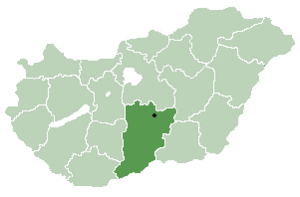
Paks
Town in Tolna, Hungary
Distance: Approx. 570 meters
Latitude and longitude: 46.622047,18.855918
Paks is a small town in Tolna county, in the south of Hungary, on the right bank of the Danube River, 100 km south of Budapest. Paks as a former agricultural settlement is now the home of the only Hungarian nuclear power plant, which provides about 40% of the country's electricity consumption.
Paks Nuclear Power Plant
Nuclear power plant in Hungary
Distance: Approx. 6026 meters
Latitude and longitude: 46.5725,18.85416667
The Paks Nuclear Power Plant (Hungarian: Paksi atomerőmű) is located 5 kilometres (3.1 mi) from the small town of Paks, central Hungary, 100km southwest of Budapest on the shores of the Danube river. It is the first and only operating nuclear power station in Hungary. In 2019, its four reactors produced more than 50% of Hungary's electricity production.

Fehérvári úti Stadion
Football stadium in Paks, Tolna, Hungary
Distance: Approx. 960 meters
Latitude and longitude: 46.63361111,18.8525
Fehérvári úti Stadion is a multi-use stadium in Paks, Hungary. It is currently used mostly for football matches and is the home stadium of Paksi FC. The stadium is able to hold 5,000 people.

Ordas
Place in Bács-Kiskun, Hungary
Distance: Approx. 6991 meters
Latitude and longitude: 46.636,18.95
Ordas is a village and municipality in Bács-Kiskun county, in the Southern Great Plain region of southern Hungary.

Dunaszentbenedek
Place in Bács-Kiskun, Hungary
Distance: Approx. 4385 meters
Latitude and longitude: 46.594,18.892
Dunaszentbenedek (Croatian: Sabendak) is a village and municipality in Bács-Kiskun county, in the Southern Great Plain region of southern Hungary.

Uszód
Place in Bács-Kiskun, Hungary
Distance: Approx. 7964 meters
Latitude and longitude: 46.56666667,18.91666667
Uszód (Croatian: Vusad) is a village in Bács-Kiskun county, in the Southern Great Plain region of southern Hungary.

Géderlak
Place in Bács-Kiskun, Hungary
Distance: Approx. 4498 meters
Latitude and longitude: 46.61666667,18.91666667
Géderlak (Croatian: Gider) is a village in Bács-Kiskun county, in the Southern Great Plain region of southern Hungary.
Madocsa
Place in Southern Transdanubia, Hungary
Distance: Approx. 9671 meters
Latitude and longitude: 46.688,18.949
Madocsa is a village in Tolna County, Hungary.

Paks District
Districts of Hungary in Tolna
Distance: Approx. 2169 meters
Latitude and longitude: 46.6084,18.8491
Paks (Hungarian: Paksi járás) is a district in north-eastern part of Tolna County. Paks is also the name of the town where the district seat is found. The district is located in the Southern Transdanubia Statistical Region.
Weather in this IP's area
overcast clouds
1 Celsius
1 Celsius
1 Celsius
1 Celsius
1031 hPa
82 %
1031 hPa
1017 hPa
10000 meters
0.98 m/s
1 m/s
198 degree
98 %
