Country:
 Italy
ItalyRegion:
City:
Latitude and Longitude:
Time Zone:
Postal Code:
IP information under different IP Channel
ip-api
Country
Region
City
ASN
Time Zone
ISP
Blacklist
Proxy
Latitude
Longitude
Postal
Route
IPinfo
Country
Region
City
ASN
Time Zone
ISP
Blacklist
Proxy
Latitude
Longitude
Postal
Route
MaxMind
Country
Region
City
ASN
Time Zone
ISP
Blacklist
Proxy
Latitude
Longitude
Postal
Route
Luminati
Country
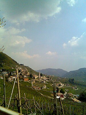
ITRegion
34
City
valledicadore
ASN
Time Zone
Europe/Rome
ISP
ASDASD srl a socio unico
Latitude
Longitude
Postal
db-ip
Country
Region
City
ASN
Time Zone
ISP
Blacklist
Proxy
Latitude
Longitude
Postal
Route
ipdata
Country
Region
City
ASN
Time Zone
ISP
Blacklist
Proxy
Latitude
Longitude
Postal
Route
Popular places and events near this IP address
Quero, Veneto
Comune in Veneto, Italy
Distance: Approx. 3986 meters
Latitude and longitude: 45.91666667,11.93333333
Quero is a town in the province of Belluno, in the Veneto region of northern Italy. It is a frazione of Quero Vas, having been a commune in its own right until 2013.
Valdobbiadene
Comune in Veneto, Italy
Distance: Approx. 4837 meters
Latitude and longitude: 45.9,11.91666667
Valdobbiadene (Italian: [ˌvaldobˈbjaːdene]; Venetian: Valdobiàden) is a town and comune (municipality) in the province of Treviso, Veneto, Italy. Valdobbiadene is a wine growing area: located below the Alpine-Dolomite areas of Veneto, the climate allows the cultivation of the Glera variety of grape. The Conegliano Valdobbiadene area is the home of the best Prosecco, an extra dry sparkling white wine.

Cavaso del Tomba
Comune in Veneto, Italy
Distance: Approx. 7183 meters
Latitude and longitude: 45.86666667,11.9
Cavaso del Tomba is a comune with about 3000 inhabitants in the province of Treviso, Veneto, north-eastern Italy. The municipality of Cavaso is spread over the southern flank of the buttress that extends from Monte Grappa towards the Piave River. It includes various villages, along its main road: Obledo, Caniezza, Paveion, Pieve, Vettorazzi, Granigo and Virago.

Cornuda
Comune in Veneto, Italy
Distance: Approx. 7629 meters
Latitude and longitude: 45.83333333,12
Cornuda is a comune with 6,276 inhabitants in the province of Treviso.

Alano di Piave
Comune in Veneto, Italy
Distance: Approx. 4837 meters
Latitude and longitude: 45.9,11.91666667
Alano di Piave is a former comune (municipality) in the province of Belluno in the Italian region of Veneto, located about 60 kilometres (37 mi) northwest of Venice and about 35 kilometres (22 mi) southwest of Belluno. As of 31 December 2021, it had a population of 2,665 and an area of 36.4 square kilometres (14.1 sq mi). On January 22, 2024, it merged with Quero Vas to form the municipality of Setteville.
Vas, Veneto
Frazione in Veneto, Italy
Distance: Approx. 5107 meters
Latitude and longitude: 45.93333333,11.93333333
Vas is a frazione of Quero Vas and a former comune (municipality) in the province of Belluno in the Italian region of Veneto, located about 60 kilometres (37 mi) northwest of Venice and about 30 kilometres (19 mi) southwest of Belluno. As of 31 December 2004, it had a population of 909 and an area of 17.8 square kilometres (6.9 sq mi). The municipality of Vas contained the frazioni (subdivisions, mainly villages and hamlets) Marziai and Caorera.
Pederobba
Comune in Veneto, Italy
Distance: Approx. 4371 meters
Latitude and longitude: 45.86666667,11.95
Pederobba (Venetian: Pederoba) is a comune (municipality) in the Province of Treviso in the Italian region Veneto, located about 60 kilometres (37 mi) northwest of Venice and about 30 kilometres (19 mi) northwest of Treviso. As of 31 December 2021, it had a population of 7,280 and an area of 29.3 square kilometres (11.3 sq mi). The municipality of Pederobba contains the frazioni (subdivisions, mainly villages and hamlets) Onigo, Covolo, Curogna, Levada.

Segusino
Comune in Veneto, Italy
Distance: Approx. 2898 meters
Latitude and longitude: 45.91666667,11.95
Segusino (Venetian: Seguxin) is a comune (municipality) in the province of Treviso in the Italian region Veneto, located about 60 kilometres (37 mi) northwest of Venice and about 35 kilometres (22 mi) northwest of Treviso. As of 31 December 2017, it had a population of 1,833 and an area of 18.1 square kilometres (7.0 sq mi). The municipality of Segusino contains the frazioni (subdivisions, mainly villages and hamlets) Col lonc, Stramare and Milies.

Monte Tesoro
Mountain in Italy
Distance: Approx. 3801 meters
Latitude and longitude: 45.93333333,11.96666667
The Monte Tesoro is a summit of the Bergamasque Prealps. It is 1,432 metres above sea level and is located in the municipality of Carenno on the mountain ridge that goes south from the Resegone towards the plains at the hills of Bergamo. It divides the valley of San Martino from the Valle Imagna between the passes of Pertus and Valcava, dividing, therefore the provinces of Lecco and Bergamo.

Cesen
Mountain in Italy
Distance: Approx. 5735 meters
Latitude and longitude: 45.94694444,12.01055556
Cesen is a mountain of the Veneto, Italy. It has an elevation of 1,570 metres.
Quero Vas
Comune in Veneto, Italy
Distance: Approx. 4392 meters
Latitude and longitude: 45.92277778,11.9325
Quero Vas (Venetian: Cuero Vas) is a former comune (municipality) in the Province of Belluno in the Italian region Veneto. It was established on 28 December 2013 by the merger of the municipalities of Quero and Vas. On January 22, 2024, it merged with Alano di Piave to form the municipality of Setteville.

Setteville
Comune in Veneto, Italy
Distance: Approx. 4392 meters
Latitude and longitude: 45.92277778,11.9325
Setteville is a comune located in the province of Belluno, in the region of Veneto in northern Italy. It was established in January 2024 from the merger of Alano di Piave and Quero Vas. It is located about 34 km (21 mi) southwest of the provincial capital of Belluno.
Weather in this IP's area
few clouds
21 Celsius
20 Celsius
19 Celsius
22 Celsius
1022 hPa
65 %
1022 hPa
985 hPa
10000 meters
1.43 m/s
1.69 m/s
134 degree
17 %
06:58:03
19:12:09