Country:
Region:
City:
Latitude and Longitude:
Time Zone:
Postal Code:
IP information under different IP Channel
ip-api
Country
Region
City
ASN
Time Zone
ISP
Blacklist
Proxy
Latitude
Longitude
Postal
Route
Luminati
Country
Region
34
City
valledicadore
ASN
Time Zone
Europe/Rome
ISP
ASDASD srl a socio unico
Latitude
Longitude
Postal
IPinfo
Country
Region
City
ASN
Time Zone
ISP
Blacklist
Proxy
Latitude
Longitude
Postal
Route
db-ip
Country
Region
City
ASN
Time Zone
ISP
Blacklist
Proxy
Latitude
Longitude
Postal
Route
ipdata
Country
Region
City
ASN
Time Zone
ISP
Blacklist
Proxy
Latitude
Longitude
Postal
Route
Popular places and events near this IP address
Calalzo di Cadore
Comune in Veneto, Italy
Distance: Approx. 5060 meters
Latitude and longitude: 46.45,12.38333333
Calalzo di Cadore is a municipality of 2,400 inhabitants of the province of Belluno, in the Italian region of Veneto. The name Calalzo derives from the Latin altus callis, meaning "high place." The geographical name "di Cadore" was added by Presidential Decree on 30 June 1959.

Cadore
Historical region in Italy
Distance: Approx. 2575 meters
Latitude and longitude: 46.39638889,12.35694444
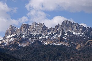
Cadore (Italian pronunciation: [kaˈdoːre]; Ladin: Ciadòre; Venetian: Cadór or, rarely, Cadòria; Austrian German: Cadober or Kadober; Sappada German: Kadour; Friulian: Cjadovri) is a historical region in the Italian region of Veneto, in the northernmost part of the province of Belluno bordering on Austria, the Trentino-Alto Adige/Südtirol and Friuli-Venezia Giulia. It is watered by the Piave River which has its source in the Carnic Alps. Once an undeveloped and poor district, the former contado (countship) of Cadore now has a thriving economy based on tourism and a small manufacturing industry, specialising in the production of glasses.
Cibiana di Cadore
Comune in Veneto, Italy
Distance: Approx. 5642 meters
Latitude and longitude: 46.38333333,12.28333333
Cibiana di Cadore is a comune (municipality) in the province of Belluno in the Italian region of Veneto, located about 110 kilometres (68 mi) north of Venice and about 30 kilometres (19 mi) north of Belluno. As of 31 December 2004, it had a population of 454 and an area of 21.7 square kilometres (8.4 sq mi). The municipality of Cibiana di Cadore contains the frazioni (subdivisions, mainly villages and hamlets) Borgate: Masarié, Cibiana di Sotto, Pianezze, Strassei, Sù Gesia, Le Nove, Col, Pian Gran, and Dèona.

Perarolo di Cadore
Comune in Veneto, Italy
Distance: Approx. 1968 meters
Latitude and longitude: 46.4,12.35
Perarolo di Cadore is a comune (municipality) in the Province of Belluno in the Italian region of Veneto, located about 110 kilometres (68 mi) north of Venice and about 30 kilometres (19 mi) northeast of Belluno. The Cadore Viaduct is nearby on the Strada statale 51 di Alemagna (SS51).
Pieve di Cadore
Comune in Veneto, Italy
Distance: Approx. 2839 meters
Latitude and longitude: 46.43333333,12.36666667
Pieve di Cadore is a comune (municipality) in the province of Belluno in the Italian region of Veneto, about 110 kilometres (68 miles) north of Venice and about 35 km (22 miles) northeast of Belluno. "Pieve" means "Parish church". It is the birthplace of the Italian painter Titian.

Valle di Cadore
Comune in Veneto, Italy
Distance: Approx. 470 meters
Latitude and longitude: 46.41666667,12.33333333
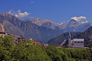
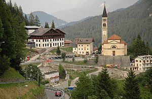
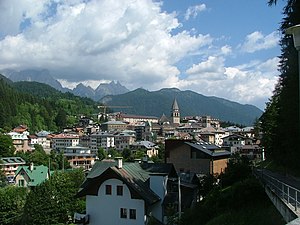
Valle di Cadore is a comune (municipality) in the province of Belluno in the Italian region of Veneto, located about 110 km (68 mi) north of Venice and about 35 km (22 mi) northeast of Belluno. Valle is part of the Cadore Valley, not far from the Antelao peak, 3,264 metres (10,709 ft) above sea level. The main attraction is the Renaissance Palazzo Costantini Lanza.
Vodo di Cadore
Comune in Veneto, Italy
Distance: Approx. 6861 meters
Latitude and longitude: 46.41666667,12.25
Vodo Cadore is a comune (municipality) in the province of Belluno in the Italian region of Veneto, located about 110 kilometres (68 mi) north of Venice and about 30 kilometres (19 mi) north of Belluno, in the mid-Boite valley, between the two Dolomites massifs of Antelao and Monte Pelmo.

Antelao
Mountain in Italy
Distance: Approx. 7281 meters
Latitude and longitude: 46.4525,12.26055556
Monte Antelao (Cadorino dialect: Nantelòu) is the highest mountain in the eastern Dolomites (a section of the Alps) in northeastern Italy, southeast of the town of Cortina d'Ampezzo, in the region of Cadore. The Monte Antelao is an ultra-prominent peak (Ultra). It is known as the "King of the Dolomites" (Marmolada, the highest of all the Dolomites, is the "Queen" although composed mostly of limestones).
Cibiana Pass
Mountain pass in the Dolomites
Distance: Approx. 7746 meters
Latitude and longitude: 46.37416667,12.25888889
The Cibiana Pass (Italian: Passo Cibiana) (1530 m) is a high mountain pass in the southern Dolomites in the province of Belluno in Italy. It connects Val Boite in the east and Val di Zoldo in the west. The pass road is narrow but open year-round.
Cadore Lake
Distance: Approx. 4160 meters
Latitude and longitude: 46.43333333,12.3875
The Centro Cadore lake, or more simply Cadore lake, is an artificial body of water located in the historical-geographical region of Cadore, along the upper course of the Piave river in Italy. The 2.3 km2 basin originated in the 1950s with the construction of the Pieve di Cadore dam, in the Sottocastello area. Narrow and long in shape with a south-north orientation, it reaches the town of Lozzo di Cadore, also involving the municipalities of Calalzo di Cadore, Domegge di Cadore and Lorenzago di Cadore.

Boite (river)
River in Italy
Distance: Approx. 2584 meters
Latitude and longitude: 46.3964,12.3572
The Boite (Cadorino dialect, Guóite) is a river of the Province of Belluno, Veneto region, northern Italy. Passing through the town of Cortina d'Ampezzo, it joins the Piave at Perarolo di Cadore. The principal valley, that of the Piave, runs parallel to the mountain chain which separates the province of Belluno from the basin of the Adige.
Cadore Viaduct
Bridge in Veneto, north-east Italy
Distance: Approx. 2896 meters
Latitude and longitude: 46.403,12.372
The Cadore Viaduct is a road bridge in Italy, in the southern Alps.
Weather in this IP's area
clear sky
3 Celsius
0 Celsius
2 Celsius
3 Celsius
1025 hPa
55 %
1025 hPa
929 hPa
10000 meters
2.31 m/s
3.22 m/s
355 degree
10 %
07:11:18
16:39:09


