Country:
Region:
City:
Latitude and Longitude:
Time Zone:
Postal Code:
IP information under different IP Channel
ip-api
Country
Region
City
ASN
Time Zone
ISP
Blacklist
Proxy
Latitude
Longitude
Postal
Route
Luminati
Country
ASN
Time Zone
Europe/Rome
ISP
ASDASD srl a socio unico
Latitude
Longitude
Postal
IPinfo
Country
Region
City
ASN
Time Zone
ISP
Blacklist
Proxy
Latitude
Longitude
Postal
Route
db-ip
Country
Region
City
ASN
Time Zone
ISP
Blacklist
Proxy
Latitude
Longitude
Postal
Route
ipdata
Country
Region
City
ASN
Time Zone
ISP
Blacklist
Proxy
Latitude
Longitude
Postal
Route
Popular places and events near this IP address

Montefioralle
Italian village
Distance: Approx. 1309 meters
Latitude and longitude: 43.58083333,11.30277778
Montefioralle is a village in Tuscany, a frazione of the comune of Greve in Chianti. It is sometimes claimed to be the birthplace of Amerigo Vespucci, though in fact it is known that Vespucci was born (on 9 March 1454) in Florence, in the suburb of Peretola. It is one of I Borghi più belli d'Italia ("The most beautiful villages of Italy").
Greve in Chianti
Comune in Tuscany, Italy
Distance: Approx. 166 meters
Latitude and longitude: 43.58333333,11.31666667
Greve in Chianti (the old name was Greve; in 1972 it was renamed Greve in Chianti after the inclusion of that area in the Chianti wine district) is a town and comune (municipality) in the Metropolitan City of Florence, Tuscany, Italy. It is located about 31 kilometres (19 mi) south of Florence and 42 kilometres (26 mi) north of Siena. Sitting in the Val di Greve, it is named for the small, fast-flowing river that runs through it, is the principal town in the Chianti wine district that stretches south of Florence to just north of Siena.

Cintoia
Locality in Tuscany, Italy
Distance: Approx. 6234 meters
Latitude and longitude: 43.6367,11.3411
Cintoia is a locality in Greve in Chianti in Tuscany, Italy, between Florence and Siena.

Badia di Passignano
Distance: Approx. 5778 meters
Latitude and longitude: 43.5773,11.2475
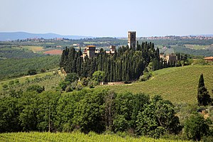
The Badia di Passignano, also called the Abbey of San Michele Arcangelo a Passignano is a historic Benedictine abbey located atop a scenic hilltop, surrounded by cypresses, east of the town of Tavarnelle Val di Pesa, Province of Florence, Italy. The abbey complex is located about 2 kilometres east of the Siena-Florence autostrada. The settlement is also a frazione of Barberino Tavarnelle.

Chiantishire
Nickname for an area of Tuscany, Italy
Distance: Approx. 260 meters
Latitude and longitude: 43.58416667,11.31583333
Chiantishire is a nickname for an area of Tuscany, Italy, where many upper class British citizens have moved or usually spend their holidays. The word is a late 20th century neologism and derives from Chianti, a red wine produced in central Tuscany, in particular in the provinces of Siena and Florence. The location rose to prominence in the UK in the mid 1990s when then Prime Minister Tony Blair chose it as one of his preferred summer retreats.

Pieve of San Leolino
Distance: Approx. 5614 meters
Latitude and longitude: 43.5329,11.312
The pieve (parish church) of San Leolino is a catholic place of worship near Panzano in Chianti , Greve in Chianti comune, in the province of Florence. It belongs to the diocese of Fiesole. The earliest known reference to the pieve dates from 982, where it is referred to as San Leolino in Flacciano, in a parchment of the Abbey of Passignano, but two sculptural fragments within the church suggest even older origins.

Castle of Verrazzano
Castle in Tuscany, Italy
Distance: Approx. 3433 meters
Latitude and longitude: 43.60155,11.28458
The Castle of Verrazzano is located about a mile from the center of Greve in Chianti in Italy, and sits on a mountain spur above the River Greve. The castle dates back to an Etruscan, and then Roman, settlement. The Verrazzano family held the castle for centuries and the navigator Giovanni da Verrazzano is said to have been born there in 1485.

La Piazza, Castellina in Chianti
Frazione in Tuscany, Italy
Distance: Approx. 6563 meters
Latitude and longitude: 43.52944444,11.285
La Piazza (or Piazza) is a village in Tuscany, central Italy, administratively a frazione of the comune of Castellina in Chianti, province of Siena. At the time of the 2001 census its population was 36. La Piazza is about 36 km from Siena and 9 km from Castellina in Chianti.

Badia a Montemuro
Frazione in Tuscany, Italy
Distance: Approx. 7607 meters
Latitude and longitude: 43.54555556,11.3975
Badia a Montemuro (or Badiaccia a Montemuro) is a village in Tuscany, central Italy, administratively a frazione of the comune of Radda in Chianti, province of Siena. At the time of the 2001 census its population was 26. Badia a Montemuro is about 40 km from Siena and 14 km from Radda in Chianti.

Lucarelli, Radda in Chianti
Frazione in Tuscany, Italy
Distance: Approx. 7321 meters
Latitude and longitude: 43.5175,11.31222222
Lucarelli is a village in Tuscany, central Italy, administratively a frazione of the comune of Radda in Chianti, province of Siena. At the time of the 2001 census its population was 65. Lucarelli is about 36 km from Siena and 6 km from Radda in Chianti.

Sicelle
Frazione in Tuscany, Italy
Distance: Approx. 6550 meters
Latitude and longitude: 43.535,11.27194444
Sicelle is a village in Tuscany, central Italy, located in the comune of Castellina in Chianti, province of Siena. Sicelle is about 35 kilometres (22 mi) from Siena and 11 kilometres (6.8 mi) from Castellina in Chianti.

Ponte agli Stolli
Frazione in Tuscany, Italy
Distance: Approx. 7759 meters
Latitude and longitude: 43.60111111,11.41166667
Ponte agli Stolli is a hamlet (frazione) in the comune of Figline e Incisa Valdarno in the Metropolitan City of Florence in Tuscany, Italy. As of 2011, it had a population of 177. The hamlet lies to the east of Greve in Chianti and to the west of Figline Valdarno, and, as such, is located on the SP16 Chianti-Valdarno road.
Weather in this IP's area
clear sky
8 Celsius
7 Celsius
7 Celsius
9 Celsius
1022 hPa
100 %
1022 hPa
993 hPa
10000 meters
1.69 m/s
2.12 m/s
65 degree
07:03:48
16:53:54
