Country:
Region:
City:
Latitude and Longitude:
Time Zone:
Postal Code:
IP information under different IP Channel
ip-api
Country
Region
City
ASN
Time Zone
ISP
Blacklist
Proxy
Latitude
Longitude
Postal
Route
Luminati
Country
ASN
Time Zone
Europe/Rome
ISP
ASDASD srl a socio unico
Latitude
Longitude
Postal
IPinfo
Country
Region
City
ASN
Time Zone
ISP
Blacklist
Proxy
Latitude
Longitude
Postal
Route
db-ip
Country
Region
City
ASN
Time Zone
ISP
Blacklist
Proxy
Latitude
Longitude
Postal
Route
ipdata
Country
Region
City
ASN
Time Zone
ISP
Blacklist
Proxy
Latitude
Longitude
Postal
Route
Popular places and events near this IP address

Montevarchi
Comune in Tuscany, Italy
Distance: Approx. 6690 meters
Latitude and longitude: 43.52861111,11.57
Montevarchi is a town and comune in the province of Arezzo, Tuscany, Italy.
Laterina
Frazione in Tuscany, Italy
Distance: Approx. 8573 meters
Latitude and longitude: 43.5,11.71666667
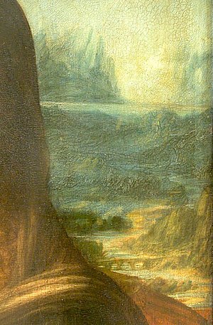
Laterina is a frazione of Laterina Pergine Valdarno in the Province of Arezzo in the Italian region Tuscany, located about 50 kilometres (31 mi) southeast of Florence and about 14 kilometres (9 mi) northwest of Arezzo. The Romito di Laterina, the bridge in the background of the Mona Lisa, is located in Laterina.
Pergine Valdarno
Frazione in Tuscany, Italy
Distance: Approx. 5673 meters
Latitude and longitude: 43.46666667,11.68333333
Pergine Valdarno is a frazione of Laterina Pergine Valdarno in the Province of Arezzo in the Italian region Tuscany, located about 50 kilometres (31 mi) southeast of Florence and about 15 kilometres (9 mi) west of Arezzo. The American architect Craig Ellwood died there on May 30, 1992.

Terranuova Bracciolini
Comune in Tuscany, Italy
Distance: Approx. 8400 meters
Latitude and longitude: 43.55,11.58333333
Terranuova Bracciolini is a comune (municipality) in the Province of Arezzo in the Italian region Tuscany, located about 35 kilometres (22 mi) southeast of Florence and about 25 kilometres (16 mi) northwest of Arezzo. Terranuova Bracciolini borders the following municipalities: Castelfranco Piandiscò, Castiglion Fibocchi, Laterina Pergine Valdarno, Loro Ciuffenna, Montevarchi, San Giovanni Valdarno. Known historically as just Terranuova, the municipality was the birthplace in 1380 of the famed early humanist Poggio Bracciolini, for which it was renamed in 1862.
Laterina Pergine Valdarno
Comune in Tuscany, Italy
Distance: Approx. 5730 meters
Latitude and longitude: 43.47833333,11.68583333
Laterina Pergine Valdarno is a comune (municipality) in the Province of Arezzo in the Italian region Tuscany. It was established on 1 January 2018 by the merger of the municipalities of Laterina and Pergine Valdarno.

Nusenna
Frazione in Tuscany, Italy
Distance: Approx. 7358 meters
Latitude and longitude: 43.45083333,11.53194444
Nusenna is a village in Tuscany, central Italy, administratively a frazione of the comune of Gaiole in Chianti, province of Siena. At the time of the 2001 census its population was 36. Nusenna is about 35 km from Siena and 14 km from Gaiole in Chianti.

San Vincenti
Village in Tuscany, Italy
Distance: Approx. 8979 meters
Latitude and longitude: 43.42333333,11.53333333
San Vincenti is a village in Tuscany, central Italy, administratively a frazione of the comune of Gaiole in Chianti, province of Siena. In the 2001 census, its population was 10.

Starda
Frazione in Tuscany, Italy
Distance: Approx. 8093 meters
Latitude and longitude: 43.46027778,11.51777778
Starda is a village in Tuscany, central Italy, administratively a frazione of the comune of Gaiole in Chianti, province of Siena.

Romito di Laterina bridge
Bridge in Laterina, Italy
Distance: Approx. 5627 meters
Latitude and longitude: 43.49944444,11.67805556
The Romito di Laterina Bridge is a four arched bridge from Etruscan-Roman times located in Laterina in the Province of Arezzo, Italy. In 2023, Italian historian Silvano Vinceti proposed it could be the bridge in background of Leonardo da Vinci's painting, Mona Lisa.

Collegiata di San Lorenzo, Montevarchi
Distance: Approx. 6330 meters
Latitude and longitude: 43.52359,11.56786
The Insigne Collegiata di San Lorenzo (Distinguished Collegiate Church of St Lawrence) is a church in Piazza Varchi of central Montevarchi, Province of Arezzo, Tuscany, central Italy. Attached to the church is a small museum of sacred art, which includes a reconstructed chapel (tempietto) bedecked with panels by Andrea della Robbia.
Weather in this IP's area
clear sky
8 Celsius
7 Celsius
6 Celsius
9 Celsius
1022 hPa
83 %
1022 hPa
994 hPa
10000 meters
2.03 m/s
1.83 m/s
46 degree
07:02:22
16:52:59

