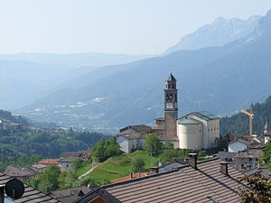
Country:
Region:
City:
Latitude and Longitude:
Time Zone:
Postal Code:
IP information under different IP Channel
ip-api
Country
Region
City
ASN
Time Zone
ISP
Blacklist
Proxy
Latitude
Longitude
Postal
Route
Luminati
Country
ASN
Time Zone
Europe/Rome
ISP
ASDASD srl a socio unico
Latitude
Longitude
Postal
IPinfo
Country
Region
City
ASN
Time Zone
ISP
Blacklist
Proxy
Latitude
Longitude
Postal
Route
db-ip
Country
Region
City
ASN
Time Zone
ISP
Blacklist
Proxy
Latitude
Longitude
Postal
Route
ipdata
Country
Region
City
ASN
Time Zone
ISP
Blacklist
Proxy
Latitude
Longitude
Postal
Route
Popular places and events near this IP address
Civezzano
Comune in Trentino-Alto Adige/Südtirol, Italy
Distance: Approx. 5942 meters
Latitude and longitude: 46.08333333,11.16666667
Civezzano (Zivezan in local dialect) is a comune (municipality) in Trentino in the northern Italian region Trentino-Alto Adige/Südtirol, located about 4 kilometres (2 mi) northeast of Trento. As of 31 December 2004, it had a population of 3,484 and an area of 15.5 square kilometres (6.0 sq mi). Civezzano borders the following municipalities: Albiano, Trento, Fornace and Pergine Valsugana.

Fornace
Comune in Trentino-Alto Adige/Südtirol, Italy
Distance: Approx. 6317 meters
Latitude and longitude: 46.11666667,11.21666667
Fornace (Fornàs in local dialect) is a comune (municipality) in Trentino in the northern Italian region Trentino-Alto Adige/Südtirol, located about 10 kilometres (6 mi) northeast of Trento. As of 31 December 2004, it had a population of 1,218 and an area of 7.2 square kilometres (2.8 sq mi). Fornace borders the following municipalities: Lona-Lases, Baselga di Pinè, Albiano, Civezzano and Pergine Valsugana.

Frassilongo
Comune in Trentino-Alto Adige/Südtirol, Italy
Distance: Approx. 5429 meters
Latitude and longitude: 46.08333333,11.3
Frassilongo (Mocheno: Garait) is a comune (municipality) in Trentino in the northern Italian region Trentino-Alto Adige/Südtirol, located about 14 kilometres (9 mi) east of Trento. As of 31 December 2004, it had a population of 354 and an area of 16.7 square kilometres (6.4 sq mi). Frassilongo borders the following municipalities: Sant'Orsola Terme, Fierozzo, Roncegno, Vignola-Falesina, Pergine Valsugana, Novaledo and Levico Terme.
Pergine Valsugana
Comune in Trentino-Alto Adige/Südtirol, Italy
Distance: Approx. 621 meters
Latitude and longitude: 46.06666667,11.23333333
Pergine Valsugana (Pèrzen or Pèrzem in local dialect) is a comune (municipality) in Trentino in the northern Italian region Trentino-Alto Adige/Südtirol, located about 9 kilometres (6 mi) east of Trento. Pergine Valsugana borders the following municipalities: Baselga di Pinè, Trento, Fornace, Sant'Orsola Terme, Civezzano, Frassilongo, Vignola-Falesina, Novaledo, Levico Terme, Tenna, Vigolo Vattaro, Bosentino, Caldonazzo and Calceranica al Lago.

Tenna, Trentino
Comune in Trentino-Alto Adige/Südtirol, Italy
Distance: Approx. 5512 meters
Latitude and longitude: 46.01666667,11.26666667
Tenna (Téna in local dialect) is a comune (municipality) in Trentino in the northern Italian region Trentino-Alto Adige/Südtirol, located about 13 kilometres (8 mi) southeast of Trento. As of 31 December 2004, it had a population of 918 and an area of 3.1 square kilometres (1.2 sq mi). Tenna borders the following municipalities: Pergine Valsugana, Levico Terme and Caldonazzo.
Vignola-Falesina
Comune in Trentino-Alto Adige/Südtirol, Italy
Distance: Approx. 3809 meters
Latitude and longitude: 46.05,11.28333333
Vignola-Falesina is a comune (municipality) in Trentino in the northern Italian region Trentino-Alto Adige/Südtirol, located about 13 kilometres (8 mi) east of Trento. As of 31 December 2004, it had a population of 128 and an area of 12.0 square kilometres (4.6 sq mi). Vignola-Falesina borders the following municipalities: Frassilongo, Pergine Valsugana and Levico Terme.
Lake Levico
Distance: Approx. 6222 meters
Latitude and longitude: 46.01367778,11.27820833
Lake Levico is a natural lake in Trentino, Italy. At an elevation of 440 m, its surface area is 1.164 km².

Lake Caldonazzo
Lake in Trentino, Italy
Distance: Approx. 4783 meters
Latitude and longitude: 46.01888889,11.24222222
Lake Caldonazzo (Italian: Lago di Caldonazzo) is a lake in Trentino, Italy. At an elevation of 449 m, its surface area is 5.38 km2. It is located in the valley communities of Alta Valsugana e Bersntol.

Bersntol
Valley in Trentino, Italy
Distance: Approx. 6469 meters
Latitude and longitude: 46.1,11.3
The Bersntol (German: Fersental, Italian: Valle del Fersina) is a valley in the Autonomous Province of Trento, in north-eastern Italy. The Fersina river runs through it. It is also known as the Valle del Mòcheni after its inhabitants, who speak the Upper German Mòcheno language.
COSBI
Italian nonprofit research center
Distance: Approx. 6377 meters
Latitude and longitude: 46.065872,11.154652
The Microsoft Research - University of Trento Centre for Computational and Systems Biology (COSBI) is a nonprofit research center in Trentino, Italy. Its first office opened on December 6, 2005, in Trento; the second opened in 2011 in Rovereto. It is a limited liability consortium, half owned by Microsoft Research Cambridge and half by the University of Trento.
Überetsch
Mountain in Italy
Distance: Approx. 1365 meters
Latitude and longitude: 46.07,11.25
The Überetsch (German: Überetsch; Italian: Oltradige) is a hilly section of the Etschtal in South Tyrol, northern Italy. It lies south-west of Bolzano and is a known tourist destination, famous for its wines, castles and lakes (Kalterer See, Montiggler Seen). The municipalities of the Überetsch are Kaltern and Eppan.

Alta Valsugana e Bersntol
Territory in Italy
Distance: Approx. 1665 meters
Latitude and longitude: 46.06666667,11.21666667
Alta Valsugana e Bersntol (German: Hoch Suganertal und Fersental; Mocheno: Hoa Valzegu' ont Bersntol) is one of the sixteen districts of Trentino in the Italian region of Trentino-Alto Adige/Südtirol. Its administrative seat and major town is Pergine Valsugana.
Weather in this IP's area
clear sky
6 Celsius
6 Celsius
5 Celsius
6 Celsius
1026 hPa
38 %
1026 hPa
969 hPa
10000 meters
0.96 m/s
0.89 m/s
49 degree
07:10:25
16:47:56

