Country:
Region:
City:
Latitude and Longitude:
Time Zone:
Postal Code:
IP information under different IP Channel
ip-api
Country
Region
City
ASN
Time Zone
ISP
Blacklist
Proxy
Latitude
Longitude
Postal
Route
Luminati
Country
ASN
Time Zone
Europe/Rome
ISP
ASDASD srl a socio unico
Latitude
Longitude
Postal
IPinfo
Country
Region
City
ASN
Time Zone
ISP
Blacklist
Proxy
Latitude
Longitude
Postal
Route
db-ip
Country
Region
City
ASN
Time Zone
ISP
Blacklist
Proxy
Latitude
Longitude
Postal
Route
ipdata
Country
Region
City
ASN
Time Zone
ISP
Blacklist
Proxy
Latitude
Longitude
Postal
Route
Popular places and events near this IP address
Laterina
Frazione in Tuscany, Italy
Distance: Approx. 3617 meters
Latitude and longitude: 43.5,11.71666667
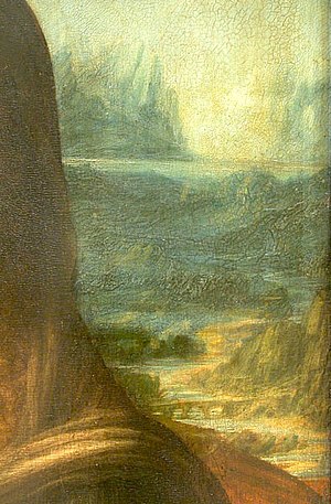
Laterina is a frazione of Laterina Pergine Valdarno in the Province of Arezzo in the Italian region Tuscany, located about 50 kilometres (31 mi) southeast of Florence and about 14 kilometres (9 mi) northwest of Arezzo. The Romito di Laterina, the bridge in the background of the Mona Lisa, is located in Laterina.
Pergine Valdarno
Frazione in Tuscany, Italy
Distance: Approx. 1230 meters
Latitude and longitude: 43.46666667,11.68333333
Pergine Valdarno is a frazione of Laterina Pergine Valdarno in the Province of Arezzo in the Italian region Tuscany, located about 50 kilometres (31 mi) southeast of Florence and about 15 kilometres (9 mi) west of Arezzo. The American architect Craig Ellwood died there on May 30, 1992.

Tuori
Frazione in Tuscany, Italy
Distance: Approx. 8301 meters
Latitude and longitude: 43.43333333,11.76666667
Tuori is a frazione of Civitella in Val di Chiana in the province of Arezzo, Tuscany, Italy.

Ponte Buriano
Bridge in Tuscany
Distance: Approx. 9796 meters
Latitude and longitude: 43.50456,11.799606
The Ponte Buriano is a 1277 stone seven-arch bridge that is located north of the town of Arezzo in the Tuscany region of central Italy. Some references tells that the bridge was used by Leonardo da Vinci in the lower-right quadrant of his painting Mona Lisa.

Arezzo War Cemetery
CWGC cemetery in Toscana, Italy
Distance: Approx. 8613 meters
Latitude and longitude: 43.484069,11.790363
Arezzo War Cemetery is a war cemetery operated by the Commonwealth War Graves Commission, to the North West of the city of Arezzo, Italy. It was established in November 1944, to house the remains of Allied casualties from World War II. The remains of 1,266 men are interred there, mostly British. However, the interments also include a number of members of the 4th and 8th Divisions of the Indian Army, who are buried in a separate section, in plots VII–IX. The cemetery also has one American burial, plus more from Canada, New Zealand, and South Africa, and 37 who are unidentified.
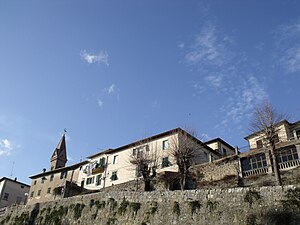
Laterina Pergine Valdarno
Comune in Tuscany, Italy
Distance: Approx. 157 meters
Latitude and longitude: 43.47833333,11.68583333
Laterina Pergine Valdarno is a comune (municipality) in the Province of Arezzo in the Italian region Tuscany. It was established on 1 January 2018 by the merger of the municipalities of Laterina and Pergine Valdarno.

Romito di Laterina bridge
Bridge in Laterina, Italy
Distance: Approx. 2469 meters
Latitude and longitude: 43.49944444,11.67805556
The Romito di Laterina Bridge is a four arched bridge from Etruscan-Roman times located in Laterina in the Province of Arezzo, Italy. In 2023, Italian historian Silvano Vinceti proposed it could be the bridge in background of Leonardo da Vinci's painting, Mona Lisa.
Weather in this IP's area
clear sky
6 Celsius
4 Celsius
6 Celsius
9 Celsius
1022 hPa
85 %
1022 hPa
989 hPa
10000 meters
2.27 m/s
2 m/s
48 degree
07:02:05
16:52:42

