Country:
Region:
City:
Latitude and Longitude:
Time Zone:
Postal Code:
IP information under different IP Channel
ip-api
Country
Region
City
ASN
Time Zone
ISP
Blacklist
Proxy
Latitude
Longitude
Postal
Route
Luminati
Country
Region
24
City
goleszow
ASN
Time Zone
Europe/Warsaw
ISP
SilesNet s.r.o.
Latitude
Longitude
Postal
IPinfo
Country
Region
City
ASN
Time Zone
ISP
Blacklist
Proxy
Latitude
Longitude
Postal
Route
db-ip
Country
Region
City
ASN
Time Zone
ISP
Blacklist
Proxy
Latitude
Longitude
Postal
Route
ipdata
Country
Region
City
ASN
Time Zone
ISP
Blacklist
Proxy
Latitude
Longitude
Postal
Route
Popular places and events near this IP address

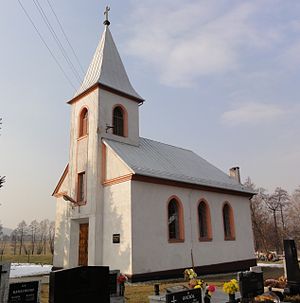
Goleszów
Village in Silesian Voivodeship, Poland
Distance: Approx. 601 meters
Latitude and longitude: 49.7357,18.73984722
Goleszów [ɡɔˈlɛʂuf] is a village and the seat of Gmina Goleszów (an administrative district) in Cieszyn County in Silesian Voivodeship, southern Poland. The name of the village is possessive in origin, derived from a personal name Golesz.
Cisownica
Village in Silesian Voivodeship, Poland
Distance: Approx. 2140 meters
Latitude and longitude: 49.72095833,18.762825
Cisownica is a village in Gmina Goleszów, Cieszyn County, Silesian Voivodeship, southern Poland, close to the border with the Czech Republic. In 2008 it had a population of 1,705. It lies in the historical region of Cieszyn Silesia on the slopes of Mała Czantoria mountain.
Leszna Górna
Village in Silesian Voivodeship, Poland
Distance: Approx. 3879 meters
Latitude and longitude: 49.69897222,18.71447778
is a village in Gmina Goleszów, Cieszyn County, Silesian Voivodeship, in southern Poland, on the border with the Czech Republic. It lies in the Silesian Foothills and in the historical region of Cieszyn Silesia.

Dzięgielów
Village in Silesian Voivodeship, Poland
Distance: Approx. 2587 meters
Latitude and longitude: 49.72219167,18.70358333
Dzięgielów is a village in Gmina Goleszów, Cieszyn County, Silesian Voivodeship, southern Poland, near the border with the Czech Republic. It lies in the Silesian Foothills and in the historical region of Cieszyn Silesia. Dzięgielów is one of the most Protestant municipalities of the region.
Bażanowice
Village in Silesian Voivodeship, Poland
Distance: Approx. 2452 meters
Latitude and longitude: 49.73722778,18.70459722
Bażanowice (/baʐanɔvit͡sɛ/) is a village in Gmina Goleszów, Cieszyn County, Silesian Voivodeship, southern Poland, close to the border with the Czech Republic. It lies in the Silesian Foothills in the historical region of Cieszyn Silesia. The name is patronymic in origin derived from personal name Bażan.
Godziszów, Silesian Voivodeship
Village in Silesian Voivodeship, Poland
Distance: Approx. 3639 meters
Latitude and longitude: 49.76053056,18.75743056
Godziszów is a village in Gmina Goleszów, Cieszyn County, Silesian Voivodeship, southern Poland, close to the border with the Czech Republic. The village lies in the Silesian Foothills, in the historical region of Cieszyn Silesia.
Kozakowice
Village in Silesian Voivodeship, Poland
Distance: Approx. 2966 meters
Latitude and longitude: 49.74873333,18.76730833
Kozakowice is a village in Gmina Goleszów, Cieszyn County, Silesian Voivodeship, southern Poland, close to the border with the Czech Republic. It lies in the Silesian Foothills and in the historical region of Cieszyn Silesia. Traditionally as weel as currently they form two sołectwos: Kozakowice Dolne and Kozakowice Górne.

Gmina Goleszów
Gmina in Silesian Voivodeship, Poland
Distance: Approx. 601 meters
Latitude and longitude: 49.7357,18.73984722
Gmina Goleszów is a rural gmina (administrative district) in Cieszyn County, Silesian Voivodeship, in southern Poland, in the historical region of Cieszyn Silesia. Its seat is the village of Goleszów. The gmina covers an area of 65.89 square kilometres (25.4 sq mi), and as of 2019 its total population is 13,160.
Ogrodzona, Silesian Voivodeship
Village in Silesian Voivodeship, Poland
Distance: Approx. 4515 meters
Latitude and longitude: 49.77049444,18.72578333
Ogrodzona [ɔɡrɔˈd͡zɔna] is a village in Gmina Dębowiec, Cieszyn County, Silesian Voivodeship, southern Poland. The name is of cultural origins and literally means [a] fenced/penned [place, village] (feminine adjective from Polish ogrodzenie).
Hermanice, Ustroń
District of Ustroń, Silesian Voivodeship, Poland
Distance: Approx. 4623 meters
Latitude and longitude: 49.74027778,18.79958333
Hermanice is a district of Ustroń, Silesian Voivodeship, Poland. It was a separate municipality, but became administratively a part of Ustroń in 1945.

Gułdowy
Distance: Approx. 4569 meters
Latitude and longitude: 49.74305556,18.67658333
Gułdowy is a district of Cieszyn, Silesian Voivodeship, Poland. It was a separate municipality, but became administratively a part of Cieszyn in 1973. The village was first mentioned in 1461.

Goleszów railway station
Railway station in Silesia, Poland
Distance: Approx. 1996 meters
Latitude and longitude: 49.7467,18.7493
Goleszów is one of two railway stations in Goleszów, Poland, the other is Goleszów Górny railway station. The station is located at the junction of the railway lines 190 and 191 near the village of Kozakowice Górne.
Weather in this IP's area
clear sky
2 Celsius
-1 Celsius
1 Celsius
3 Celsius
1026 hPa
89 %
1026 hPa
974 hPa
10000 meters
2.39 m/s
2.64 m/s
178 degree
8 %
06:57:26
16:02:11


