78.138.43.38 - IP Lookup: Free IP Address Lookup, Postal Code Lookup, IP Location Lookup, IP ASN, Public IP
Country:
 Italy
ItalyRegion:
City:
Location:
Time Zone:
Postal Code:
ISP:
ASN:
language:
User-Agent:
Proxy IP:
Blacklist:
IP information under different IP Channel
ip-api
Country
Region
City
ASN
Time Zone
ISP
Blacklist
Proxy
Latitude
Longitude
Postal
Route
db-ip
Country
Region
City
ASN
Time Zone
ISP
Blacklist
Proxy
Latitude
Longitude
Postal
Route
IPinfo
Country
Region
City
ASN
Time Zone
ISP
Blacklist
Proxy
Latitude
Longitude
Postal
Route
IP2Location
78.138.43.38Country
itRegion
sardegna
City
alghero
Time Zone
Europe/Rome
ISP
Language
User-Agent
Latitude
Longitude
Postal
ipdata
Country
Region
City
ASN
Time Zone
ISP
Blacklist
Proxy
Latitude
Longitude
Postal
Route
Popular places and events near this IP address

Alghero
City in Sardinia, Italy
Distance: Approx. 289 meters
Latitude and longitude: 40.56,8.315
Alghero (Italian: [alˈɡɛːro]; Algherese: L'Alguer [lalˈɣe]; Sardinian: S'Alighera [saliˈɣɛɾa]; Sassarese: L'Aliera [laˈljɛːɾa]) is a city of about 45,000 inhabitants in the Italian province of Sassari in the north west of the island of Sardinia, next to the Mediterranean Sea. The city's name comes from Aleguerium, which is a mediaeval Latin word meaning "stagnation of algae" (Posidonia oceanica). The population is noted for having retained the language of the Crown of Aragon rulers from the end of the Middle Ages, when Sardinia was part of the Crown of Aragon; hence, Algherese (the Catalan dialect spoken there) is officially recognized as a minority language.
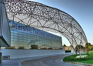
Alghero–Fertilia Airport
Airport in Fertilia, Italy
Distance: Approx. 8416 meters
Latitude and longitude: 40.63111111,8.28861111
Alghero - Riviera del Corallo Airport (Italian: Aeroporto di Alghero - Riviera del Corallo; Catalan: L'Aeroport de l'Alguer-Fertília) (IATA: AHO, ICAO: LIEA) is an international airport situated 4.3 NM (8.0 km; 4.9 mi) north-northwest of the city of Alghero, in northern Sardinia, Italy. It is also known as Alghero–Fertilia Airport, named for the nearby village of Fertilia or Alghero Airport. It is one of the three main airports serving Sardinia, the other ones being Olbia in the northeast, and near Cagliari in the south.

Roman Catholic Diocese of Alghero-Bosa
Roman Catholic diocese in Italy
Distance: Approx. 998 meters
Latitude and longitude: 40.55,8.3167
The Diocese of Alghero-Bosa (Latin: Dioecesis Algarensis-Bosanensis) is a Latin Church diocese of the Catholic Church. It is a suffragan of the Metropolitan Archdiocese of Sassari, on Sardinia, insular Italy. The diocese has an area of 2,012; a total population of 106,300; a Catholic population of 105,650; 87 priests, 7 permanent deacons and 176 religious.

Alghero Cathedral
Distance: Approx. 451 meters
Latitude and longitude: 40.5592,8.31278
Alghero Cathedral, otherwise the Cathedral of St. Mary the Immaculate (Italian: Duomo di Alghero; Cattedrale di Santa Maria Immacolata Catalan: Catedral de l'Alguer; Catedral de Santa Maria Immaculada), is a Roman Catholic cathedral in Alghero in the province of Sassari, Sardinia, Italy. It is located in the historic center of the city.
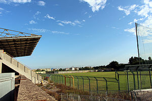
Stadio Mariotti
Distance: Approx. 789 meters
Latitude and longitude: 40.56388889,8.32472222
Stadio Mariotti is an arena in Alghero, Sardinia (Italy). It is primarily used for football, and is the home to the Polisportiva Alghero of the Eccellenza Sardinia. The stadium has a capacity of 2,815 spectators.

Nuraghe Palmavera
Distance: Approx. 7529 meters
Latitude and longitude: 40.595,8.2428
The nuraghe Palmavera is an archaeological site located in the territory of Alghero, Sardinia. It is classified as a complex nuraghe, that consists of several towers joined together. The nuraghe and the surrounding village were built in various phase during the Bronze Age and the Iron Age.

Necropolis of Anghelu Ruju
Archaeological site in Alghero, Italy
Distance: Approx. 8225 meters
Latitude and longitude: 40.6325,8.3267
The necropolis of Anghelu Ruju is a pre-Nuragic archaeological site located north of the city of Alghero, Province of Sassari, Sardinia. It is the largest necropolis of pre-Nuragic Sardinia. The necropolis was discovered accidentally in 1903 during the excavations for the construction of a farmhouse, in the winery of Sella&Mosca.

Isolotto della Maddalena Lighthouse
Lighthouse
Distance: Approx. 2114 meters
Latitude and longitude: 40.572292,8.300374
Isolotto della Maddalena Lighthouse (Italian: Faro di Isolotto della Maddalena) is an active lighthouse located on a small islet, 84 metres (276 ft) long, placed 800 metres (2,600 ft) north of the south mole of the Port of Alghero on the Sea of Sardinia.
Weather in this IP's area
clear sky
10 Celsius
10 Celsius
10 Celsius
10 Celsius
1019 hPa
93 %
1019 hPa
1011 hPa
10000 meters
0.51 m/s