Country:
 Italy
ItalyRegion:
City:
Latitude and Longitude:
Time Zone:
Postal Code:
IP information under different IP Channel
ip-api
Country
Region
City
ASN
Time Zone
ISP
Blacklist
Proxy
Latitude
Longitude
Postal
Route
IPinfo
Country
Region
City
ASN
Time Zone
ISP
Blacklist
Proxy
Latitude
Longitude
Postal
Route
MaxMind
Country
Region
City
ASN
Time Zone
ISP
Blacklist
Proxy
Latitude
Longitude
Postal
Route
Luminati
Country
ITRegion
25
City
quistello
ASN
Time Zone
Europe/Rome
ISP
Convergenze S.p.A.
Latitude
Longitude
Postal
db-ip
Country
Region
City
ASN
Time Zone
ISP
Blacklist
Proxy
Latitude
Longitude
Postal
Route
ipdata
Country
Region
City
ASN
Time Zone
ISP
Blacklist
Proxy
Latitude
Longitude
Postal
Route
Popular places and events near this IP address

Secchia
Italian river
Distance: Approx. 6268 meters
Latitude and longitude: 45.0624,11.0057
The Secchia (pronounced [ˈsekkja]; Emilian: Sècia; called by Pliny Gabellus) is an Italian river. One of the main right bank tributaries of the Po, it flows through the Emilia-Romagna region in northern Italy. It is 172 kilometres (107 mi) long, and has a drainage basin with a catchment area of 2,292 square kilometres (885 sq mi), alternating between aridity in the dry summer months and higher flows during the wet spring and autumn periods.

Mincio
River in Italy
Distance: Approx. 6864 meters
Latitude and longitude: 45.07111111,10.98194444
The Mincio (Italian: [ˈmintʃo]; Lombard: Mens; Venetian: Menzo; Latin: Mincius; Ancient Greek: Μίγχιος, romanized: Mínchios) is a river in the Lombardy region of northern Italy. The river is the main outlet of Lake Garda. It is a part of the Sarca-Mincio river system which also includes the river Sarca and the Lake Garda.

Pieve di Coriano
Frazione in Lombardy, Italy
Distance: Approx. 9929 meters
Latitude and longitude: 45.03333333,11.1
Pieve di Coriano is a frazione of Borgo Mantovano in the Province of Mantua in the Italian region Lombardy, located about 160 kilometres (99 mi) southeast of Milan and about 30 kilometres (19 mi) southeast of Mantua.
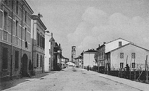
Quistello
Comune in Lombardy, Italy
Distance: Approx. 887 meters
Latitude and longitude: 45.01666667,10.98333333
Quistello (Lower Mantovano: Quistèl) is a comune (municipality) in the Province of Mantua in the Italian region Lombardy, located about 150 kilometres (93 mi) southeast of Milan and about 20 kilometres (12 mi) southeast of Mantua. Quistello borders the following municipalities: Concordia sulla Secchia, Moglia, Quingentole, San Benedetto Po, San Giacomo delle Segnate, San Giovanni del Dosso, Schivenoglia, Sustinente.

San Benedetto Po
Comune in Lombardy, Italy
Distance: Approx. 5535 meters
Latitude and longitude: 45.03333333,10.91666667
San Benedetto Po (Lower Mantovano: San Banadèt) is a comune (municipality) in the Province of Mantua in the Italian region Lombardy, located about 150 kilometres (93 mi) southeast of Milan and about 15 kilometres (9 mi) southeast of Mantua. It is one of I Borghi più belli d'Italia ("The most beautiful villages of Italy"). It is best known as the location of the Polirone Abbey.

San Giacomo delle Segnate
Comune in Lombardy, Italy
Distance: Approx. 6437 meters
Latitude and longitude: 44.96666667,11.03333333
San Giacomo delle Segnate (Lower Mantovano: San Iàcum dli Sgnàdi) is a comune (municipality) in the Province of Mantua in the Italian region Lombardy, located about 160 kilometres (99 mi) southeast of Milan and about 30 kilometres (19 mi) southeast of Mantua. San Giacomo delle Segnate borders the following municipalities: Concordia sulla Secchia, Quistello, San Giovanni del Dosso.
Polirone Abbey
Distance: Approx. 5349 meters
Latitude and longitude: 45.04222222,10.92861111
The Abbey of San Benedetto in Polirone is a large complex of Benedictine order monastic buildings, including a church and cloisters, located in the town of San Benedetto Po, Province of Mantua, Region of Lombardy, Italy. The complex, now belonging to the city, houses offices, a museum, and is open to visitors.
Weather in this IP's area
overcast clouds
19 Celsius
18 Celsius
18 Celsius
19 Celsius
1011 hPa
54 %
1011 hPa
1009 hPa
10000 meters
2.06 m/s
2.26 m/s
17 degree
99 %
06:56:17
19:25:38