Country:
Region:
City:
Latitude and Longitude:
Time Zone:
Postal Code:
IP information under different IP Channel
ip-api
Country
Region
City
ASN
Time Zone
ISP
Blacklist
Proxy
Latitude
Longitude
Postal
Route
Luminati
Country
Region
l
City
bray
ASN
Time Zone
Europe/Dublin
ISP
Digiweb ltd
Latitude
Longitude
Postal
IPinfo
Country
Region
City
ASN
Time Zone
ISP
Blacklist
Proxy
Latitude
Longitude
Postal
Route
db-ip
Country
Region
City
ASN
Time Zone
ISP
Blacklist
Proxy
Latitude
Longitude
Postal
Route
ipdata
Country
Region
City
ASN
Time Zone
ISP
Blacklist
Proxy
Latitude
Longitude
Postal
Route
Popular places and events near this IP address

Trim, County Meath
Town in County Meath, Ireland
Distance: Approx. 369 meters
Latitude and longitude: 53.553,-6.793
Trim (Irish: Baile Átha Troim, meaning 'town at the ford of elderflowers') is a town in County Meath, Ireland. It is situated on the River Boyne and, as of the 2022 census, had a population of 9,563. The town is in a civil parish of the same name.

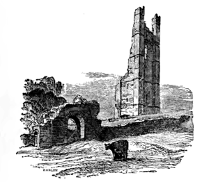
Trim Castle
Largest Norman castle in Ireland (ruin), Trim, County Meath
Distance: Approx. 154 meters
Latitude and longitude: 53.555,-6.7897
Trim Castle (Irish: Caisleán Bhaile Átha Troim) is a castle on the south bank of the River Boyne in Trim, County Meath, Ireland, with an area of 30,000 m2. Over a period of 30 years, it was built by Hugh de Lacy and his son Walter as the caput of the Lordship of Meath. The Irish Government currently own and are in charge of the care of the castle, through the state agency The Office of Public Works (OPW).
Trim GAA
Gaelic games club in County Meath, Ireland
Distance: Approx. 866 meters
Latitude and longitude: 53.55354722,-6.80085
Trim GAA is a Gaelic Athletic Association club based in Trim, in County Meath, Ireland. The club fields both Gaelic football and hurling teams. It competes in Meath GAA competitions.

Trim Cathedral
Church in County Meath, Ireland
Distance: Approx. 516 meters
Latitude and longitude: 53.55852778,-6.79061111
The Cathedral Church of St Patrick, Trim is a cathedral of the Church of Ireland in Trim, County Meath, Ireland. Previously the cathedral of the Diocese of Meath, it is now one of two cathedrals in the United Dioceses of Meath and Kildare which is part of the ecclesiastical province of Dublin.

St. Mary's Abbey, Trim
Distance: Approx. 133 meters
Latitude and longitude: 53.55527778,-6.78694444
St. Mary's Abbey in Trim, County Meath, Ireland is a former house of Augustinian canons dedicated to the Blessed Virgin. The abbey was situated on the north bank of the River Boyne, opposite Trim Castle, on land given to St.
St Loman's Park
Gaelic sports stadium
Distance: Approx. 906 meters
Latitude and longitude: 53.55083333,-6.80027778
St Loman's Park (Irish: Páirc Naomh Lómáin), in Trim, Ireland, is a stadium which is home to Trim GAA and is traditionally known as the home of Meath Hurling. The grounds are at the western end of the town, situated on the Newhaggard Road. St Loman's hosted the Meath Senior Hurling Championship final up until 2007, when the main pitch and clubhouse were closed for redevelopment.

Laracor
Parish in County Meath, Ireland
Distance: Approx. 3700 meters
Latitude and longitude: 53.521,-6.785
Laracor, in Irish Láithreach Cora, is a civil parish which is located in County Meath in Ireland, south of Trim. It overlaps with the electoral division of the same name. The civil parish consists of the 21 townlands of Adamstown, Ballinrig, Brownstown, Clondoogan, Clonmahon, Cnoc an Línsigh (Summerhill), An Daingean (Dangan), Fearann Eoin Baiste (Saintjohns), Freffans Great, Freffans Little, Ifferknock, Knightsbrook, the eponymous Láithreach Cora (Laracor), Maigh (Moy), Readstown, Springvalley, Stokestown, Summerhill Demesne, Summerstown, Umberstone Great, and Umberstown Little.
The Black Friary
Distance: Approx. 683 meters
Latitude and longitude: 53.56027778,-6.78916667
The Black Friary (Irish: An Mhainistir Dhubh) was a Dominican friary located in Trim, County Meath, Ireland.

Sheep Gate
Town gate in Trim, Ireland
Distance: Approx. 120 meters
Latitude and longitude: 53.555281,-6.787875
The Sheep Gate is a town gate in Trim, Ireland. It is a National Monument.

Porch Fields
Distance: Approx. 243 meters
Latitude and longitude: 53.554921,-6.784334
The Porch Fields is an area of medieval farmland outside Trim, Ireland with a medieval roadway that forms a National Monument.
Knightsbrook
Village in Leinster, Ireland
Distance: Approx. 2488 meters
Latitude and longitude: 53.531852,-6.786913
Knightsbrook is a village and townland in County Meath, Ireland. It is located on the R158 road, close to the junction with the R159. to the south of Trim.

Knightsbrook River
Watercourse in County Meath, Ireland
Distance: Approx. 2634 meters
Latitude and longitude: 53.55093,-6.74835
The Knightsbrook River is a river in County Meath, Ireland. The river rises near Summerhill, and flows north past the R156, and later the R158 and R159 roads, through Knightsbrook, and merges into the River Boyne a few kilometres to the east of Trim.
Weather in this IP's area
overcast clouds
8 Celsius
6 Celsius
7 Celsius
9 Celsius
1017 hPa
90 %
1017 hPa
1010 hPa
10000 meters
3.3 m/s
7.43 m/s
235 degree
100 %
07:57:28
16:27:11