77.93.94.241 - IP Lookup: Free IP Address Lookup, Postal Code Lookup, IP Location Lookup, IP ASN, Public IP
Country:
Region:
City:
Location:
Time Zone:
Postal Code:
IP information under different IP Channel
ip-api
Country
Region
City
ASN
Time Zone
ISP
Blacklist
Proxy
Latitude
Longitude
Postal
Route
Luminati
Country
ASN
Time Zone
Europe/Amsterdam
ISP
SouthernHill BV
Latitude
Longitude
Postal
IPinfo
Country
Region
City
ASN
Time Zone
ISP
Blacklist
Proxy
Latitude
Longitude
Postal
Route
IP2Location
77.93.94.241Country
Region
limburg
City
sittard
Time Zone
Europe/Amsterdam
ISP
Language
User-Agent
Latitude
Longitude
Postal
db-ip
Country
Region
City
ASN
Time Zone
ISP
Blacklist
Proxy
Latitude
Longitude
Postal
Route
ipdata
Country
Region
City
ASN
Time Zone
ISP
Blacklist
Proxy
Latitude
Longitude
Postal
Route
Popular places and events near this IP address

Sittard-Geleen
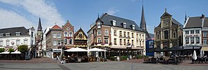
Municipality in Limburg, Netherlands
Distance: Approx. 277 meters
Latitude and longitude: 51,5.86666667
Sittard-Geleen (Dutch: [ˈsɪtɑrt xəˈleːn] ; Limburgish: Zittert-Gelaen [ˈzɪtəʀt xəˈlɛːn]) is a municipality in the southeastern Netherlands. It was formed in 2001 from the former municipalities Sittard, Geleen and Born. The combined municipality has approximately 92,650 inhabitants (January 2024) and is thus the third most populated municipality in Limburg (after Maastricht with 125,000 and Venlo with 103,000 inhabitants).
Sittard
City in Limburg, Netherlands
Distance: Approx. 277 meters
Latitude and longitude: 51,5.86666667
Sittard (Dutch pronunciation: [ˈsɪtɑrt]; Limburgish: Zitterd [ˈzɪtəʀt]) is a city in the Netherlands, situated in the southernmost province of Limburg. The town is part of the municipality of Sittard-Geleen and has almost 37,500 inhabitants in 2016. In its east, Sittard borders the German municipality of Selfkant (in the state of North Rhine-Westphalia).

Lutterade
District in Geleen, Limburg
Distance: Approx. 3897 meters
Latitude and longitude: 50.97833333,5.82361111
Lutterade (Dutch pronunciation: [ˈlʏtəˌraːdə]; Limburgish: Lötterao [ˈlœtəʀɔː]) is a district of Geleen and later Sittard-Geleen (a municipality in the southeastern Netherlands, in the province of Limburg).

Limbricht
Village in Limburg, Netherlands
Distance: Approx. 2728 meters
Latitude and longitude: 51.0117,5.8369
Limbricht (Dutch pronunciation: [ˈlɪmbrɪxt]; Limburgish: Lömmerig [ˈlœməʀɪx] locally spelled Lömmerich) is a village in the Dutch province of Limburg. Part of the municipality of Sittard-Geleen, it is about three kilometres northwest of Sittard. The village was first mentioned in 1224 as de Lumburg.

Selfkant
Municipality in North Rhine-Westphalia, Germany
Distance: Approx. 3897 meters
Latitude and longitude: 51.01666667,5.91666667
Selfkant (German: [ˈzɛlfkant] ; Dutch: Selfkant or Zelfkant [ˈzɛl(ə)fkɑnt]; Limburgish: Zelfkantj [ˈzæl˦əfˌkɑntʃ˦]) is a municipality in the Heinsberg district, in North Rhine-Westphalia, Germany. It is the most westerly municipality in Germany.
De Baandert
Distance: Approx. 1054 meters
Latitude and longitude: 51.00638889,5.87694444
De Baandert was a multi-use stadium in Sittard-Geleen, Netherlands. Opened in 1964 it was used mostly for football matches and hosted the home matches of Fortuna Sittard. The stadium was able to hold 22,000 people.
Broeksittard
Place in Limburg, Netherlands
Distance: Approx. 1827 meters
Latitude and longitude: 51.00277778,5.89444444
Broeksittard (Dutch pronunciation: [ˈbrukˌsɪtɑrt]; Limburgish: Broukzittert [ˈbʀɔwkˌsɪtəʀt]) is a former village in the Dutch province of Limburg. It is now a neighbourhood of the town Sittard, and part of the municipality of Sittard-Geleen. It has partly kept its village character.
Munstergeleen
Village in Limburg, Netherlands
Distance: Approx. 2621 meters
Latitude and longitude: 50.97472222,5.86666667
Munstergeleen (Dutch pronunciation: [ˈmʏnstərɣəˌleːn]; Limburgish: Munstergelaen [ˈmʏnstəʀɣəˌlɛːn]) is a village in the Dutch province of Limburg. It is located in the municipality of Sittard-Geleen, and it lies in the Western Mine Region (Westelijke Mijnstreek in Dutch).
Geleen Oost railway station
Railway station in the Netherlands
Distance: Approx. 3912 meters
Latitude and longitude: 50.96722222,5.84305556
Geleen Oost is a railway station located in Geleen, Netherlands. The station opened in 1896 and is located on the Sittard–Herzogenrath railway. The station is operated by Arriva.

Sittard railway station
Railway station in the Netherlands
Distance: Approx. 840 meters
Latitude and longitude: 51.00111111,5.85833333
Sittard is a railway station located in Sittard, Netherlands. The station was opened in 1862 and is located on the Maastricht–Venlo railway and the Sittard–Herzogenrath railway. Train services are operated by Nederlandse Spoorwegen and Arriva.

Abshoven
Hamlet in Limburg, Netherlands
Distance: Approx. 3764 meters
Latitude and longitude: 50.96666667,5.85
Abshoven (Dutch: [ˈɑpsˌɦoːvə(n)]; Limburgish: Abshaove) is a hamlet in the municipality of Sittard-Geleen in the province of Limburg in the Netherlands. It is located to the south of Munstergeleen and to the east of Geleen. The hamlet has approximately forty houses and is located on the Abshoven and Beekstraat roads.

Fortuna Sittard Stadion
Distance: Approx. 1927 meters
Latitude and longitude: 50.992069,5.843675
The Fortuna Sittard Stadion (Dutch pronunciation: [fɔrˌtynaː ˈsɪtɑrt ˌstaːdijɔn]) is a 12,500-capacity multi-use stadium on the Milaanstraat, Sittard, Netherlands. Currently used mostly for football matches, it is the home stadium of Fortuna Sittard. Built on the site of an industrial estate in 1999, it replaced Fortuna Sittard's former stadium, De Baandert.
Weather in this IP's area
fog
3 Celsius
3 Celsius
1 Celsius
4 Celsius
1034 hPa
98 %
1034 hPa
1029 hPa
200 meters
0.51 m/s
60 degree
100 %


