77.90.61.105 - IP Lookup: Free IP Address Lookup, Postal Code Lookup, IP Location Lookup, IP ASN, Public IP
Country:
Region:
City:
Location:
Time Zone:
Postal Code:
IP information under different IP Channel
ip-api
Country
Region
City
ASN
Time Zone
ISP
Blacklist
Proxy
Latitude
Longitude
Postal
Route
Luminati
Country
ASN
Time Zone
Europe/Berlin
ISP
KemmIT
Latitude
Longitude
Postal
IPinfo
Country
Region
City
ASN
Time Zone
ISP
Blacklist
Proxy
Latitude
Longitude
Postal
Route
IP2Location
77.90.61.105Country
Region
saarland
City
dillingen
Time Zone
Europe/Berlin
ISP
Language
User-Agent
Latitude
Longitude
Postal
db-ip
Country
Region
City
ASN
Time Zone
ISP
Blacklist
Proxy
Latitude
Longitude
Postal
Route
ipdata
Country
Region
City
ASN
Time Zone
ISP
Blacklist
Proxy
Latitude
Longitude
Postal
Route
Popular places and events near this IP address
Saarlouis (district)
District in Saarland, Germany
Distance: Approx. 3273 meters
Latitude and longitude: 49.33,6.75
Saarlouis (Sarrelouis in French) is a Kreis (district) in the middle of the Saarland, Germany. Neighboring districts are Merzig-Wadern, Sankt Wendel, Neunkirchen, Saarbrücken, and the French département Moselle.

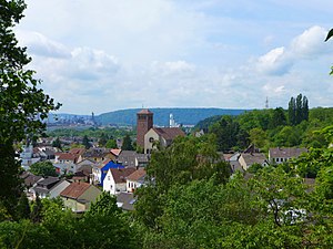
Dillingen, Saarland
Town in Saarland, Germany
Distance: Approx. 741 meters
Latitude and longitude: 49.35,6.73333333
Dillingen (also: Dillingen an der Saar) (French: Dillange) is a town in the district of Saarlouis, in Saarland. It has about 20,000 inhabitants and is divided into the three districts Dillingen-city center, Pachten and Diefflen. The city is located on the edge of the Saar-Hunsrück Nature Park at the mouth of the Prims in the Saar and is located about 10 km from the French border.

Nalbach
Municipality in Saarland, Germany
Distance: Approx. 3075 meters
Latitude and longitude: 49.36666667,6.76666667
Nalbach is a municipality in the district of Saarlouis, in Saarland, Germany. It is situated approximately 8 km northeast of Saarlouis, and 20 km northwest of Saarbrücken.

Prims
River in Germany
Distance: Approx. 1955 meters
Latitude and longitude: 49.34055556,6.71388889
The Prims is a 91 km long river in western Germany, right tributary of the Saar. It rises in the Hunsrück mountains, near the village Malborn. It flows generally south through the towns Nonnweiler, Wadern and Schmelz.
Saarlouis Body & Assembly
German car plant located in Saarlouis of Ford
Distance: Approx. 2835 meters
Latitude and longitude: 49.34722222,6.76472222
Ford Saarlouis Body & Assembly (SB&A) is a major car plant located on the western edge of Saarlouis in the German Saarland. It belongs to Ford-Werke GmbH, the German subsidiary of the American automaker Ford Motor Company.

Altes Schloss (Dillingen)
Distance: Approx. 508 meters
Latitude and longitude: 49.35305556,6.73361111
Altes Schloss (Dillingen) is a castle and museum in Dillingen, Saarland, Germany. The Old castle, like many castles, was originally a medieval castle, probably of the 14th century. It is leased to the town, which uses it for cultural purposes, among other things.

Museum Pachten
Museum in Germany
Distance: Approx. 1393 meters
Latitude and longitude: 49.355,6.70861111
Museum Pachten, also known as the Römermuseum Pachten, is a museum in a former farmhouse in Fischerstraße, one of the oldest streets in the Dillingen district of Pachten, Saarland, Germany. The museum was established in 1990 and features displays related to the Gallo-Roman period in the Roman settlement of what was Contiomagus. Artifacts dated to the Stone Age, Bronze Age, Iron Age and the era of the Celts are also on display.

Westwallbunker (Pachten)
Distance: Approx. 1340 meters
Latitude and longitude: 49.34972222,6.71166667
Westwallbunker is a bunker and museum in Saarland, Germany, that was part of the Siegfried Line. The bunker was built in 1939.

Ellbach (Saar)
River in Germany
Distance: Approx. 3092 meters
Latitude and longitude: 49.3286,6.7378
Ellbach is a river of Saarland, Germany. It is a tributary of the Saar and is 8 kilometers long.

Dillingen (Saar) station
Railway station in Dillingen/Saar, Germany
Distance: Approx. 502 meters
Latitude and longitude: 49.35263228,6.7225787
Dillingen (Saar) station is on the Saar Railway between Saarbrücken and Trier in the town of Dillingen in the German state of the Saarland. The station is classified by Deutsche Bahn as a category 4 station. A bus station is connected to the station.

Diefflen
Stadtteil of Dillingen/Saar in Saarland, Germany
Distance: Approx. 1726 meters
Latitude and longitude: 49.35,6.75
Diefflen (pronounced: Dieflen, in the local, Moselle-Franconian dialect Dejfeln) is a district of Dillingen/Saar in the district of Saarlouis (Saarland) and has about 4700 inhabitants. It is located on the lower Prims, a tributary of the Saar. Since its foundation in the High Middle Ages Diefflen was historically linked to the villages of the former "Hochgericht Nalbacher Tal".

Saardom
Distance: Approx. 142 meters
Latitude and longitude: 49.35648,6.72639
The so-called Saardom (full name: "Ecclesia Parochialis Catholica Sacratissimi Sacramenti Dioecesis Treverensis", "Catholic Parish Church of the Blessed Sacrament in the Diocese of Trier") in Dillingen/Saar is one of the largest sacred buildings in Saarland. It is the parish church of the parish of St Sacrament. The parish belongs to the parish community of the Holy Sacrament, St John the Baptist in Dillingen, St Joseph and St Wendelin in Diefflen, St Maximin in Pachten, and St Mary consolation of the saddeneds (Consolatrix afflictorum) on the Pachtener Heide.
Weather in this IP's area
clear sky
-3 Celsius
-7 Celsius
-4 Celsius
-3 Celsius
1041 hPa
85 %
1041 hPa
1004 hPa
10000 meters
2.64 m/s
9.31 m/s
67 degree
10 %