77.83.147.65 - IP Lookup: Free IP Address Lookup, Postal Code Lookup, IP Location Lookup, IP ASN, Public IP
Country:
Region:
City:
Location:
Time Zone:
Postal Code:
IP information under different IP Channel
ip-api
Country
Region
City
ASN
Time Zone
ISP
Blacklist
Proxy
Latitude
Longitude
Postal
Route
Luminati
Country
Region
an
City
alcaladelvalle
ASN
Time Zone
Europe/Madrid
ISP
Alcort Ingenieria Y Asesoria S.l.
Latitude
Longitude
Postal
IPinfo
Country
Region
City
ASN
Time Zone
ISP
Blacklist
Proxy
Latitude
Longitude
Postal
Route
IP2Location
77.83.147.65Country
Region
madrid, comunidad de
City
pinar de chamartin
Time Zone
Europe/Madrid
ISP
Language
User-Agent
Latitude
Longitude
Postal
db-ip
Country
Region
City
ASN
Time Zone
ISP
Blacklist
Proxy
Latitude
Longitude
Postal
Route
ipdata
Country
Region
City
ASN
Time Zone
ISP
Blacklist
Proxy
Latitude
Longitude
Postal
Route
Popular places and events near this IP address
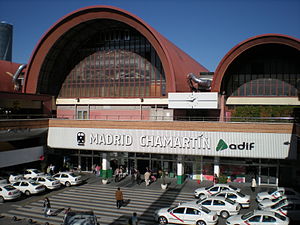
Madrid Chamartín railway station
Railway station in Madrid, Spain
Distance: Approx. 1433 meters
Latitude and longitude: 40.472101,-3.6826857
The Estación de Madrid-Chamartín Clara Campoamor or Madrid Chamartín [tʃamaɾˈtin] is the second major railway station in Madrid, Spain. Located on the northern side of the city, it was built between 1970 and 1975, but more work was carried on into the early 1980s. It then superseded Atocha station, which is located just south of the city centre.
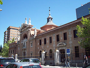
Convent of Madres Reparadoras
Historic site in Madrid, Spain
Distance: Approx. 851 meters
Latitude and longitude: 40.473776,-3.675738
The Convent of Madres Reparadoras (Spanish: Convento de las Madres Reparadoras) is a convent located in Madrid, Spain. It was declared Bien de Interés Cultural in 1979.
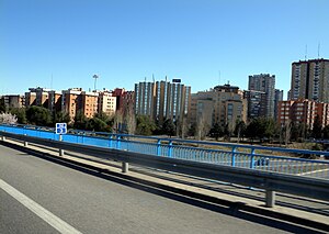
Costillares (Madrid)
Ward of Madrid in Spain
Distance: Approx. 524 meters
Latitude and longitude: 40.4744,-3.6697
Costillares [kostiˈʝaɾes], also known as Pinar de Chamartín [piˈnaɾ ðe tʃamaɾˈtin], is a neighborhood part of the Ciudad Lineal district, in north Madrid, Spain.
Bambú (Madrid Metro)
Madrid Metro station
Distance: Approx. 717 meters
Latitude and longitude: 40.4768117,-3.6763701
Bambú [bamˈbu] is a station on Line 1 of the Madrid Metro, opened on 4 November, 2007. It is located in fare Zone A. It is named for the Calle Bambú. The station has a single entrance located at Calle de Bambú 14.
Pinar de Chamartín (Madrid Metro)
Madrid Metro station
Distance: Approx. 185 meters
Latitude and longitude: 40.4801375,-3.6667999
Pinar de Chamartín [piˈnaɾ ðe tʃamaɾˈtin] is a station on the Madrid Metro, opened to the public on 4 November, 2007. It is located in fare Zone A and serves the area of Pinar de Chamartín. The station is the terminus for Line 1, Line 4 and the Metro Ligero line 1.
Hortaleza (Madrid Metro)
Madrid Metro station
Distance: Approx. 1400 meters
Latitude and longitude: 40.4753716,-3.6525732
Hortaleza [oɾtaˈleθa] is a station on Line 4 of the Madrid Metro, in the Hortaleza district.
Manoteras (Madrid Metro)
Madrid Metro station
Distance: Approx. 523 meters
Latitude and longitude: 40.4768716,-3.6628981
Manoteras [manoˈteɾas] is a station on Line 4 of the Madrid Metro. It is located in fare Zone A. It was named after the Manoteras neighbourhood.
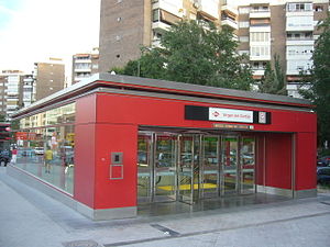
Virgen del Cortijo (Madrid Metro)
Madrid metro station
Distance: Approx. 1121 meters
Latitude and longitude: 40.487342,-3.6609833
Virgen del Cortijo [ˈbiɾxen del koɾˈtixo] is a station on Line 1 of the Metro Ligero.
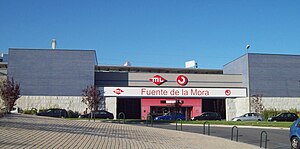
Fuente de la Mora (Madrid Metro)
Distance: Approx. 775 meters
Latitude and longitude: 40.4846851,-3.6631068
Fuente de la Mora [ˈfwente ðe la ˈmoɾa] is a station on Line 1 of the Metro Ligero.

Castilla (Madrid)
City neighborhood in Madrid, Community of Madrid, Spain
Distance: Approx. 994 meters
Latitude and longitude: 40.475,-3.67888889
Castilla is an administrative neighborhood (barrio) of Madrid belonging to the district of Chamartín.

Atalaya (Madrid)
Ward of Madrid in Spain
Distance: Approx. 1440 meters
Latitude and longitude: 40.46611111,-3.66694444
Atalaya is a ward (barrio) of Madrid belonging to the district of Ciudad Lineal.

Apóstol Santiago
Ward of Madrid in Community of Madrid, Spain
Distance: Approx. 923 meters
Latitude and longitude: 40.47638889,-3.65805556
Apóstol Santiago is a ward (barrio) of Madrid belonging to the district of Hortaleza.
Weather in this IP's area
clear sky
7 Celsius
7 Celsius
5 Celsius
9 Celsius
1028 hPa
77 %
1028 hPa
942 hPa
10000 meters
0.89 m/s
1.34 m/s
31 degree


