Country:
Region:
City:
Latitude and Longitude:
Time Zone:
Postal Code:
IP information under different IP Channel
ip-api
Country
Region
City
ASN
Time Zone
ISP
Blacklist
Proxy
Latitude
Longitude
Postal
Route
Luminati
Country
Region
mo
City
montevideo
ASN
Time Zone
America/Montevideo
ISP
Comvive Servidores S.L.
Latitude
Longitude
Postal
IPinfo
Country
Region
City
ASN
Time Zone
ISP
Blacklist
Proxy
Latitude
Longitude
Postal
Route
db-ip
Country
Region
City
ASN
Time Zone
ISP
Blacklist
Proxy
Latitude
Longitude
Postal
Route
ipdata
Country
Region
City
ASN
Time Zone
ISP
Blacklist
Proxy
Latitude
Longitude
Postal
Route
Popular places and events near this IP address
Estadio Alfredo Victor Viera
Distance: Approx. 1307 meters
Latitude and longitude: -34.859278,-56.204027
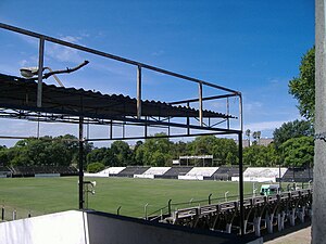
Estadio Parque Alfredo Víctor Viera is a multi-purpose stadium in Montevideo, Uruguay. It is the home of Montevideo Wanderers Fútbol Club, and is currently used solely for football matches. Presently the stadium holds 7,527 people and was built in 1933.

Estadio Saroldi
Distance: Approx. 1403 meters
Latitude and longitude: -34.862135,-56.20164
Estadio Saroldi (full name: Parque Federico Omar Saroldi) is a multi-use stadium in Montevideo, Uruguay. It is currently used mostly for football matches. The stadium holds 6,000 all seated.

Prado, Montevideo
Barrio and park in Montevideo Department, Uruguay
Distance: Approx. 1610 meters
Latitude and longitude: -34.86388889,-56.2025
Prado is a barrio (neighbourhood or district) and a major public park in Montevideo, Uruguay. Together with Nueva Savona, they form the Prado - Nueva Savona composite barrio. Prado is also the name given to all the park areas on both sides of Miguelete Creek, limited by the bridge of Agraciada Avenue over the river to the south and by Millan Avenue to the northeast.

Parque Posadas
Distance: Approx. 550 meters
Latitude and longitude: -34.8565,-56.194
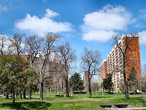
The Parque Posadas (Posadas Park, in English) is a large apartments' complex placed in the geographical centre of Montevideo, Uruguay. It was built between 1969 and 1973, their firsts apartments were given that same year, although the official inauguration of the complex was August 25, 1975. It has a communal hall, a library, a shopping mall and a school.

Atahualpa, Montevideo
Barrio in Montevideo Department, Uruguay
Distance: Approx. 1495 meters
Latitude and longitude: -34.86472222,-56.18972222
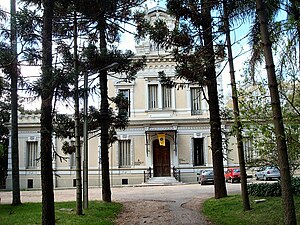
Atahualpa is a barrio (neighbourhood or district) of Montevideo, Uruguay. It borders with Prado to the west, Aires Puros to the north, Brazo Oriental to the east and Reducto to the south. Politically located in Municipality C of Montevideo, it is a residential neighborhood, with large stately mansions and gardens, closely linked to the Prado neighborhood.

Paso de las Duranas
Barrio in Montevideo Department, Uruguay
Distance: Approx. 888 meters
Latitude and longitude: -34.84444444,-56.1975
Paso de las Duranas is a cultural center in Montevideo, Uruguay.

Aires Puros
Barrio in Montevideo Department, Uruguay
Distance: Approx. 446 meters
Latitude and longitude: -34.85194444,-56.18833333
Aires Puros is a barrio (neighbourhood or district) of Montevideo, Uruguay.

Parque Prado
Distance: Approx. 1521 meters
Latitude and longitude: -34.85777778,-56.20805556
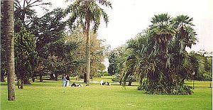
Parque Prado is the largest of Montevideo's six principal public parks. Established in 1873, it covers an area of 106 hectares and is located in the barrio of Prado. Located in the northern part of the city, the Miguelete Creek flows through the neighbourhood and park of the same name.

Cementerio del Norte, Montevideo
Cemetery in Montevideo, Uruguay
Distance: Approx. 1771 meters
Latitude and longitude: -34.84138889,-56.17833333
Cementerio del Norte is the largest cemetery in Montevideo, Uruguay, and also the largest green park area of the city. It is located in the barrio of Casavalle in the northern-central part of the city, about 7 kilometres from the centre. To the southwest is Parque Luis Rivero and the barrio of Aires Puros.
Virgen del Carmen y Santa Teresita, Montevideo
Church building in Montevideo, Uruguay
Distance: Approx. 1750 meters
Latitude and longitude: -34.8647,-56.2038
The Church of the Virgin of Mount Carmel and St. Thérèse of Lisieux (Spanish: Iglesia de la Virgen del Carmen y Santa Teresita), also known as Iglesia de los Carmelitas, is a Roman Catholic parish church in the neighbourhood of Prado, Montevideo, Uruguay. The church was built in Neo-Gothic style by architects Guillermo Armas and Albérico Isola, between 1929 and 1954.

Museo de la Memoria (Uruguay)
Museum in Montevideo, Uruguay
Distance: Approx. 1162 meters
Latitude and longitude: -34.84213,-56.19856
Museo de la Memoria (MUME) is a museum in Montevideo, Uruguay dedicated to the memory of those or died or were "disappeared" during the Uruguayan dictatorship of 1973 to 1985.

Japanese Garden, Montevideo
Distance: Approx. 553 meters
Latitude and longitude: -34.85330556,-56.19888889
The Japanese Garden of Montevideo (Spanish: Jardín Japonés de Montevideo; Japanese: モンテビデオの日本庭園') is located in the Prado neighbourhood of Montevideo, behind the Juan Manuel Blanes Museum. It was donated by Japan as a memorial to the 80th anniversary of the establishment of diplomatic relations between both countries, and inaugurated on 24 September 2001 by Princess Sayako. A wooden plaque, with calligraphy by then-Prime Minister Junichiro Koizumi, bears the inscription 平成苑 "Heisei Garden", being the year 13 of the Heisei Era (reign of Akihito) at the time of the inauguration.
Weather in this IP's area
clear sky
21 Celsius
21 Celsius
21 Celsius
22 Celsius
1014 hPa
56 %
1014 hPa
1011 hPa
10000 meters
3.09 m/s
70 degree
05:31:30
19:27:17

