Country:
 Czech Republic
Region:
City:
Latitude and Longitude:
Time Zone:
Postal Code:
IP information under different IP Channel
ip-api
Country
Region
City
ASN
Time Zone
ISP
Blacklist
Proxy
Latitude
Longitude
Postal
Route
IPinfo
Country
Region
City
ASN
Time Zone
ISP
Blacklist
Proxy
Latitude
Longitude
Postal
Route
MaxMind
Country
Region
City
ASN
Time Zone
ISP
Blacklist
Proxy
Latitude
Longitude
Postal
Route
Luminati
Country
CZRegion
31
City
pisek
ASN
Time Zone
Europe/Prague
ISP
WIA spol. s.r.o.
Latitude
Longitude
Postal
db-ip
Country
Region
City
ASN
Time Zone
ISP
Blacklist
Proxy
Latitude
Longitude
Postal
Route
ipdata
Country
Region
City
ASN
Time Zone
ISP
Blacklist
Proxy
Latitude
Longitude
Postal
Route
Popular places and events near this IP address

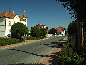
Písek
Town in South Bohemian, Czech Republic
Distance: Approx. 164 meters
Latitude and longitude: 49.30888889,14.1475
Písek (Czech pronunciation: [ˈpiːsɛk]; ‹See Tfd›German: Pisek) is a town in the South Bohemian Region of the Czech Republic. It has about 31,000 inhabitants. The town is known for the oldest bridge in the country.

Putim
Municipality in the Czech Republic
Distance: Approx. 5204 meters
Latitude and longitude: 49.26472222,14.11916667
Putim is a municipality and village in Písek District in the South Bohemian Region of the Czech Republic. It has about 600 inhabitants. The village centre is well preserved and is protected by law as a village monument zone.

Záhoří (Písek District)
Municipality in South Bohemian, Czech Republic
Distance: Approx. 6781 meters
Latitude and longitude: 49.34972222,14.21388889
Záhoří is a municipality in Písek District in the South Bohemian Region of the Czech Republic. It has about 800 inhabitants.
Čížová
Municipality in South Bohemian, Czech Republic
Distance: Approx. 6627 meters
Latitude and longitude: 49.35694444,14.09305556
Čížová is a municipality and village in Písek District in the South Bohemian Region of the Czech Republic. It has about 1,300 inhabitants.

Dolní Novosedly
Municipality in South Bohemian, Czech Republic
Distance: Approx. 4351 meters
Latitude and longitude: 49.32916667,14.19611111
Dolní Novosedly is a municipality and village in Písek District in the South Bohemian Region of the Czech Republic. It has about 300 inhabitants.

Kestřany
Municipality in South Bohemian, Czech Republic
Distance: Approx. 6854 meters
Latitude and longitude: 49.26916667,14.0725
Kestřany is a municipality and village in Písek District in the South Bohemian Region of the Czech Republic. It has about 700 inhabitants.
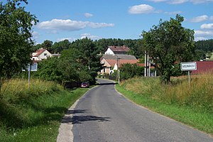
Vojníkov
Municipality in South Bohemian, Czech Republic
Distance: Approx. 5574 meters
Latitude and longitude: 49.35388889,14.17694444
Vojníkov is a municipality and village in Písek District in the South Bohemian Region of the Czech Republic. It has about 90 inhabitants.

Film School in Písek
Distance: Approx. 868 meters
Latitude and longitude: 49.30046667,14.14396944
The Film Academy of Miroslav Ondříček in Písek (Czech: Filmová akademie Miroslava Ondříčka v Písku, FAMO) is a private film university which was established in 2004 by Czech documentary cameraman and school owner / director Miloň Terč. The patron of the school, and school name are dedicated to famous Czech cinematographer Miroslav Ondříček. The school offers accredited bachelor's and master's degree programs in the Czech and English languages.
Vrcovice
Municipality in South Bohemian, Czech Republic
Distance: Approx. 4576 meters
Latitude and longitude: 49.34472222,14.17444444
Vrcovice is a municipality and village in Písek District in the South Bohemian Region of the Czech Republic. It has about 200 inhabitants. Vrcovice lies approximately 6 kilometres (4 mi) north-east of Písek, 47 km (29 mi) north-west of České Budějovice, and 85 km (53 mi) south of Prague.

Držov
Village in Czech Republic
Distance: Approx. 5546 meters
Latitude and longitude: 49.35361111,14.17694444
Držov is a village in Písek District, Czech Republic. It is a part of Vojníkov municipality, being situated between Vojníkov and Louka.
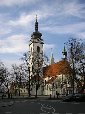
Church of the Nativity of the Blessed Virgin Mary (Písek)
Distance: Approx. 335 meters
Latitude and longitude: 49.3064,14.1492
Church of the Nativity of the Virgin Mary (Czech: Kostel Narození Panny Marie) is a Roman Catholic basilica in Písek in the South Bohemian Region of the Czech Republic. It has a nave, two aisles, and a bell tower on the south side of the western facade which has become a symbol of the town. It is also the highest building in Písek.
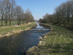
Blanice (Otava)
River in South Bohemian, Czech Republic
Distance: Approx. 4061 meters
Latitude and longitude: 49.27694444,14.11666667
The Blanice (‹See Tfd›German: Blanitz) is a river in the Czech Republic, a right tributary of the Otava River. It flows through the South Bohemian Region. It is 94.7 km (58.8 mi) long.
Weather in this IP's area
overcast clouds
8 Celsius
7 Celsius
7 Celsius
10 Celsius
1016 hPa
97 %
1016 hPa
972 hPa
10000 meters
1.72 m/s
4.48 m/s
338 degree
100 %
07:09:18
18:33:57