77.76.106.235 - IP Lookup: Free IP Address Lookup, Postal Code Lookup, IP Location Lookup, IP ASN, Public IP
Country:
Region:
City:
Location:
Time Zone:
Postal Code:
IP information under different IP Channel
ip-api
Country
Region
City
ASN
Time Zone
ISP
Blacklist
Proxy
Latitude
Longitude
Postal
Route
Luminati
Country
Region
eng
City
brentford
ASN
Time Zone
Europe/London
ISP
Digital Space Group Limited
Latitude
Longitude
Postal
IPinfo
Country
Region
City
ASN
Time Zone
ISP
Blacklist
Proxy
Latitude
Longitude
Postal
Route
IP2Location
77.76.106.235Country
Region
scotland
City
port glasgow
Time Zone
Europe/London
ISP
Language
User-Agent
Latitude
Longitude
Postal
db-ip
Country
Region
City
ASN
Time Zone
ISP
Blacklist
Proxy
Latitude
Longitude
Postal
Route
ipdata
Country
Region
City
ASN
Time Zone
ISP
Blacklist
Proxy
Latitude
Longitude
Postal
Route
Popular places and events near this IP address

Port Glasgow
Town in the Inverclyde council area of Scotland
Distance: Approx. 96 meters
Latitude and longitude: 55.934,-4.6906
Port Glasgow (Scottish Gaelic: Port Ghlaschu, pronounced [pʰɔrˠʃt̪ˈɣl̪ˠas̪əxu]) is the second-largest town in the Inverclyde council area of Scotland. The population according to the 1991 census for Port Glasgow was 19,426 persons and in the 2001 census was 16,617 persons. The most recent census in 2011 states that the population has declined to 15,414.
Boglestone
Distance: Approx. 1532 meters
Latitude and longitude: 55.92649,-4.66965
Boglestone (named after the Bogal Stone) is located around the top of the Clune Brae, Port Glasgow, Inverclyde, Scotland. The area includes housing, but also serves as an important 'hub' for upper Port Glasgow, offering amenities such as education, shopping, health centres, and leisure. The two schools previously situated here were Boglestone Primary a non-denominational school, and St Michael's a Roman Catholic primary School.

Gibshill
Human settlement in Scotland
Distance: Approx. 1393 meters
Latitude and longitude: 55.93456,-4.71184
Gibshill (sometimes spelt as Gibbshill and often referred to as The Gibby, but also known as Spam Island) is the easternmost housing estate in Greenock and adjoins Port Glasgow, both in the Inverclyde Council Area, Scotland. It is served by Bogston railway station. As of 2012 most of the streets in Gibshill have been regenerated and are opened for the first time since the 1970s, among them East Street and Dalmally Street, with new houses on every street.

Newark Castle, Port Glasgow
Castle in Port Glasgow, Scotland
Distance: Approx. 748 meters
Latitude and longitude: 55.93444444,-4.6775
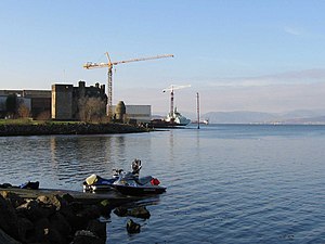
Newark Castle is a well-preserved castle sited on the south shore of the estuary of the River Clyde in Port Glasgow, Inverclyde, Scotland, where the firth gradually narrows from the Firth of Clyde and navigation upriver is made difficult by shifting sandbanks. For centuries this location was used to offload seagoing ships, and led to the growth of Port Glasgow close to the castle on either side and to the south. When dredging techniques made the Clyde navigable as far as Glasgow the port became a shipbuilding centre, and the castle was surrounded by shipyards.

Bogston railway station
Railway station in Inverclyde, Scotland, UK
Distance: Approx. 1457 meters
Latitude and longitude: 55.9372,-4.7124
Bogston railway station is on the Inverclyde Line, at Bogston in the East end of Greenock in Inverclyde council area, Scotland. The station is 213⁄4 miles (35 km) west of Glasgow Central. In past years the station had a goods yard serving the adjacent ship yards and nearby was the Ladyburn locomotive shed (shedplate 66D).
Port Glasgow railway station
Railway station in Inverclyde, Scotland
Distance: Approx. 130 meters
Latitude and longitude: 55.9335,-4.6902
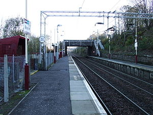
Port Glasgow railway station is on the Inverclyde Line, serving the town of Port Glasgow, Scotland. It is located in the town centre with the main entrance at the junction of Princes Street and John Wood Street. It opened on 31 March 1841, being one of the intermediate stations on the Glasgow, Paisley and Greenock Railway which opened on that date.

Bouverie, Port Glasgow
Distance: Approx. 601 meters
Latitude and longitude: 55.93194444,-4.68111111
Bouverie is an area of the town of Port Glasgow, Inverclyde, Scotland. Bouverie was developed in the late nineteenth century as part of Port Glasgow's eastward expansion. Originally consisting of ancillary shipbuilding-related businesses, and workers' housing, it now consists mainly of residential buildings and a handful of small service industries.

Port Glasgow Upper railway station
Closed railway station in Inverclyde, Scotland, UK
Distance: Approx. 1972 meters
Latitude and longitude: 55.9239,-4.6643
Port Glasgow Upper was a railway station serving Port Glasgow, Renfrewshire, Scotland, originally as part of the Greenock and Ayrshire Railway.

Bogston
Distance: Approx. 1110 meters
Latitude and longitude: 55.93873,-4.70571
Bogston (Scots: Bogstoun, Scottish Gaelic: Baile na Fèithe) is an area of the towns of Port Glasgow and Greenock in the council area of Inverclyde, Scotland. It is 35 km (21¾ miles) west of Glasgow. The area is served by Bogston railway station.
Clune Park
Sports venue in Inverclyde, Scotland
Distance: Approx. 1012 meters
Latitude and longitude: 55.9321,-4.6739
Clune Park was a football ground in Port Glasgow, Scotland. It was the home ground of Port Glasgow Athletic from 1881 until they folded in 1912, and also of Port Glasgow Athletic Juniors.

Town Buildings, Port Glasgow
Municipal building in Port Glasgow, Scotland
Distance: Approx. 133 meters
Latitude and longitude: 55.9348,-4.6874
The Town Buildings, also known as the Municipal Buildings, are in Fore Street, Port Glasgow, Scotland. The structure, which served as the meeting place of Port Glasgow Burgh Council, is a Category A listed building.

Clune Park Church, Port Glasgow
Former church in Port Glasgow, Scotland
Distance: Approx. 931 meters
Latitude and longitude: 55.9317,-4.6755
Clune Park Church Of Scotland, Robert Street, Port Glasgow is a disused church in the town of Port Glasgow, Scotland. It is located on the partly abandoned Clune Park Estate and was originally built in 1905 for use by the then-new estate. It was in use for a while until 1997 when it was closed for unknown reasons and left abandoned since.
Weather in this IP's area
broken clouds
11 Celsius
11 Celsius
11 Celsius
12 Celsius
1017 hPa
96 %
1017 hPa
996 hPa
7000 meters
7.2 m/s
240 degree
75 %

