Country:
Region:
City:
Latitude and Longitude:
Time Zone:
Postal Code:
IP information under different IP Channel
ip-api
Country
Region
City
ASN
Time Zone
ISP
Blacklist
Proxy
Latitude
Longitude
Postal
Route
Luminati
Country
Region
40
City
pembroke
ASN
Time Zone
Europe/Malta
ISP
Melita Limited
Latitude
Longitude
Postal
IPinfo
Country
Region
City
ASN
Time Zone
ISP
Blacklist
Proxy
Latitude
Longitude
Postal
Route
db-ip
Country
Region
City
ASN
Time Zone
ISP
Blacklist
Proxy
Latitude
Longitude
Postal
Route
ipdata
Country
Region
City
ASN
Time Zone
ISP
Blacklist
Proxy
Latitude
Longitude
Postal
Route
Popular places and events near this IP address

Swieqi
Local council in Northern Region, Malta
Distance: Approx. 1566 meters
Latitude and longitude: 35.92083333,14.48
Swieqi (Maltese: Is-Swieqi) is a town in the Northern Region of Malta. It is a residential area just 15 minutes by bus from Sliema and within walking distance of Malta's nightlife and entertainment centres, Paceville and St. Julian's.
Paceville
Administrative Committee in Malta, Malta
Distance: Approx. 1843 meters
Latitude and longitude: 35.9237,14.4914
Paceville (PAH-chuh-vil sometimes abbreviated PV) is a district in St Julian's which is the main nightlife hub in Malta, being heavily populated with nightclubs, bars, strip clubs, pubs and restaurants. It is hence also known as 'Malta's Sin City'. Paceville is located between Spinola Point and Dragonara Point, delimiting Spinola Bay and St.

Pembroke, Malta
Local council in Northern Region, Malta
Distance: Approx. 1006 meters
Latitude and longitude: 35.92638889,14.48083333
Pembroke is a town in the Northern Region of Malta, and it is considered to be the country's newest locality. To the east is Paceville, the nightlife district of Malta. The coastal town and tourist hub of St.

Madliena
Distance: Approx. 1566 meters
Latitude and longitude: 35.92083333,14.48
Madliena (Maltese: Il-Madliena), formerly spelt Madalena, is an area in Swieqi, in Northern Region, Malta, formerly part of the adjacent town of Għargħur.
Bay Street (entertainment complex)
Distance: Approx. 1535 meters
Latitude and longitude: 35.9244,14.4875
Bay Street is a hotel, commercial, and entertainment complex in St. Julian's, Malta. Bay Street was constructed on November 25, 2000 as part of a Lm 30 million investment for the Paceville area.

Pendergardens
Distance: Approx. 1776 meters
Latitude and longitude: 35.92205556,14.48822222
Pendergardens is a development in St. Julian's, Malta, consisting of a number of apartments, retail outlets and office space.

The Westin Dragonara
Distance: Approx. 1874 meters
Latitude and longitude: 35.925107,14.493148
The Westin Dragonara Hotel is a hotel in Paceville, St. Julian's, Malta. It is located near the Dragonara Palace, both being at Dragonara Point.

Mercury Tower
Skyscraper in Malta
Distance: Approx. 1754 meters
Latitude and longitude: 35.92311,14.48934
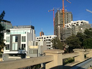
The Mercury Tower is a high-rise, mixed-use building in St. Julian's, Malta. At 121 metres (397 ft) tall, it has been Malta's tallest building since 2020 when it overtook the Portomaso Tower upon its topping out.
Ġebel ġol-Baħar
Alleged megalithic temple in Malta
Distance: Approx. 1792 meters
Latitude and longitude: 35.93255556,14.49563889
Ġebel ġol-Baħar is an alleged megalithic temple located underwater off the coast of St. Julian's, Malta. The site was identified in 1999 by retired real estate investor Hubert Zeitlmair, a follower of Zecharia Sitchin, but it was never studied properly and archaeologists are not convinced that the site is a temple.
Pembroke Army Garrison
Former British Army barracks near Fort Pembroke, Malta
Distance: Approx. 1061 meters
Latitude and longitude: 35.925,14.475
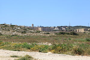
Pembroke Garrison is a dispersed collection of former British Army barracks built in the vicinity of Fort Pembroke, northern Malta.
Pembroke Military Cemetery
Cemetery in former Pembroke Army Garrison, Malta
Distance: Approx. 781 meters
Latitude and longitude: 35.92916667,14.47027778
Pembroke Military Cemetery Malta is a burial ground for military personnel and their dependants. It is located close by the former St Patrick's Barracks (now St Clare's College) in the Pembroke Council area, on a minor road (Triq Adrian Dingli). The first soldier buried at the cemetery was Sapper F Jarvis of 28 Company the Royal Engineers, who died on 5 May 1908.

Luxol Stadium
Distance: Approx. 1183 meters
Latitude and longitude: 35.92388889,14.47527778
The Luxol Stadium is a stadium in Pembroke, Malta, opened on 26 May 2006. It was built at a cost of Lm 350,000 with an artificial turf surface and floodlighting. It is the home ground of Maltese football club St.
Weather in this IP's area
few clouds
18 Celsius
18 Celsius
18 Celsius
19 Celsius
1023 hPa
88 %
1023 hPa
1020 hPa
10000 meters
1.03 m/s
20 %
06:31:41
17:00:06

